


<< Our Photo Pages >> Pierre Fritte de Neuville-Bosc - Standing Stone (Menhir) in France in Picardie:Oise (60)
Submitted by binardino on Thursday, 10 February 2005 Page Views: 3729
Neolithic and Bronze AgeSite Name: Pierre Fritte de Neuville-BoscCountry: France
NOTE: This site is 3.003 km away from the location you searched for.
Département: Picardie:Oise (60) Type: Standing Stone (Menhir)
Nearest Town: Meru Nearest Village: Neuville-Bosc
Latitude: 49.206733N Longitude: 2.026203E
Condition:
| 5 | Perfect |
| 4 | Almost Perfect |
| 3 | Reasonable but with some damage |
| 2 | Ruined but still recognisable as an ancient site |
| 1 | Pretty much destroyed, possibly visible as crop marks |
| 0 | No data. |
| -1 | Completely destroyed |
| 5 | Superb |
| 4 | Good |
| 3 | Ordinary |
| 2 | Not Good |
| 1 | Awful |
| 0 | No data. |
| 5 | Can be driven to, probably with disabled access |
| 4 | Short walk on a footpath |
| 3 | Requiring a bit more of a walk |
| 2 | A long walk |
| 1 | In the middle of nowhere, a nightmare to find |
| 0 | No data. |
| 5 | co-ordinates taken by GPS or official recorded co-ordinates |
| 4 | co-ordinates scaled from a detailed map |
| 3 | co-ordinates scaled from a bad map |
| 2 | co-ordinates of the nearest village |
| 1 | co-ordinates of the nearest town |
| 0 | no data |
Internal Links:
External Links:
")
This is a mystic stone it looks like a druid face on the rear
Location Source: T4T35
You may be viewing yesterday's version of this page. To see the most up to date information please register for a free account.
Do not use the above information on other web sites or publications without permission of the contributor.
Nearby Images from Flickr
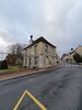
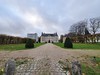
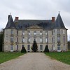
The above images may not be of the site on this page, but were taken nearby. They are loaded from Flickr so please click on them for image credits.
Click here to see more info for this site
Nearby sites
Click here to view sites on an interactive map of the areaKey: Red: member's photo, Blue: 3rd party photo, Yellow: other image, Green: no photo - please go there and take one, Grey: site destroyed
Download sites to:
KML (Google Earth)
GPX (GPS waypoints)
CSV (Garmin/Navman)
CSV (Excel)
To unlock full downloads you need to sign up as a Contributory Member. Otherwise downloads are limited to 50 sites.
Turn off the page maps and other distractions
Nearby sites listing. In the following links * = Image available
570m SSW 212° Pierre aux Coqs Standing Stone (Menhir)
5.3km WSW 249° Pierre Frite de Lavilletertre* Standing Stone (Menhir)
6.8km E 94° Amblainville Polissoir* Standing Stone (Menhir)
8.4km SE 126° Côte du Libéria* Passage Grave
8.4km SE 126° Vigne des Grès Menhir* Standing Stone (Menhir)
9.9km SE 137° Allée couverte de la Chapelle* Passage Grave
12.7km W 269° Menhir du Fayel* Standing Stone (Menhir)
13.7km WSW 247° Les Luats Passage Grave
13.7km WNW 294° Menhir dit la Pierre Droite (Delincourt)* Standing Stone (Menhir)
13.7km ESE 118° Polissoir de la Forêt du Lay Polissoir
14.0km SSE 146° Herouville Chateau Stones Ancient Village or Settlement
14.7km ESE 122° Hypogée le Trou à Mort* Chambered Tomb
15.5km WNW 298° Trie-Château Menhir* Standing Stone (Menhir)
15.6km SW 232° Menhir dit la Croisette* Standing Stone (Menhir)
15.7km WNW 298° Trie-Chateau dolmen* Passage Grave
15.9km SSE 159° Menhir de la Haute Borne (Ennery)* Standing Stone (Menhir)
16.5km SW 233° Bois Couturier Allée couverte* Passage Grave
16.7km SW 230° La Ferme Duport Passage Grave
16.8km WNW 293° Chambors Menhir* Standing Stone (Menhir)
16.8km SE 128° Le Temple Passage Grave
16.8km SW 230° Musée Archéologique Du Val-D'Oise* Museum
17.3km SW 223° Polissoir de St Martin* Polissoir
17.6km ESE 115° Basses Coutures* Standing Stones
17.9km SW 227° Menhir dit la Pierre Droite (Gadancourt)* Standing Stone (Menhir)
18.1km SSE 163° Dampont Allée couverte* Passage Grave
View more nearby sites and additional images


 We would like to know more about this location. Please feel free to add a brief description and any relevant information in your own language.
 Wir möchten mehr über diese Stätte erfahren. Bitte zögern Sie nicht, eine kurze Beschreibung und relevante Informationen in Deutsch hinzuzufügen.
 Nous aimerions en savoir encore un peu sur les lieux. S'il vous plaît n'hesitez pas à ajouter une courte description et tous les renseignements pertinents dans votre propre langue.
 Quisieramos informarnos un poco más de las lugares. No dude en añadir una breve descripción y otros datos relevantes en su propio idioma.