 with our Megalithic Portal iPhone app")


<< Our Photo Pages >> Grodzisko Bugaj - Hillfort in Poland in Malopolskie
Submitted by SolarMegalith on Sunday, 28 October 2018 Page Views: 873
Iron Age and Later PrehistorySite Name: Grodzisko Bugaj Alternative Name: Grodzisko ZakrzówCountry: Poland
NOTE: This site is 2.432 km away from the location you searched for.
Voivodeship: Malopolskie Type: Hillfort
Nearest Town: Kalwaria Zebrzydowska Nearest Village: Zakrzów
Latitude: 49.854255N Longitude: 19.655399E
Condition:
| 5 | Perfect |
| 4 | Almost Perfect |
| 3 | Reasonable but with some damage |
| 2 | Ruined but still recognisable as an ancient site |
| 1 | Pretty much destroyed, possibly visible as crop marks |
| 0 | No data. |
| -1 | Completely destroyed |
| 5 | Superb |
| 4 | Good |
| 3 | Ordinary |
| 2 | Not Good |
| 1 | Awful |
| 0 | No data. |
| 5 | Can be driven to, probably with disabled access |
| 4 | Short walk on a footpath |
| 3 | Requiring a bit more of a walk |
| 2 | A long walk |
| 1 | In the middle of nowhere, a nightmare to find |
| 0 | No data. |
| 5 | co-ordinates taken by GPS or official recorded co-ordinates |
| 4 | co-ordinates scaled from a detailed map |
| 3 | co-ordinates scaled from a bad map |
| 2 | co-ordinates of the nearest village |
| 1 | co-ordinates of the nearest town |
| 0 | no data |
Internal Links:
External Links:
I have visited· I would like to visit
SolarMegalith visited on 11th Oct 2018 - their rating: Cond: 3 Amb: 5 Access: 4
")
A hillfort (grodzisko) called Bugaj is located on the summit of the Żar mountain (530m altitude), some 1.5km SW of Kalwaria Zebrzydowska. It was discovered in 1957 and originally attributed to the Tribal period (8th-10th century AD). A circular earthwork with a ditch and outer bank is in good condition. The site was occupied in the medieval period, but recent excavations unearthed also Bronze Age pottery.
A tourist trail which leads to the nearby ruins of Barwałd castle passes through interior of the hillfort.
You may be viewing yesterday's version of this page. To see the most up to date information please register for a free account.
")
")
")
Do not use the above information on other web sites or publications without permission of the contributor.
Nearby Images from Flickr
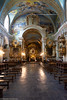
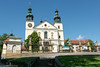
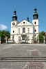

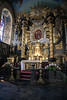
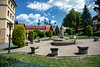
The above images may not be of the site on this page, but were taken nearby. They are loaded from Flickr so please click on them for image credits.
Click here to see more info for this site
Nearby sites
Click here to view sites on an interactive map of the areaKey: Red: member's photo, Blue: 3rd party photo, Yellow: other image, Green: no photo - please go there and take one, Grey: site destroyed
Download sites to:
KML (Google Earth)
GPX (GPS waypoints)
CSV (Garmin/Navman)
CSV (Excel)
To unlock full downloads you need to sign up as a Contributory Member. Otherwise downloads are limited to 50 sites.
Turn off the page maps and other distractions
Nearby sites listing. In the following links * = Image available
10.4km SSW 206° Grodzisko Zembrzyce* Promontory Fort / Cliff Castle
10.6km W 269° Grodzisko Gorzeń Górny* Hillfort
12.6km SSW 198° Muzeum Miejskie Suchej Beskidzkiej* Museum
15.8km NNE 16° Wołowice Flint Mine Ancient Mine, Quarry or other Industry
22.9km NNE 11° Grodzisko Mników Hillfort
28.4km SW 232° Grodzisko Gilowice* Hillfort
29.8km NE 47° Kopiec Krakusa* Artificial Mound
29.9km NE 42° Kraków - Wawel* Ancient Village or Settlement
30.2km NE 41° Archaeological Museum of Kraków* Museum
32.6km N 357° Grodzisko Bartlowa Góra - Czatkowice Hillfort
35.4km E 97° Grodzisko Poznachowice Górne* Hillfort
35.9km N 10° Grodzisko Będkowice* Hillfort
36.3km E 97° Grodzisko Klasztorzysko* Hillfort
36.9km NNE 17° Jaskinia Mamutowa* Cave or Rock Shelter
37.2km NNE 17° Jaskinia Wierzchowska Górna* Cave or Rock Shelter
38.0km NE 51° Kopiec Wandy* Artificial Mound
39.3km ENE 74° Kurhany Jawczyce Barrow Cemetery
44.4km ENE 73° Kurhan Krakuszowice Round Barrow(s)
45.7km W 266° Grodzisko Stare Bielsko* Hillfort
48.9km N 349° Grodzisko Stary Olkusz* Hillfort
50.4km W 261° Palenica Earthwork* Misc. Earthwork
50.9km W 262° Grodzisko Zómczysko* Ancient Village or Settlement
51.8km W 264° Młyńska Kępa Settlement* Ancient Village or Settlement
52.9km ENE 75° Grodzisko Łapczyca Hillfort
63.6km N 1° Jaskinia Na Biśniku Cave or Rock Shelter
View more nearby sites and additional images


 We would like to know more about this location. Please feel free to add a brief description and any relevant information in your own language.
 Wir möchten mehr über diese Stätte erfahren. Bitte zögern Sie nicht, eine kurze Beschreibung und relevante Informationen in Deutsch hinzuzufügen.
 Nous aimerions en savoir encore un peu sur les lieux. S'il vous plaît n'hesitez pas à ajouter une courte description et tous les renseignements pertinents dans votre propre langue.
 Quisieramos informarnos un poco más de las lugares. No dude en añadir una breve descripción y otros datos relevantes en su propio idioma.