 with our Megalithic Portal iPhone app")


<< Text Pages >> Grodzisko Bartlowa Góra - Czatkowice - Hillfort in Poland in Malopolskie
Submitted by SolarMegalith on Monday, 18 August 2008 Page Views: 3899
Iron Age and Later PrehistorySite Name: Grodzisko Bartlowa Góra - CzatkowiceCountry: Poland
NOTE: This site is 24.43 km away from the location you searched for.
Voivodeship: Malopolskie Type: Hillfort
Nearest Town: Krzeszowice Nearest Village: Czatkowice
Latitude: 50.147000N Longitude: 19.629543E
Condition:
| 5 | Perfect |
| 4 | Almost Perfect |
| 3 | Reasonable but with some damage |
| 2 | Ruined but still recognisable as an ancient site |
| 1 | Pretty much destroyed, possibly visible as crop marks |
| 0 | No data. |
| -1 | Completely destroyed |
| 5 | Superb |
| 4 | Good |
| 3 | Ordinary |
| 2 | Not Good |
| 1 | Awful |
| 0 | No data. |
| 5 | Can be driven to, probably with disabled access |
| 4 | Short walk on a footpath |
| 3 | Requiring a bit more of a walk |
| 2 | A long walk |
| 1 | In the middle of nowhere, a nightmare to find |
| 0 | No data. |
| 5 | co-ordinates taken by GPS or official recorded co-ordinates |
| 4 | co-ordinates scaled from a detailed map |
| 3 | co-ordinates scaled from a bad map |
| 2 | co-ordinates of the nearest village |
| 1 | co-ordinates of the nearest town |
| 0 | no data |
Internal Links:
External Links:
Hillfort in Malopolskie
Bartlowa Góra is one of the finest hillforts in southern part of Poland. The ramparts are in perfect condition, significant part of the site is covered with a forest. The hillfort was build around 8th-9th century AD, but in 17th century it was re-used by the Swedish army.
It is not difficult to reach Bartlowa Góra, the footpath leads straight to the hillfort.
You may be viewing yesterday's version of this page. To see the most up to date information please register for a free account.
Do not use the above information on other web sites or publications without permission of the contributor.
Nearby Images from Flickr
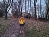
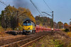

The above images may not be of the site on this page, but were taken nearby. They are loaded from Flickr so please click on them for image credits.
Click here to see more info for this site
Nearby sites
Click here to view sites on an interactive map of the areaKey: Red: member's photo, Blue: 3rd party photo, Yellow: other image, Green: no photo - please go there and take one, Grey: site destroyed
Download sites to:
KML (Google Earth)
GPX (GPS waypoints)
CSV (Garmin/Navman)
CSV (Excel)
To unlock full downloads you need to sign up as a Contributory Member. Otherwise downloads are limited to 50 sites.
Turn off the page maps and other distractions
Nearby sites listing. In the following links * = Image available
8.5km ENE 71° Grodzisko Będkowice* Hillfort
11.9km SSE 148° Grodzisko Mników Hillfort
12.9km ENE 78° Jaskinia Mamutowa* Cave or Rock Shelter
13.0km ENE 76° Jaskinia Wierzchowska Górna* Cave or Rock Shelter
17.1km NNW 335° Grodzisko Stary Olkusz* Hillfort
18.4km SSE 160° Wołowice Flint Mine Ancient Mine, Quarry or other Industry
24.0km ESE 114° Archaeological Museum of Kraków* Museum
24.1km ESE 115° Kraków - Wawel* Ancient Village or Settlement
26.4km ESE 117° Kopiec Krakusa* Artificial Mound
31.1km N 5° Jaskinia Na Biśniku Cave or Rock Shelter
32.4km ESE 105° Kopiec Wandy* Artificial Mound
32.6km N 6° Smoleń - Zamek Pilcza* Ancient Village or Settlement
32.6km S 177° Grodzisko Bugaj* Hillfort
33.9km SSW 195° Grodzisko Gorzeń Górny* Hillfort
34.5km NNE 16° Grodzisko Udórz Hillfort
42.0km S 184° Grodzisko Zembrzyce* Promontory Fort / Cliff Castle
44.6km S 183° Muzeum Miejskie Suchej Beskidzkiej* Museum
44.9km N 351° Jaskinia w Dziadowej Skale Cave or Rock Shelter
45.2km ESE 119° Kurhany Jawczyce Barrow Cemetery
48.6km ESE 114° Kurhan Krakuszowice Round Barrow(s)
49.5km N 355° Grodzisko Góra Słupsko* Hillfort
51.8km ENE 70° Kurhan Pałecznica Round Barrow(s)
52.1km SE 135° Grodzisko Poznachowice Górne* Hillfort
52.8km SE 134° Grodzisko Klasztorzysko* Hillfort
54.0km SSW 202° Grodzisko Gilowice* Hillfort
View more nearby sites and additional images


 We would like to know more about this location. Please feel free to add a brief description and any relevant information in your own language.
 Wir möchten mehr über diese Stätte erfahren. Bitte zögern Sie nicht, eine kurze Beschreibung und relevante Informationen in Deutsch hinzuzufügen.
 Nous aimerions en savoir encore un peu sur les lieux. S'il vous plaît n'hesitez pas à ajouter une courte description et tous les renseignements pertinents dans votre propre langue.
 Quisieramos informarnos un poco más de las lugares. No dude en añadir una breve descripción y otros datos relevantes en su propio idioma.