


<< Text Pages >> Gammelgarn 7:1 - Stone Circle in Sweden in Gotland
Submitted by ShamrockStone on Saturday, 30 March 2019 Page Views: 501
Neolithic and Bronze AgeSite Name: Gammelgarn 7:1Country: Sweden Landskap: Gotland Type: Stone Circle
Nearest Village: Gammelgarn
Latitude: 57.439380N Longitude: 18.799800E
Condition:
| 5 | Perfect |
| 4 | Almost Perfect |
| 3 | Reasonable but with some damage |
| 2 | Ruined but still recognisable as an ancient site |
| 1 | Pretty much destroyed, possibly visible as crop marks |
| 0 | No data. |
| -1 | Completely destroyed |
| 5 | Superb |
| 4 | Good |
| 3 | Ordinary |
| 2 | Not Good |
| 1 | Awful |
| 0 | No data. |
| 5 | Can be driven to, probably with disabled access |
| 4 | Short walk on a footpath |
| 3 | Requiring a bit more of a walk |
| 2 | A long walk |
| 1 | In the middle of nowhere, a nightmare to find |
| 0 | No data. |
| 5 | co-ordinates taken by GPS or official recorded co-ordinates |
| 4 | co-ordinates scaled from a detailed map |
| 3 | co-ordinates scaled from a bad map |
| 2 | co-ordinates of the nearest village |
| 1 | co-ordinates of the nearest town |
| 0 | no data |
Be the first person to rate this site - see the 'Contribute!' box in the right hand menu.
Internal Links:
External Links:
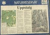
Stone Circle in Gotland
The stone circle has a diameter of 7 m. There are 8 stones, 50 to 100 cm high.
You may be viewing yesterday's version of this page. To see the most up to date information please register for a free account.
Do not use the above information on other web sites or publications without permission of the contributor.
Nearby Images from Flickr
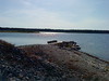
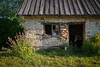
The above images may not be of the site on this page, but were taken nearby. They are loaded from Flickr so please click on them for image credits.
Click here to see more info for this site
Nearby sites
Click here to view sites on an interactive map of the areaKey: Red: member's photo, Blue: 3rd party photo, Yellow: other image, Green: no photo - please go there and take one, Grey: site destroyed
Download sites to:
KML (Google Earth)
GPX (GPS waypoints)
CSV (Garmin/Navman)
CSV (Excel)
To unlock full downloads you need to sign up as a Contributory Member. Otherwise downloads are limited to 50 sites.
Turn off the page maps and other distractions
Nearby sites listing. In the following links * = Image available
5.2km W 261° Kräklingbo 190:1 Stone Circle
5.3km S 174° Skogby* Stone Circle
5.7km WNW 283° Kräklingbo 12:1* Barrow Cemetery
6.9km NW 314° Anga 45:1* Cairn
6.9km NW 314° Båticke Great Cairn* Cairn
7.0km NW 314° Båticke Cairn B* Cairn
7.1km NW 307° Anga 31:2* Stone Circle
8.3km NNW 335° Trullhalsar* Cairn
9.2km SW 222° Ardre Bildsten VIII* Modern Stone Circle etc
9.7km SSW 204° Ardre Domarring* Stone Circle
9.9km NNW 333° Norrlanda 28:1 Cairn
9.9km NNW 334° Norrlanda 29:1* Barrow Cemetery
10.2km NNW 329° Norrlanda 20:1 Cairn
10.2km SSW 211° Kaupungs Slott* Hillfort
10.3km NNW 329° Norrlanda 25:1* Stone Circle
10.4km NNW 327° Bjärs Hög* Cairn
10.7km SSW 200° Folhammar Trojaborg* Turf Maze
10.9km SSW 200° Folhammar Raukområde* Natural Stone / Erratic / Other Natural Feature
11.5km NNW 330° Kajsarskogen* Stone Circle
12.1km SW 221° Liffende* Stone Circle
12.2km SW 220° Liffridesskeppen* Stone Circle
12.7km NW 322° Butravjs Skeppssättningar* Stone Circle
14.8km SW 215° Digerrojr* Cairn
14.8km SW 216° Gålrum Gravfält* Barrow Cemetery
15.5km SW 220° Alskog Trojaborg Turf Maze
View more nearby sites and additional images


 We would like to know more about this location. Please feel free to add a brief description and any relevant information in your own language.
 Wir möchten mehr über diese Stätte erfahren. Bitte zögern Sie nicht, eine kurze Beschreibung und relevante Informationen in Deutsch hinzuzufügen.
 Nous aimerions en savoir encore un peu sur les lieux. S'il vous plaît n'hesitez pas à ajouter une courte description et tous les renseignements pertinents dans votre propre langue.
 Quisieramos informarnos un poco más de las lugares. No dude en añadir una breve descripción y otros datos relevantes en su propio idioma.