


<< Our Photo Pages >> Grodzisko Żygląd - Hillfort in Poland in Kujawsko-pomorskie
Submitted by SolarMegalith on Sunday, 23 January 2011 Page Views: 2655
Iron Age and Later PrehistorySite Name: Grodzisko ŻyglądCountry: Poland
NOTE: This site is 5.153 km away from the location you searched for.
Voivodeship: Kujawsko-pomorskie Type: Hillfort
Nearest Town: Chełmno Nearest Village: Żygląd
Latitude: 53.260280N Longitude: 18.521580E
Condition:
| 5 | Perfect |
| 4 | Almost Perfect |
| 3 | Reasonable but with some damage |
| 2 | Ruined but still recognisable as an ancient site |
| 1 | Pretty much destroyed, possibly visible as crop marks |
| 0 | No data. |
| -1 | Completely destroyed |
| 5 | Superb |
| 4 | Good |
| 3 | Ordinary |
| 2 | Not Good |
| 1 | Awful |
| 0 | No data. |
| 5 | Can be driven to, probably with disabled access |
| 4 | Short walk on a footpath |
| 3 | Requiring a bit more of a walk |
| 2 | A long walk |
| 1 | In the middle of nowhere, a nightmare to find |
| 0 | No data. |
| 5 | co-ordinates taken by GPS or official recorded co-ordinates |
| 4 | co-ordinates scaled from a detailed map |
| 3 | co-ordinates scaled from a bad map |
| 2 | co-ordinates of the nearest village |
| 1 | co-ordinates of the nearest town |
| 0 | no data |
Internal Links:
External Links:
")
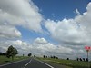
Remains of the early medieval stronghold are located east from the village of Żygląd, behind the petrol station. Earthwork is in good condition, the village itself was mentioned in late medieval sources as well.
You may be viewing yesterday's version of this page. To see the most up to date information please register for a free account.
Do not use the above information on other web sites or publications without permission of the contributor.
Nearby Images from Flickr

The above images may not be of the site on this page, but were taken nearby. They are loaded from Flickr so please click on them for image credits.
Click here to see more info for this site
Nearby sites
Click here to view sites on an interactive map of the areaKey: Red: member's photo, Blue: 3rd party photo, Yellow: other image, Green: no photo - please go there and take one, Grey: site destroyed
Download sites to:
KML (Google Earth)
GPX (GPS waypoints)
CSV (Garmin/Navman)
CSV (Excel)
To unlock full downloads you need to sign up as a Contributory Member. Otherwise downloads are limited to 50 sites.
Turn off the page maps and other distractions
Nearby sites listing. In the following links * = Image available
2.0km N 350° Grodzisko Storlus Hillfort
8.8km E 82° Grodzisko Lipienek Hillfort
8.9km W 281° Grodzisko Płutowo Hillfort
24.8km SE 129° Grodzisko Gronowo Hillfort
26.8km ENE 65° Grodzisko Gawłowice Hillfort
30.3km ESE 122° Grodzisko Chełmonie Hillfort
37.5km NE 53° Grodzisko Gruta Hillfort
43.8km ENE 71° Grodzisko Jabłonowo Pomorskie* Hillfort
43.8km ENE 73° Grodzisko Jaguszewice* Hillfort
46.8km ENE 78° Grodzisko Lembarg* Hillfort
49.0km NE 41° Grodzisko Szembruk Promontory Fort / Cliff Castle
54.3km SW 218° Złotowo Chambered Tomb* Chambered Tomb
57.8km SSW 205° Grodzisko Kościelec Kujawski Hillfort
61.0km NE 40° Grodzisko Klasztorek Promontory Fort / Cliff Castle
61.9km NNE 26° Grodzisko Baldram Hillfort
62.6km E 85° Grodzisko Bachotek Hillfort
63.3km NNW 338° Starzyska Stone Circles Stone Circle
68.5km NNE 13° Brody Pomorskie Neolithic Settlement Ancient Village or Settlement
68.7km NNW 338° Złe Mięso Stone Circles Stone Circle
69.1km ENE 57° Grodzisko Laseczno Hillfort
69.5km ENE 59° Grodzisko Stróżkowa Góra - Gulb Hillfort
69.7km SW 229° Biskupin* Hillfort
70.4km E 79° Grodzisko Nielbark Hillfort
70.5km SE 128° Grodzisko Skępe Hillfort
71.7km ENE 77° Grodzisko Kurzętnik* Hillfort
View more nearby sites and additional images


 We would like to know more about this location. Please feel free to add a brief description and any relevant information in your own language.
 Wir möchten mehr über diese Stätte erfahren. Bitte zögern Sie nicht, eine kurze Beschreibung und relevante Informationen in Deutsch hinzuzufügen.
 Nous aimerions en savoir encore un peu sur les lieux. S'il vous plaît n'hesitez pas à ajouter une courte description et tous les renseignements pertinents dans votre propre langue.
 Quisieramos informarnos un poco más de las lugares. No dude en añadir una breve descripción y otros datos relevantes en su propio idioma.