


<< Our Photo Pages >> Hjulkorsgraven - Chambered Cairn in Sweden in Gotland
Submitted by ShamrockStone on Tuesday, 09 April 2019 Page Views: 2262
Neolithic and Bronze AgeSite Name: Hjulkorsgraven Alternative Name: Stenkyrka 110:8Country: Sweden Landskap: Gotland Type: Chambered Cairn
Nearest Village: Stenkyrka
Latitude: 57.796470N Longitude: 18.526400E
Condition:
| 5 | Perfect |
| 4 | Almost Perfect |
| 3 | Reasonable but with some damage |
| 2 | Ruined but still recognisable as an ancient site |
| 1 | Pretty much destroyed, possibly visible as crop marks |
| 0 | No data. |
| -1 | Completely destroyed |
| 5 | Superb |
| 4 | Good |
| 3 | Ordinary |
| 2 | Not Good |
| 1 | Awful |
| 0 | No data. |
| 5 | Can be driven to, probably with disabled access |
| 4 | Short walk on a footpath |
| 3 | Requiring a bit more of a walk |
| 2 | A long walk |
| 1 | In the middle of nowhere, a nightmare to find |
| 0 | No data. |
| 5 | co-ordinates taken by GPS or official recorded co-ordinates |
| 4 | co-ordinates scaled from a detailed map |
| 3 | co-ordinates scaled from a bad map |
| 2 | co-ordinates of the nearest village |
| 1 | co-ordinates of the nearest town |
| 0 | no data |
Internal Links:
External Links:
I have visited· I would like to visit
NeolithicFanatic has visited here
")
You may be viewing yesterday's version of this page. To see the most up to date information please register for a free account.
")
")
Do not use the above information on other web sites or publications without permission of the contributor.
Nearby Images from Flickr
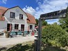
The above images may not be of the site on this page, but were taken nearby. They are loaded from Flickr so please click on them for image credits.
Click here to see more info for this site
Nearby sites
Click here to view sites on an interactive map of the areaKey: Red: member's photo, Blue: 3rd party photo, Yellow: other image, Green: no photo - please go there and take one, Grey: site destroyed
Download sites to:
KML (Google Earth)
GPX (GPS waypoints)
CSV (Garmin/Navman)
CSV (Excel)
To unlock full downloads you need to sign up as a Contributory Member. Otherwise downloads are limited to 50 sites.
Turn off the page maps and other distractions
Nearby sites listing. In the following links * = Image available
1.1km SE 128° Lilla Bjärs Gravfält* Barrow Cemetery
10.6km SW 226° Lummelundagrottan* Cave or Rock Shelter
11.4km E 81° Tänselgårde* Stone Circle
12.3km SE 137° Tiselhagens* Stone Circle
12.3km SE 137° Filehajdars* Standing Stones
12.6km S 169° Grausne* Stone Circle
12.8km ENE 58° Hangvar 34:1 Barrow Cemetery
12.8km SSE 151° Bjärs Gravfält (Hejnum) Barrow Cemetery
13.3km S 188° Bro stainkällingar* Standing Stones
14.3km SSW 192° Bro kyrka* Carving
15.3km SSW 195° Dacker* Stone Circle
15.7km SSW 199° Bro ojkar* Standing Stones
15.7km SSW 198° Bro stainkalm* Cairn
15.9km E 94° Lärbro Kyrka Bildsten* Sculptured Stone
16.5km ESE 105° Stora Bjärs* Chambered Cairn
16.7km ESE 113° Stenstugu* Stone Circle
16.8km E 87° Kauparve röse* Cairn
16.9km E 95° Sangelstainen* Natural Stone / Erratic / Other Natural Feature
17.1km E 94° Lajkarhajd* Cairn
17.3km E 94° Domarlunden* Stone Circle
17.9km E 99° Pavals* Stone Circle
18.8km SW 217° Annelund Gravfält* Barrow Cemetery
20.2km SE 133° Klinteklinten* Natural Stone / Erratic / Other Natural Feature
20.4km E 93° Lilla Ihre Gravfält Barrow Cemetery
20.6km SW 219° Galberget Trojaborg Turf Maze
View more nearby sites and additional images


 We would like to know more about this location. Please feel free to add a brief description and any relevant information in your own language.
 Wir möchten mehr über diese Stätte erfahren. Bitte zögern Sie nicht, eine kurze Beschreibung und relevante Informationen in Deutsch hinzuzufügen.
 Nous aimerions en savoir encore un peu sur les lieux. S'il vous plaît n'hesitez pas à ajouter une courte description et tous les renseignements pertinents dans votre propre langue.
 Quisieramos informarnos un poco más de las lugares. No dude en añadir una breve descripción y otros datos relevantes en su propio idioma.