


<< Text Pages >> Grodzisko Junkrowy - Hillfort in Poland in Pomorskie
Submitted by SolarMegalith on Tuesday, 11 January 2011 Page Views: 2011
Iron Age and Later PrehistorySite Name: Grodzisko JunkrowyCountry: Poland
NOTE: This site is 13.754 km away from the location you searched for.
Voivodeship: Pomorskie Type: Hillfort
Nearest Town: Starogard Gdański
Latitude: 54.084340N Longitude: 18.379860E
Condition:
| 5 | Perfect |
| 4 | Almost Perfect |
| 3 | Reasonable but with some damage |
| 2 | Ruined but still recognisable as an ancient site |
| 1 | Pretty much destroyed, possibly visible as crop marks |
| 0 | No data. |
| -1 | Completely destroyed |
| 5 | Superb |
| 4 | Good |
| 3 | Ordinary |
| 2 | Not Good |
| 1 | Awful |
| 0 | No data. |
| 5 | Can be driven to, probably with disabled access |
| 4 | Short walk on a footpath |
| 3 | Requiring a bit more of a walk |
| 2 | A long walk |
| 1 | In the middle of nowhere, a nightmare to find |
| 0 | No data. |
| 5 | co-ordinates taken by GPS or official recorded co-ordinates |
| 4 | co-ordinates scaled from a detailed map |
| 3 | co-ordinates scaled from a bad map |
| 2 | co-ordinates of the nearest village |
| 1 | co-ordinates of the nearest town |
| 0 | no data |
Internal Links:
External Links:
Hillfort in Pomorskie
A well-preserved early medieval hilfort is located on the top of a hill near Wietcisa river. Its 5m high rampart is still distinguishable. The hillfort is oval in shape and has 45-50m in diameter diameter. There are no traces of earthworks in northern part of the site, where river was a natural defence. Before the hillfort was built, in the 7th century AD an open settlement existed in this place.
More info
You may be viewing yesterday's version of this page. To see the most up to date information please register for a free account.
Do not use the above information on other web sites or publications without permission of the contributor.
Nearby Images from Flickr
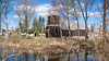
The above images may not be of the site on this page, but were taken nearby. They are loaded from Flickr so please click on them for image credits.
Click here to see more info for this site
Nearby sites
Click here to view sites on an interactive map of the areaKey: Red: member's photo, Blue: 3rd party photo, Yellow: other image, Green: no photo - please go there and take one, Grey: site destroyed
Download sites to:
KML (Google Earth)
GPX (GPS waypoints)
CSV (Garmin/Navman)
CSV (Excel)
To unlock full downloads you need to sign up as a Contributory Member. Otherwise downloads are limited to 50 sites.
Turn off the page maps and other distractions
Nearby sites listing. In the following links * = Image available
10.7km E 89° Grodzisko Siwiałka* Promontory Fort / Cliff Castle
16.2km W 276° Kurhany Nowy Barkoczyn Barrow Cemetery
21.3km E 88° Grodzisko Lubiszewo Tczewskie Hillfort
23.5km NNE 19° Lublewo Gdańskie Stone Circles Stone Circle
23.6km NNW 344° Kurhany Trątkownica* Barrow Cemetery
25.8km SE 129° Pelplin - Diabielski Kamień Natural Stone / Erratic / Other Natural Feature
29.2km WNW 302° Kurchany Uniradze Barrow Cemetery
31.3km NW 305° Zgorzałe Stone Circles Stone Circle
32.2km SSW 210° Złe Mięso Stone Circles Stone Circle
32.6km SW 231° Odry* Stone Circle
33.8km NNE 29° Gdansk* Sculptured Stone
33.8km N 349° Przodkowo Stone Circles Stone Circle
35.0km NW 315° Grodzisko Borzestowo Hillfort
35.2km SE 135° Brody Pomorskie Neolithic Settlement Ancient Village or Settlement
35.2km WNW 288° Grodzisko Gostomie* Hillfort
35.7km SSW 203° Starzyska Stone Circles Stone Circle
38.3km WNW 296° Wesiory* Stone Circle
40.5km WNW 300° Kurhany Mściszewice* Barrow Cemetery
43.9km WSW 257° Kurhany Główczewice Barrow Cemetery
44.2km ESE 108° Kurhany Koniecwałd Barrow Cemetery
47.7km WSW 250° Kurhany Leśno* Barrow Cemetery
48.2km NW 323° Potęgowo Megalithic Tomb Chambered Tomb
49.1km WNW 284° Kurhan Gołczewo* Round Barrow(s)
51.2km WNW 287° Kurhan Jamno Round Barrow(s)
51.3km SE 135° Grodzisko Baldram Hillfort
View more nearby sites and additional images


 We would like to know more about this location. Please feel free to add a brief description and any relevant information in your own language.
 Wir möchten mehr über diese Stätte erfahren. Bitte zögern Sie nicht, eine kurze Beschreibung und relevante Informationen in Deutsch hinzuzufügen.
 Nous aimerions en savoir encore un peu sur les lieux. S'il vous plaît n'hesitez pas à ajouter une courte description et tous les renseignements pertinents dans votre propre langue.
 Quisieramos informarnos un poco más de las lugares. No dude en añadir una breve descripción y otros datos relevantes en su propio idioma.