


<< Other Photo Pages >> Sant'Anna Menhir - Standing Stone (Menhir) in Italy in Puglia
Submitted by davidmorgan on Friday, 08 August 2014 Page Views: 1012
Neolithic and Bronze AgeSite Name: Sant'Anna MenhirCountry: Italy
NOTE: This site is 0.228 km away from the location you searched for.
Region: Puglia Type: Standing Stone (Menhir)
Nearest Town: Zollino
Latitude: 40.201901N Longitude: 18.251018E
Condition:
| 5 | Perfect |
| 4 | Almost Perfect |
| 3 | Reasonable but with some damage |
| 2 | Ruined but still recognisable as an ancient site |
| 1 | Pretty much destroyed, possibly visible as crop marks |
| 0 | No data. |
| -1 | Completely destroyed |
| 5 | Superb |
| 4 | Good |
| 3 | Ordinary |
| 2 | Not Good |
| 1 | Awful |
| 0 | No data. |
| 5 | Can be driven to, probably with disabled access |
| 4 | Short walk on a footpath |
| 3 | Requiring a bit more of a walk |
| 2 | A long walk |
| 1 | In the middle of nowhere, a nightmare to find |
| 0 | No data. |
| 5 | co-ordinates taken by GPS or official recorded co-ordinates |
| 4 | co-ordinates scaled from a detailed map |
| 3 | co-ordinates scaled from a bad map |
| 2 | co-ordinates of the nearest village |
| 1 | co-ordinates of the nearest town |
| 0 | no data |
Internal Links:
External Links:
Standing Stone (Menhir) in Puglia
A 3 metre tall menhir.
You may be viewing yesterday's version of this page. To see the most up to date information please register for a free account.
Do not use the above information on other web sites or publications without permission of the contributor.
davidmorgan has found this location on Google Street View:
Nearby Images from Flickr
The above images may not be of the site on this page, but were taken nearby. They are loaded from Flickr so please click on them for image credits.
Click here to see more info for this site
Nearby sites
Click here to view sites on an interactive map of the areaKey: Red: member's photo, Blue: 3rd party photo, Yellow: other image, Green: no photo - please go there and take one, Grey: site destroyed
Download sites to:
KML (Google Earth)
GPX (GPS waypoints)
CSV (Garmin/Navman)
CSV (Excel)
To unlock full downloads you need to sign up as a Contributory Member. Otherwise downloads are limited to 50 sites.
Turn off the page maps and other distractions
Nearby sites listing. In the following links * = Image available
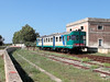
1.4km WSW 258° Stazione Standing stone* Standing Stone (Menhir)
4.6km E 95° Teofilo Menhir* Standing Stone (Menhir)
5.2km SE 146° Scineo Menhir Standing Stone (Menhir)
5.7km SSE 154° Massenia Piccinna Menhir Standing Stone (Menhir)
5.7km SE 142° Minonna Standing stone* Standing Stone (Menhir)
5.9km SSE 166° Corigliano Double Dolmen* Burial Chamber or Dolmen
5.9km SSE 147° Lama Standing Stone* Standing Stone (Menhir)
6.2km SE 142° Candelora Menhir* Standing Stone (Menhir)
6.3km NE 35° Pietra di San Vito Standing Stone (Menhir)
6.7km SE 143° Giovane Menhir* Standing Stone (Menhir)
6.7km SSE 152° Chipuru Menhir Standing Stone (Menhir)
6.8km NNW 330° Lete Standing Stone* Standing Stone (Menhir)
6.9km SSE 154° Santa Loja Menhir Standing Stone (Menhir)
6.9km E 90° Grassi Menhir* Standing Stone (Menhir)
7.1km NNW 329° Curti Vecchi Standing Stone* Standing Stone (Menhir)
7.3km SE 143° Croce alle Tajate Menhir* Standing Stone (Menhir)
7.4km SE 146° Meriggina Dolmen Burial Chamber or Dolmen
7.4km SSE 161° San Rocco Menhir Standing Stone (Menhir)
7.5km SSE 164° Specchia Dolmen* Burial Chamber or Dolmen
7.7km SSE 149° Calamauri Dolmen II Burial Chamber or Dolmen
7.8km SSE 148° Calamauri Dolmen I Burial Chamber or Dolmen
7.8km SSE 155° Calamauri Menhir* Standing Stone (Menhir)
7.9km SSE 163° Masseria Noa Dolmen Burial Chamber or Dolmen
7.9km N 5° Luce Standing Stone* Standing Stone (Menhir)
8.0km E 86° Chianca di Santo Stefano Trilithon* Burial Chamber or Dolmen
View more nearby sites and additional images


 We would like to know more about this location. Please feel free to add a brief description and any relevant information in your own language.
 Wir möchten mehr über diese Stätte erfahren. Bitte zögern Sie nicht, eine kurze Beschreibung und relevante Informationen in Deutsch hinzuzufügen.
 Nous aimerions en savoir encore un peu sur les lieux. S'il vous plaît n'hesitez pas à ajouter une courte description et tous les renseignements pertinents dans votre propre langue.
 Quisieramos informarnos un poco más de las lugares. No dude en añadir una breve descripción y otros datos relevantes en su propio idioma.