


<< Our Photo Pages >> Västergarn 19:1 - Stone Circle in Sweden in Gotland
Submitted by ShamrockStone on Saturday, 30 March 2019 Page Views: 578
Neolithic and Bronze AgeSite Name: Västergarn 19:1Country: Sweden
NOTE: This site is 3.35 km away from the location you searched for.
Landskap: Gotland Type: Stone Circle
Nearest Village: Västergarn
Latitude: 57.464880N Longitude: 18.196070E
Condition:
| 5 | Perfect |
| 4 | Almost Perfect |
| 3 | Reasonable but with some damage |
| 2 | Ruined but still recognisable as an ancient site |
| 1 | Pretty much destroyed, possibly visible as crop marks |
| 0 | No data. |
| -1 | Completely destroyed |
| 5 | Superb |
| 4 | Good |
| 3 | Ordinary |
| 2 | Not Good |
| 1 | Awful |
| 0 | No data. |
| 5 | Can be driven to, probably with disabled access |
| 4 | Short walk on a footpath |
| 3 | Requiring a bit more of a walk |
| 2 | A long walk |
| 1 | In the middle of nowhere, a nightmare to find |
| 0 | No data. |
| 5 | co-ordinates taken by GPS or official recorded co-ordinates |
| 4 | co-ordinates scaled from a detailed map |
| 3 | co-ordinates scaled from a bad map |
| 2 | co-ordinates of the nearest village |
| 1 | co-ordinates of the nearest town |
| 0 | no data |
Internal Links:
External Links:
")
A domarring with a diameter of 8 m. There are 5 stones, 35 to 70 cm high.
You may be viewing yesterday's version of this page. To see the most up to date information please register for a free account.
Do not use the above information on other web sites or publications without permission of the contributor.
Nearby Images from Flickr
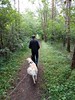

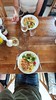

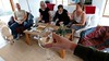
The above images may not be of the site on this page, but were taken nearby. They are loaded from Flickr so please click on them for image credits.
Click here to see more info for this site
Nearby sites
Click here to view sites on an interactive map of the areaKey: Red: member's photo, Blue: 3rd party photo, Yellow: other image, Green: no photo - please go there and take one, Grey: site destroyed
Download sites to:
KML (Google Earth)
GPX (GPS waypoints)
CSV (Garmin/Navman)
CSV (Excel)
To unlock full downloads you need to sign up as a Contributory Member. Otherwise downloads are limited to 50 sites.
Turn off the page maps and other distractions
Nearby sites listing. In the following links * = Image available
1.3km SSE 151° Sanda 58:1* Stone Circle
3.8km NNW 327° Ullviar* Barrow Cemetery
5.9km NW 326° Gnisvärd skeppssättning* Stone Circle
5.9km NW 326° Tofta 143:3* Burial Chamber or Dolmen
6.3km NW 318° Gnisvärds private skeppssättning* Modern Stone Circle etc
6.8km NNE 13° Stenkumla 96:1* Stone Circle
7.7km SSE 167° Rannarve Röse* Cairn
7.8km SSE 168° Rannarve skeppssättning* Stone Circle
9.0km ESE 106° Gräne Skeppssättning* Stone Circle
13.0km S 181° Gannarve skeppssättning* Stone Circle
14.0km S 171° Vallhagar* Ancient Village or Settlement
14.4km S 181° Fröjel Trojaborg* Turf Maze
15.0km SE 135° Hejde 34:1 Barrow Cemetery
16.0km N 9° Västerhejde Gravfält* Barrow Cemetery
17.1km ENE 78° Nordens största gravklot* Natural Stone / Erratic / Other Natural Feature
17.8km S 189° Djupvik Skeppssättning* Stone Circle
18.0km E 87° Sjonhem 16:1* Stone Circle
19.4km NNE 17° Vår Skulpturpark Skeppssättning* Modern Stone Circle etc
19.8km ESE 113° Änges Bildstenar* Standing Stones
19.9km NNE 18° Visby (Gotland)* Polissoir
19.9km ESE 113° Buttle 266 Ancient Village or Settlement
20.3km NNE 16° Gotlands Fornsal* Museum
20.3km NE 36° Endre 17:1* Stone Circle
20.9km NNE 33° Endre 35:1* Stone Circle
20.9km ENE 61° Stenkusten modern rock art Rock Art
View more nearby sites and additional images


 We would like to know more about this location. Please feel free to add a brief description and any relevant information in your own language.
 Wir möchten mehr über diese Stätte erfahren. Bitte zögern Sie nicht, eine kurze Beschreibung und relevante Informationen in Deutsch hinzuzufügen.
 Nous aimerions en savoir encore un peu sur les lieux. S'il vous plaît n'hesitez pas à ajouter une courte description et tous les renseignements pertinents dans votre propre langue.
 Quisieramos informarnos un poco más de las lugares. No dude en añadir una breve descripción y otros datos relevantes en su propio idioma.