


<< Our Photo Pages >> Puketapapa Pa - Hillfort in New Zealand
Submitted by DrewParsons on Monday, 20 August 2012 Page Views: 4179
Iron Age and Later PrehistorySite Name: Puketapapa Pa Alternative Name: Mt Roskill Pa, Pukewiwi Pa, Puketaapapa Pa, R11/19Country: New Zealand
NOTE: This site is 81.303 km away from the location you searched for.
Type: Hillfort
Nearest Town: Auckland Nearest Village: Mt Roskill
Latitude: 36.91259S Longitude: 174.737210E
Condition:
| 5 | Perfect |
| 4 | Almost Perfect |
| 3 | Reasonable but with some damage |
| 2 | Ruined but still recognisable as an ancient site |
| 1 | Pretty much destroyed, possibly visible as crop marks |
| 0 | No data. |
| -1 | Completely destroyed |
| 5 | Superb |
| 4 | Good |
| 3 | Ordinary |
| 2 | Not Good |
| 1 | Awful |
| 0 | No data. |
| 5 | Can be driven to, probably with disabled access |
| 4 | Short walk on a footpath |
| 3 | Requiring a bit more of a walk |
| 2 | A long walk |
| 1 | In the middle of nowhere, a nightmare to find |
| 0 | No data. |
| 5 | co-ordinates taken by GPS or official recorded co-ordinates |
| 4 | co-ordinates scaled from a detailed map |
| 3 | co-ordinates scaled from a bad map |
| 2 | co-ordinates of the nearest village |
| 1 | co-ordinates of the nearest town |
| 0 | no data |
Internal Links:
External Links:
I have visited· I would like to visit
DrewParsons has visited here
")
From the summit car park there is a short path leading to the western summit of the volcanic cone from where you can look down to the cultivation and habitation terraces on the upper slopes of the cone. There is a kumera pit (once it would have been thatched and with wicker walls and used for storing kumera through the winter) as you reach the summit. The aerial photographs of the site clearly show the terraces and other kumera pits on the western, southern and eastern sides of the cone.
The construction of a water reservoir and access lane on the summit has caused major damage to parts of the cone. Rescue archaeological finds from that work have included basalt and greywacke adzes, sandstone polishers, and two baked clay items interpreted as beads. Post holes from a double row of palisades were also found at the summit. Four radio carbon dates place occupation of the site between 1400 AD 1700 AD, after which the site was abandoned due to the defeat of the local tribe by the Ngati Whatua tribe around 1750.
The site is located in the Auckland suburb of Mt Roskill and is reached by a summit road leading off of Dominion Road immediately south of the bridge over the South Western Motorway.
References:
Clough R. and Bickler S., Mt Roskill Cycleway Archaeological Assessment Auckland City Council, 2007
S Bulmer, Sources for the Archaeology of the Maaori Settlement of the Taamaki Volcanic District, Dept of Conservation, Wellington, 1994
You may be viewing yesterday's version of this page. To see the most up to date information please register for a free account.
")
")
")
Do not use the above information on other web sites or publications without permission of the contributor.
Nearby Images from Flickr
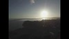
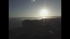

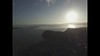
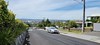

The above images may not be of the site on this page, but were taken nearby. They are loaded from Flickr so please click on them for image credits.
Click here to see more info for this site
Nearby sites
Click here to view sites on an interactive map of the areaKey: Red: member's photo, Blue: 3rd party photo, Yellow: other image, Green: no photo - please go there and take one, Grey: site destroyed
Download sites to:
KML (Google Earth)
GPX (GPS waypoints)
CSV (Garmin/Navman)
CSV (Excel)
To unlock full downloads you need to sign up as a Contributory Member. Otherwise downloads are limited to 50 sites.
Turn off the page maps and other distractions
Nearby sites listing. In the following links * = Image available
4.1km NE 42° Epsom Modern Megalith* Modern Stone Circle etc
4.3km ENE 71° Maungakiekie Pa* Hillfort
4.5km NNE 32° Maungawhau* Hillfort
5.0km ENE 70° Cornwall Park Rongo Stone* Standing Stone (Menhir)
5.0km NE 50° Te Kopuke Pa* Hillfort
5.8km SE 135° Mangere Mountain Pa* Hillfort
5.9km NE 49° Remuera Pa* Hillfort
6.8km NNE 32° Auckland Museum* Museum
9.4km ESE 104° Otahuhu Pa* Hillfort
9.4km ENE 76° Maungarei Stonefields* Ancient Village or Settlement
10.0km ENE 77° Maungarei Pa* Hillfort
13.0km ENE 66° Taurere Pa* Hillfort
13.9km ENE 72° Tahuna Torea* Ancient Village or Settlement
16.9km ENE 57° Motukorea Cone Pa* Hillfort
17.3km N 10° Rahopara Pa* Hillfort
18.1km NNW 330° Te Taou Pa* Hillfort
25.6km ENE 64° Matarahui Bay Pa* Hillfort
26.6km ENE 56° Mokemoke Pa* Hillfort
27.3km N 359° Okura 784 Settlement & Midden* Artificial Mound
27.9km N 359° Dacre Point Pa* Hillfort
29.5km N 1° Rarowhara Pa* Hillfort
30.8km N 5° Little Manly East Point Pa* Hillfort
31.7km N 3° West Manly Pa* Hillfort
32.0km N 9° Rakauananga Pa* Hillfort
33.4km N 351° Silverdale Pioneer Village* Museum
View more nearby sites and additional images


 We would like to know more about this location. Please feel free to add a brief description and any relevant information in your own language.
 Wir möchten mehr über diese Stätte erfahren. Bitte zögern Sie nicht, eine kurze Beschreibung und relevante Informationen in Deutsch hinzuzufügen.
 Nous aimerions en savoir encore un peu sur les lieux. S'il vous plaît n'hesitez pas à ajouter une courte description et tous les renseignements pertinents dans votre propre langue.
 Quisieramos informarnos un poco más de las lugares. No dude en añadir una breve descripción y otros datos relevantes en su propio idioma.