


<< Our Photo Pages >> Oropoko - Rock Art in Namibia
Submitted by DrewParsons on Saturday, 17 May 2014 Page Views: 2341
Rock ArtSite Name: OropokoCountry: Namibia
NOTE: This site is 117.148 km away from the location you searched for.
Type: Rock Art
Nearest Town: Okahandja Nearest Village: Oropoko Lodge
Latitude: 21.75488S Longitude: 16.503780E
Condition:
| 5 | Perfect |
| 4 | Almost Perfect |
| 3 | Reasonable but with some damage |
| 2 | Ruined but still recognisable as an ancient site |
| 1 | Pretty much destroyed, possibly visible as crop marks |
| 0 | No data. |
| -1 | Completely destroyed |
| 5 | Superb |
| 4 | Good |
| 3 | Ordinary |
| 2 | Not Good |
| 1 | Awful |
| 0 | No data. |
| 5 | Can be driven to, probably with disabled access |
| 4 | Short walk on a footpath |
| 3 | Requiring a bit more of a walk |
| 2 | A long walk |
| 1 | In the middle of nowhere, a nightmare to find |
| 0 | No data. |
| 5 | co-ordinates taken by GPS or official recorded co-ordinates |
| 4 | co-ordinates scaled from a detailed map |
| 3 | co-ordinates scaled from a bad map |
| 2 | co-ordinates of the nearest village |
| 1 | co-ordinates of the nearest town |
| 0 | no data |
Internal Links:
External Links:
I have visited· I would like to visit
DrewParsons has visited here
")
Oropoko rock art is located in the extensive safari grounds of Orokopo Lodge, Namibia. The rock art is remote and you need to take the lodge safari vehicle to reach it. The coordinates are given for the lodge and not the petroglyphs. I visited these petroglyphs in February 2005 and have no information about their age although I suspect that they are similar to those at other sites in this region including those at Omburo Ost.
You may be viewing yesterday's version of this page. To see the most up to date information please register for a free account.
Do not use the above information on other web sites or publications without permission of the contributor.
Nearby Images from Flickr


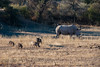


The above images may not be of the site on this page, but were taken nearby. They are loaded from Flickr so please click on them for image credits.
Click here to see more info for this site
Nearby sites
Click here to view sites on an interactive map of the areaKey: Red: member's photo, Blue: 3rd party photo, Yellow: other image, Green: no photo - please go there and take one, Grey: site destroyed
Download sites to:
KML (Google Earth)
GPX (GPS waypoints)
CSV (Garmin/Navman)
CSV (Excel)
To unlock full downloads you need to sign up as a Contributory Member. Otherwise downloads are limited to 50 sites.
Turn off the page maps and other distractions
Nearby sites listing. In the following links * = Image available
53.9km W 267° Paula's Cave Rock Art
89.2km W 267° Phillipp's Cave Rock Art
134.5km W 266° Bushman Paradise* Rock Art
164.0km SSW 196° Rooisand Rock Painting* Rock Art
183.2km NW 324° Omburo Ost* Rock Art
188.7km NW 324° Vingerklip* Natural Stone / Erratic / Other Natural Feature
203.6km WNW 290° The White Lady Group* Rock Art
222.8km SSW 212° Mirabib* Natural Stone / Erratic / Other Natural Feature
255.5km WNW 300° Twyfelfontein* Stone Circle
255.7km WNW 300° Twyfelfontein* Rock Art
633.0km SSE 152° The Lost City of Kalahari* Ancient Village or Settlement
640.0km ENE 60° Tsodilo Hills* Rock Art
643.2km NNW 328° Pinturas Rupestres do Monte Negro Rock Art
665.5km S 175° Apollo 11 Cave* Cave or Rock Shelter
750.7km NNW 329° Tshitundo Hulo Rock Art
793.1km S 176° Spitzkloof* Cave or Rock Shelter
888.7km NNW 343° Quilengues Gravures Rupestres Rock Art
907.3km E 83° Makgadikgadi* Ancient Village or Settlement
914.9km NNW 337° Txipopilu Petroglyphs Rock Art
934.6km SE 136° Kathu Pan* Ancient Mine, Quarry or other Industry
981.9km SE 135° Wonderwerk Cave* Cave or Rock Shelter
1022.4km ESE 108° Matsieng Footprints Rock Art
1091.6km N 360° Moma Rock Art
1111.4km SE 130° Stowlands Rock art Rock Art
1114.9km SE 135° Nooitgedacht Rock art Rock Art
View more nearby sites and additional images


 We would like to know more about this location. Please feel free to add a brief description and any relevant information in your own language.
 Wir möchten mehr über diese Stätte erfahren. Bitte zögern Sie nicht, eine kurze Beschreibung und relevante Informationen in Deutsch hinzuzufügen.
 Nous aimerions en savoir encore un peu sur les lieux. S'il vous plaît n'hesitez pas à ajouter une courte description et tous les renseignements pertinents dans votre propre langue.
 Quisieramos informarnos un poco más de las lugares. No dude en añadir una breve descripción y otros datos relevantes en su propio idioma.