 with our Megalithic Portal iPhone app")

<< Text Pages >> Moma - Rock Art in Angola
Submitted by KaiHofmann on Saturday, 02 February 2013 Page Views: 2298
Rock ArtSite Name: MomaCountry: Angola
NOTE: This site is 210.384 km away from the location you searched for.
Type: Rock Art
Nearest Town: Mungo
Latitude: 11.938602S Longitude: 16.469955E
Condition:
| 5 | Perfect |
| 4 | Almost Perfect |
| 3 | Reasonable but with some damage |
| 2 | Ruined but still recognisable as an ancient site |
| 1 | Pretty much destroyed, possibly visible as crop marks |
| 0 | No data. |
| -1 | Completely destroyed |
| 5 | Superb |
| 4 | Good |
| 3 | Ordinary |
| 2 | Not Good |
| 1 | Awful |
| 0 | No data. |
| 5 | Can be driven to, probably with disabled access |
| 4 | Short walk on a footpath |
| 3 | Requiring a bit more of a walk |
| 2 | A long walk |
| 1 | In the middle of nowhere, a nightmare to find |
| 0 | No data. |
| 5 | co-ordinates taken by GPS or official recorded co-ordinates |
| 4 | co-ordinates scaled from a detailed map |
| 3 | co-ordinates scaled from a bad map |
| 2 | co-ordinates of the nearest village |
| 1 | co-ordinates of the nearest town |
| 0 | no data |
Be the first person to rate this site - see the 'Contribute!' box in the right hand menu.
Internal Links:
External Links:
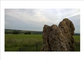
Rock Art in Angola
Rock shelter at the Pedra Candingili granite rocks with paintings on the wall.
You may be viewing yesterday's version of this page. To see the most up to date information please register for a free account.
Do not use the above information on other web sites or publications without permission of the contributor.
Click here to see more info for this site
Nearby sites
Click here to view sites on an interactive map of the areaKey: Red: member's photo, Blue: 3rd party photo, Yellow: other image, Green: no photo - please go there and take one, Grey: site destroyed
Download sites to:
KML (Google Earth)
GPX (GPS waypoints)
CSV (Garmin/Navman)
CSV (Excel)
To unlock full downloads you need to sign up as a Contributory Member. Otherwise downloads are limited to 50 sites.
Turn off the page maps and other distractions
Nearby sites listing. In the following links * = Image available
259.3km NW 325° Pedra Quissongo Rock Art
270.3km NNW 339° Pungo Andongo Rock Art
353.9km SW 227° Quilengues Gravures Rupestres Rock Art
425.4km SW 235° Txipopilu Petroglyphs Rock Art
590.1km SW 221° Tshitundo Hulo Rock Art
642.6km SSW 212° Pinturas Rupestres do Monte Negro Rock Art
760.2km NNW 347° Grottes de Dimba et Ngoyo Cave or Rock Shelter
945.5km S 187° Vingerklip* Natural Stone / Erratic / Other Natural Feature
945.7km SE 144° Tsodilo Hills* Rock Art
946.0km E 91° Nyambwezu Rock Shelter Rock Art
949.6km S 186° Omburo Ost* Rock Art
988.3km SSW 193° Twyfelfontein* Rock Art
988.5km SSW 193° Twyfelfontein* Stone Circle
1037.9km S 190° The White Lady Group* Rock Art
1091.6km S 180° Oropoko* Rock Art
1096.0km S 183° Paula's Cave Rock Art
1100.1km S 184° Phillipp's Cave Rock Art
1107.6km S 187° Bushman Paradise* Rock Art
1181.7km ESE 118° Sikaunda petroglyphs Rock Art
1249.9km S 182° Rooisand Rock Painting* Rock Art
1285.9km S 185° Mirabib* Natural Stone / Erratic / Other Natural Feature
1333.7km SE 137° Makgadikgadi* Ancient Village or Settlement
1589.6km SE 128° Bambata Cave* Cave or Rock Shelter
1598.3km SE 128° World's View Matobo National Park* Natural Stone / Erratic / Other Natural Feature
1601.3km SE 128° Inanke Cave Cave or Rock Shelter
View more nearby sites and additional images


 We would like to know more about this location. Please feel free to add a brief description and any relevant information in your own language.
 Wir möchten mehr über diese Stätte erfahren. Bitte zögern Sie nicht, eine kurze Beschreibung und relevante Informationen in Deutsch hinzuzufügen.
 Nous aimerions en savoir encore un peu sur les lieux. S'il vous plaît n'hesitez pas à ajouter une courte description et tous les renseignements pertinents dans votre propre langue.
 Quisieramos informarnos un poco más de las lugares. No dude en añadir una breve descripción y otros datos relevantes en su propio idioma.