


<< Our Photo Pages >> Nakovana Cave - Cave or Rock Shelter in Croatia
Submitted by Andy B on Wednesday, 25 January 2012 Page Views: 12548
Natural PlacesSite Name: Nakovana CaveCountry: Croatia Type: Cave or Rock Shelter
Latitude: 42.999630N Longitude: 17.087170E
Condition:
| 5 | Perfect |
| 4 | Almost Perfect |
| 3 | Reasonable but with some damage |
| 2 | Ruined but still recognisable as an ancient site |
| 1 | Pretty much destroyed, possibly visible as crop marks |
| 0 | No data. |
| -1 | Completely destroyed |
| 5 | Superb |
| 4 | Good |
| 3 | Ordinary |
| 2 | Not Good |
| 1 | Awful |
| 0 | No data. |
| 5 | Can be driven to, probably with disabled access |
| 4 | Short walk on a footpath |
| 3 | Requiring a bit more of a walk |
| 2 | A long walk |
| 1 | In the middle of nowhere, a nightmare to find |
| 0 | No data. |
| 5 | co-ordinates taken by GPS or official recorded co-ordinates |
| 4 | co-ordinates scaled from a detailed map |
| 3 | co-ordinates scaled from a bad map |
| 2 | co-ordinates of the nearest village |
| 1 | co-ordinates of the nearest town |
| 0 | no data |
Internal Links:
External Links:
I have visited· I would like to visit
WindC would like to visit
Andy B has visited here
")
The excavation of this unusual site, evidently sealed for the last 2,000 years, has provided new insight into the Illyrian people, contemporaries of the ancient Greeks. Until now, very little was known about the Illyrians' beliefs, cults and symbolic lives.
"This discovery is rare and provocative. The archaeological evidence we have found to date strongly points to some mysterious, previously unknown cult activity, which may have been practiced in secrecy by the Illyrians," said Dr. Tim Kaiser, Research Associate in the ROM's Department of Western Art and Culture and co-director of the Nakovana Cave project. "For archaeologists to find a sealed, undisturbed cave site is fairly unusual. Nakovana is like a window on a Mediterranean past that's much richer than we ever thought."
The Royal Ontario Museum has worked closely on this and related projects with a team of Croatian archaeologists, co-directed by Dr. Staso Forenbaher, of the Institute of Anthropology, Zagreb, Croatia.
The cave is located on a remote hillside at the western tip of the Pelješac Peninsula in southern Dalmatia
Source: The Royal Ontario Museum
Note: Oldest known astrologer's board discovered in Dalmatia
You may be viewing yesterday's version of this page. To see the most up to date information please register for a free account.
")
")
")
Do not use the above information on other web sites or publications without permission of the contributor.
Nearby Images from Flickr


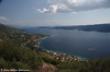
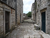
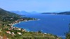
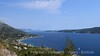
The above images may not be of the site on this page, but were taken nearby. They are loaded from Flickr so please click on them for image credits.
Click here to see more info for this site
Nearby sites
Click here to view sites on an interactive map of the areaKey: Red: member's photo, Blue: 3rd party photo, Yellow: other image, Green: no photo - please go there and take one, Grey: site destroyed
Download sites to:
KML (Google Earth)
GPX (GPS waypoints)
CSV (Garmin/Navman)
CSV (Excel)
To unlock full downloads you need to sign up as a Contributory Member. Otherwise downloads are limited to 50 sites.
Turn off the page maps and other distractions
Nearby sites listing. In the following links * = Image available
35.7km WNW 298° Tor Hillfort (Croatia)* Hillfort
38.9km WNW 299° Hvar Island* Ancient Village or Settlement
43.7km WNW 296° Purkin Kuk Hillfort* Hillfort
44.5km ENE 78° Narona Museum* Museum
44.6km ENE 78° Narona Town Wall* Hillfort
44.7km WNW 297° Pharos Town wall* Hillfort
44.7km WNW 297° Stari Grad Museum* Museum
49.9km NW 306° Zmajeva Spilja* Cave or Rock Shelter
52.7km ENE 78° Klepci tumuli 1* Round Barrow(s)
52.8km ENE 78° Klepci tumuli 2* Round Barrow(s)
55.6km WNW 291° Hvar Castle Museum* Museum
55.9km WNW 291° Fortica* Hillfort
56.0km WNW 290° Hvar Museum* Museum
56.0km ENE 61° Citluk-Greda-Illyrian observatory* Carving
57.3km NW 310° Brac Island* Ancient Village or Settlement
57.4km WNW 292° Vira (Hvar)* Barrow Cemetery
63.2km NW 309° Gradina Rat Hillfort
64.6km NE 49° Zvonigrad - fortification wall* Hillfort
64.6km NE 49° Zvonigrad* Hillfort
65.2km NE 51° Polog.* Hillfort
69.2km E 80° Osanici Hillfort* Hillfort
77.1km NW 317° Diocletian's Palace* Ancient Palace
77.2km NW 324° Klis Hillfort* Hillfort
77.4km NW 321° Solin Town Gate* Ancient Village or Settlement
77.4km NW 321° Salona Town wall* Hillfort
View more nearby sites and additional images

")
 We would like to know more about this location. Please feel free to add a brief description and any relevant information in your own language.
 Wir möchten mehr über diese Stätte erfahren. Bitte zögern Sie nicht, eine kurze Beschreibung und relevante Informationen in Deutsch hinzuzufügen.
 Nous aimerions en savoir encore un peu sur les lieux. S'il vous plaît n'hesitez pas à ajouter une courte description et tous les renseignements pertinents dans votre propre langue.
 Quisieramos informarnos un poco más de las lugares. No dude en añadir una breve descripción y otros datos relevantes en su propio idioma.