


<< Our Photo Pages >> Kurhany Oborniki Slaskie (1) - Round Barrow(s) in Poland in Dolnoslaskie
Submitted by SolarMegalith on Monday, 23 June 2008 Page Views: 3828
Neolithic and Bronze AgeSite Name: Kurhany Oborniki Slaskie (1) Alternative Name: Oborniki Slaskie Round Barrows (1)Country: Poland
NOTE: This site is 8.06 km away from the location you searched for.
Voivodeship: Dolnoslaskie Type: Round Barrow(s)
Nearest Town: Oborniki Śląskie
Latitude: 51.285470N Longitude: 16.946200E
Condition:
| 5 | Perfect |
| 4 | Almost Perfect |
| 3 | Reasonable but with some damage |
| 2 | Ruined but still recognisable as an ancient site |
| 1 | Pretty much destroyed, possibly visible as crop marks |
| 0 | No data. |
| -1 | Completely destroyed |
| 5 | Superb |
| 4 | Good |
| 3 | Ordinary |
| 2 | Not Good |
| 1 | Awful |
| 0 | No data. |
| 5 | Can be driven to, probably with disabled access |
| 4 | Short walk on a footpath |
| 3 | Requiring a bit more of a walk |
| 2 | A long walk |
| 1 | In the middle of nowhere, a nightmare to find |
| 0 | No data. |
| 5 | co-ordinates taken by GPS or official recorded co-ordinates |
| 4 | co-ordinates scaled from a detailed map |
| 3 | co-ordinates scaled from a bad map |
| 2 | co-ordinates of the nearest village |
| 1 | co-ordinates of the nearest town |
| 0 | no data |
Internal Links:
External Links:
I have visited· I would like to visit
SolarMegalith has visited here
 (PID:39825)")
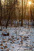
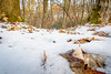
It is easy to find this site - driving from the east to Oborniki you have to turn left into one of the roads which lead through the forest, but I recommend leaving the car near the main road and taking a walk.
You may be viewing yesterday's version of this page. To see the most up to date information please register for a free account.
 (PID:39826)")
Do not use the above information on other web sites or publications without permission of the contributor.
Nearby Images from Flickr
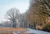
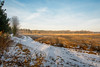
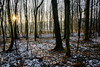
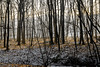
The above images may not be of the site on this page, but were taken nearby. They are loaded from Flickr so please click on them for image credits.
Click here to see more info for this site
Nearby sites
Click here to view sites on an interactive map of the areaKey: Red: member's photo, Blue: 3rd party photo, Yellow: other image, Green: no photo - please go there and take one, Grey: site destroyed
Download sites to:
KML (Google Earth)
GPX (GPS waypoints)
CSV (Garmin/Navman)
CSV (Excel)
To unlock full downloads you need to sign up as a Contributory Member. Otherwise downloads are limited to 50 sites.
Turn off the page maps and other distractions
Nearby sites listing. In the following links * = Image available
1.1km NNE 27° Grodzisko Oborniki Śląskie* Hillfort
5.2km NW 310° Kurhany Oborniki Slaskie (2)* Round Barrow(s)
12.2km WNW 302° Grodzisko Bagno* Hillfort
14.2km S 171° Grodzisko Szwedzki Szaniec - Osobowice* Hillfort
15.0km SSE 167° Grodzisko Góra Kapliczna - Osobowice* Hillfort
21.1km ENE 78° Kurhany Niedary* Barrow Cemetery
22.3km E 80° Kurhany Ludgierzowice* Barrow Cemetery
26.7km ENE 57° Kurhan Łazy Wielkie Round Barrow(s)
29.0km ESE 124° Kurhany Oleśniczka* Barrow Cemetery
30.4km NW 304° Kurhan Słup Round Barrow(s)
31.3km NW 304° Grodzisko Słup Hillfort
32.9km S 178° Grodzisko Magnice Hillfort
38.0km S 180° Kurhan Kuklice Round Barrow(s)
38.3km NW 319° Kurhany Psary Barrow Cemetery
39.3km ENE 72° Kurhany Goszcz Barrow Cemetery
44.9km E 96° Kurhany Jemielna* Barrow Cemetery
45.2km SSW 198° Sobótka sculptered stone I* Sculptured Stone
46.2km SSW 199° Sobótka Mnich II* Sculptured Stone
48.4km WSW 244° Grodzisko Mierczyce* Hillfort
48.8km SSW 199° Niedźwiedź i Panna z Rybą* Sculptured Stone
51.3km SE 141° Grodzisko Ryczyn Mały* Hillfort
51.3km SE 141° Grodzisko Ryczyn Wielki* Hillfort
53.4km N 356° Grodzisko Karzec* Hillfort
53.5km SE 141° Grodzisko Lipki* Hillfort
57.0km SW 222° Grodzisko Nowy Jaworów* Hillfort
View more nearby sites and additional images

")
 We would like to know more about this location. Please feel free to add a brief description and any relevant information in your own language.
 Wir möchten mehr über diese Stätte erfahren. Bitte zögern Sie nicht, eine kurze Beschreibung und relevante Informationen in Deutsch hinzuzufügen.
 Nous aimerions en savoir encore un peu sur les lieux. S'il vous plaît n'hesitez pas à ajouter une courte description et tous les renseignements pertinents dans votre propre langue.
 Quisieramos informarnos un poco más de las lugares. No dude en añadir una breve descripción y otros datos relevantes en su propio idioma.