 with our Megalithic Portal iPhone app")


<< Our Photo Pages >> Sverker Runestone - Carving in Sweden in Södermanland
Submitted by GaryWebster on Tuesday, 12 March 2013 Page Views: 4242
Multi-periodSite Name: Sverker Runestone Alternative Name: Sö 209Country: Sweden
NOTE: This site is 9.613 km away from the location you searched for.
Landskap: Södermanland Type: Carving
Nearest Town: Strängnäs Nearest Village: Fröberga
Latitude: 59.398777N Longitude: 17.178128E
Condition:
| 5 | Perfect |
| 4 | Almost Perfect |
| 3 | Reasonable but with some damage |
| 2 | Ruined but still recognisable as an ancient site |
| 1 | Pretty much destroyed, possibly visible as crop marks |
| 0 | No data. |
| -1 | Completely destroyed |
| 5 | Superb |
| 4 | Good |
| 3 | Ordinary |
| 2 | Not Good |
| 1 | Awful |
| 0 | No data. |
| 5 | Can be driven to, probably with disabled access |
| 4 | Short walk on a footpath |
| 3 | Requiring a bit more of a walk |
| 2 | A long walk |
| 1 | In the middle of nowhere, a nightmare to find |
| 0 | No data. |
| 5 | co-ordinates taken by GPS or official recorded co-ordinates |
| 4 | co-ordinates scaled from a detailed map |
| 3 | co-ordinates scaled from a bad map |
| 2 | co-ordinates of the nearest village |
| 1 | co-ordinates of the nearest town |
| 0 | no data |
Internal Links:
External Links:
")
Runestone inscribed in latter part of 11th century AD most likely by master rune carver "Balle".
Probable translation: "Vighjälm and Ödmund they let raise the stone after Sverker, their good brother"
You may be viewing yesterday's version of this page. To see the most up to date information please register for a free account.
Do not use the above information on other web sites or publications without permission of the contributor.
Nearby Images from Flickr
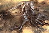
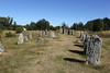
The above images may not be of the site on this page, but were taken nearby. They are loaded from Flickr so please click on them for image credits.
Click here to see more info for this site
Nearby sites
Click here to view sites on an interactive map of the areaKey: Red: member's photo, Blue: 3rd party photo, Yellow: other image, Green: no photo - please go there and take one, Grey: site destroyed
Download sites to:
KML (Google Earth)
GPX (GPS waypoints)
CSV (Garmin/Navman)
CSV (Excel)
To unlock full downloads you need to sign up as a Contributory Member. Otherwise downloads are limited to 50 sites.
Turn off the page maps and other distractions
Nearby sites listing. In the following links * = Image available
1.1km SSE 148° Åsa skeppssättning* Stone Circle
3.4km SSE 163° Ytterselö 147:1* Barrow Cemetery
20.3km ESE 102° Skopintull* Round Barrow(s)
21.9km N 355° Hemsta* Rock Art
22.0km ESE 109° Birkas fornborg* Hillfort
22.0km N 359° Boglösaby* Rock Art
22.2km N 358° Brandskog* Rock Art
22.3km ESE 108° Hemlanden* Barrow Cemetery
22.4km ENE 77° Vallbyåsen* Standing Stones
23.2km ESE 110° Kärrbacka Cairn* Cairn
23.3km N 354° Rickeby A* Rock Art
24.9km ENE 60° Rösaring* Carving
27.2km E 99° Sånga 70:1 Cairn
27.6km ENE 64° Upplands-Bro* Carving
31.0km ESE 112° Nyckelby* Standing Stone (Menhir)
31.1km W 279° Sigurdsristning* Carving
33.5km N 349° Tjursåker* Rock Art
33.7km NW 324° Berga Hällristning* Rock Art
34.3km NW 325° Björksta Church* Rock Art
34.4km NW 323° Vallen Hällristning* Rock Art
36.5km NW 322° Klavabacken* Standing Stones
38.9km NE 51° Sigtuna U 389* Sculptured Stone
39.0km NE 51° Sigtuna U 390* Sculptured Stone
39.1km NE 51° Sigtuna U Fv1958 250* Sculptured Stone
39.4km NW 310° Tibble labyrinth* Turf Maze
View more nearby sites and additional images


 We would like to know more about this location. Please feel free to add a brief description and any relevant information in your own language.
 Wir möchten mehr über diese Stätte erfahren. Bitte zögern Sie nicht, eine kurze Beschreibung und relevante Informationen in Deutsch hinzuzufügen.
 Nous aimerions en savoir encore un peu sur les lieux. S'il vous plaît n'hesitez pas à ajouter une courte description et tous les renseignements pertinents dans votre propre langue.
 Quisieramos informarnos un poco más de las lugares. No dude en añadir una breve descripción y otros datos relevantes en su propio idioma.