


<< Other Photo Pages >> MAMUZ Museum Mistelbach - Museum in Austria
Submitted by holger_rix on Monday, 30 November 2015 Page Views: 1796
MuseumsSite Name: MAMUZ Museum Mistelbach Alternative Name: MAMUZ Museumszentrum Betriebs GmbH, MZM Museumszentrum Mistelbach (old name)Country: Austria
NOTE: This site is 11.112 km away from the location you searched for.
Type: Museum
Nearest Town: Mistelbach
Latitude: 48.575586N Longitude: 16.571145E
Condition:
| 5 | Perfect |
| 4 | Almost Perfect |
| 3 | Reasonable but with some damage |
| 2 | Ruined but still recognisable as an ancient site |
| 1 | Pretty much destroyed, possibly visible as crop marks |
| 0 | No data. |
| -1 | Completely destroyed |
| 5 | Superb |
| 4 | Good |
| 3 | Ordinary |
| 2 | Not Good |
| 1 | Awful |
| 0 | No data. |
| 5 | Can be driven to, probably with disabled access |
| 4 | Short walk on a footpath |
| 3 | Requiring a bit more of a walk |
| 2 | A long walk |
| 1 | In the middle of nowhere, a nightmare to find |
| 0 | No data. |
| 5 | co-ordinates taken by GPS or official recorded co-ordinates |
| 4 | co-ordinates scaled from a detailed map |
| 3 | co-ordinates scaled from a bad map |
| 2 | co-ordinates of the nearest village |
| 1 | co-ordinates of the nearest town |
| 0 | no data |
Internal Links:
External Links:
")
In the six years of its existence, the museum centre MZM Museumszentrum Mistelbach housed the Lebenswelt Weinviertel museum and the nitsch museum. Visitors were offered a varied programme with constantly changing, top-class historical exhibitions and their accompanying events.
In the new configuration, in the 737 m² exhibition hall of the previous Lebenswelt Weinviertel, alternating exhibition highlights will be shown in the future as the perfect complement to the newly set-up collection of the province at the castle Schloss Asparn/Zaya. The exhibition area of the Lebenswelt Weinviertel museum was reopened in 2014 under the name MAMUZ Museum Mistelbach.
Museum Mistelbach, Waldstraße 44-46
2130 Mistelbach, Tel. 02572/20719
Official Web Site: Museum Mistelbach (English summary also available)
You may be viewing yesterday's version of this page. To see the most up to date information please register for a free account.
")
Do not use the above information on other web sites or publications without permission of the contributor.
Nearby Images from Flickr
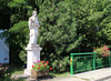

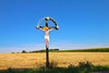

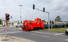

The above images may not be of the site on this page, but were taken nearby. They are loaded from Flickr so please click on them for image credits.
Click here to see more info for this site
Nearby sites
Click here to view sites on an interactive map of the areaKey: Red: member's photo, Blue: 3rd party photo, Yellow: other image, Green: no photo - please go there and take one, Grey: site destroyed
Download sites to:
KML (Google Earth)
GPX (GPS waypoints)
CSV (Garmin/Navman)
CSV (Excel)
To unlock full downloads you need to sign up as a Contributory Member. Otherwise downloads are limited to 50 sites.
Turn off the page maps and other distractions
Nearby sites listing. In the following links * = Image available
6.0km WNW 285° MAMUZ Schloss Asparn-Zaya* Museum
20.3km SSW 196° Keltenstein Ulrichskirchen* Holed Stone
23.0km WSW 239° Niederfellabrunn Leeberg Round Barrow(s)
24.4km S 188° Pillichsdorf Kalvarienberg Tumulus Round Barrow(s)
24.5km WSW 237° Niederhollabrunn Leeberg Round Barrow(s)
24.8km ENE 67° Rabensburg Tumuli (1) Round Barrow(s)
26.6km ENE 64° Rabensburg Tumulus (2) Round Barrow(s)
27.0km SE 132° Stillfried Zentrum der Urzeit* Museum
27.4km WSW 249° Leeberg* Artificial Mound
28.9km WSW 248° Geitzendorf* Barrow Cemetery
30.6km NNE 12° Klentnice Stone Circle* Modern Stone Circle etc
34.5km NNE 13° Archeopark Pavlov* Museum
35.2km N 9° Dolní Věstonice* Ancient Village or Settlement
36.8km SW 234° Hügelgrab Löwenberg* Round Barrow(s)
38.2km SSW 200° Summstein Wasserpark* Modern Stone Circle etc
44.1km SSW 201° Naturhistorisches Museum Wien* Museum
45.6km NE 56° Slavic fortified settlement in Mikulčice* Ancient Village or Settlement
46.5km ENE 58° Church of Saint Margaret of Antioch, Kopčany* Misc. Earthwork
50.2km NW 309° Stone stele Hradiste* Standing Stone (Menhir)
50.2km WNW 299° Heiliger Stein (Mitterretzbach)* Rock Art
50.3km SE 131° Stupavsky hrad* Hillfort
50.5km ENE 59° Menhiry Holic* Standing Stones
50.5km NW 309° Great Moravia hillfort - Hradiště* Hillfort
50.9km NW 309° U oveček* Rock Outcrop
51.7km NW 309° Samaritánka Well* Holy Well or Sacred Spring
View more nearby sites and additional images


 We would like to know more about this location. Please feel free to add a brief description and any relevant information in your own language.
 Wir möchten mehr über diese Stätte erfahren. Bitte zögern Sie nicht, eine kurze Beschreibung und relevante Informationen in Deutsch hinzuzufügen.
 Nous aimerions en savoir encore un peu sur les lieux. S'il vous plaît n'hesitez pas à ajouter une courte description et tous les renseignements pertinents dans votre propre langue.
 Quisieramos informarnos un poco más de las lugares. No dude en añadir una breve descripción y otros datos relevantes en su propio idioma.