 with our Megalithic Portal iPhone app")


<< Text Pages >> Gradina Rat - Hillfort in Croatia
Submitted by davidmorgan on Sunday, 26 April 2015 Page Views: 1728
Iron Age and Later PrehistorySite Name: Gradina RatCountry: Croatia
NOTE: This site is 1.32 km away from the location you searched for.
Type: Hillfort
Nearest Town: Brač Island Nearest Village: Ložišća
Latitude: 43.351946N Longitude: 16.476103E
Condition:
| 5 | Perfect |
| 4 | Almost Perfect |
| 3 | Reasonable but with some damage |
| 2 | Ruined but still recognisable as an ancient site |
| 1 | Pretty much destroyed, possibly visible as crop marks |
| 0 | No data. |
| -1 | Completely destroyed |
| 5 | Superb |
| 4 | Good |
| 3 | Ordinary |
| 2 | Not Good |
| 1 | Awful |
| 0 | No data. |
| 5 | Can be driven to, probably with disabled access |
| 4 | Short walk on a footpath |
| 3 | Requiring a bit more of a walk |
| 2 | A long walk |
| 1 | In the middle of nowhere, a nightmare to find |
| 0 | No data. |
| 5 | co-ordinates taken by GPS or official recorded co-ordinates |
| 4 | co-ordinates scaled from a detailed map |
| 3 | co-ordinates scaled from a bad map |
| 2 | co-ordinates of the nearest village |
| 1 | co-ordinates of the nearest town |
| 0 | no data |
Internal Links:
External Links:
Hillfort in Croatia
Originally a Bronze Age settlement of the Cetina Culture, later an Iron Age hillfort.
You may be viewing yesterday's version of this page. To see the most up to date information please register for a free account.
Do not use the above information on other web sites or publications without permission of the contributor.
Nearby Images from Flickr
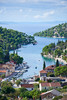
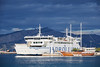
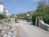
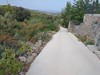
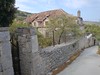
The above images may not be of the site on this page, but were taken nearby. They are loaded from Flickr so please click on them for image credits.
Click here to see more info for this site
Nearby sites
Click here to view sites on an interactive map of the areaKey: Red: member's photo, Blue: 3rd party photo, Yellow: other image, Green: no photo - please go there and take one, Grey: site destroyed
Download sites to:
KML (Google Earth)
GPX (GPS waypoints)
CSV (Garmin/Navman)
CSV (Excel)
To unlock full downloads you need to sign up as a Contributory Member. Otherwise downloads are limited to 50 sites.
Turn off the page maps and other distractions
Nearby sites listing. In the following links * = Image available
6.0km ESE 116° Brac Island* Ancient Village or Settlement
13.4km SE 137° Zmajeva Spilja* Cave or Rock Shelter
17.5km NNW 346° Split Archaeological Museum* Museum
17.6km N 351° Diocletian's Palace* Ancient Palace
18.3km SSW 192° Vira (Hvar)* Barrow Cemetery
19.9km S 188° Fortica* Hillfort
20.1km S 187° Hvar Castle Museum* Museum
20.1km S 188° Hvar Museum* Museum
20.8km N 1° Salona Town wall* Hillfort
20.8km N 1° Solin Town Gate* Ancient Village or Settlement
21.2km SSE 152° Pharos Town wall* Hillfort
21.3km SSE 153° Stari Grad Museum* Museum
22.6km SSE 153° Purkin Kuk Hillfort* Hillfort
23.4km N 9° Klis Hillfort* Hillfort
25.7km SE 143° Hvar Island* Ancient Village or Settlement
28.7km NW 314° Sutilija Hillfort* Hillfort
28.9km SE 142° Tor Hillfort (Croatia)* Hillfort
40.2km NNE 29° Cetina Valley Ancient Village or Settlement
60.0km NNW 327° Pokrovnik Ancient Village or Settlement
63.2km SE 128° Nakovana Cave* Cave or Rock Shelter
74.6km NW 313° Arauzona Hillfort* Hillfort
81.6km NW 322° Varvaria* Hillfort
97.8km ESE 108° Narona Museum* Museum
97.9km NW 319° Asseria Hillfort* Hillfort
97.9km ESE 108° Narona Town Wall* Hillfort
View more nearby sites and additional images


 We would like to know more about this location. Please feel free to add a brief description and any relevant information in your own language.
 Wir möchten mehr über diese Stätte erfahren. Bitte zögern Sie nicht, eine kurze Beschreibung und relevante Informationen in Deutsch hinzuzufügen.
 Nous aimerions en savoir encore un peu sur les lieux. S'il vous plaît n'hesitez pas à ajouter une courte description et tous les renseignements pertinents dans votre propre langue.
 Quisieramos informarnos un poco más de las lugares. No dude en añadir una breve descripción y otros datos relevantes en su propio idioma.