


<< Our Photo Pages >> Stra Darby - Standing Stones in Sweden in Öland
Submitted by Aska on Monday, 10 October 2016 Page Views: 1196
Neolithic and Bronze AgeSite Name: Stra Darby Alternative Name: RAÄ Kastlösa 28:1Country: Sweden
NOTE: This site is 2.887 km away from the location you searched for.
Landskap: Öland Type: Standing Stones
Nearest Town: Kastlösa Nearest Village: Stra Darby
Latitude: 56.478620N Longitude: 16.454090E
Condition:
| 5 | Perfect |
| 4 | Almost Perfect |
| 3 | Reasonable but with some damage |
| 2 | Ruined but still recognisable as an ancient site |
| 1 | Pretty much destroyed, possibly visible as crop marks |
| 0 | No data. |
| -1 | Completely destroyed |
| 5 | Superb |
| 4 | Good |
| 3 | Ordinary |
| 2 | Not Good |
| 1 | Awful |
| 0 | No data. |
| 5 | Can be driven to, probably with disabled access |
| 4 | Short walk on a footpath |
| 3 | Requiring a bit more of a walk |
| 2 | A long walk |
| 1 | In the middle of nowhere, a nightmare to find |
| 0 | No data. |
| 5 | co-ordinates taken by GPS or official recorded co-ordinates |
| 4 | co-ordinates scaled from a detailed map |
| 3 | co-ordinates scaled from a bad map |
| 2 | co-ordinates of the nearest village |
| 1 | co-ordinates of the nearest town |
| 0 | no data |
Internal Links:
External Links:
")
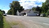
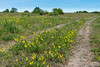
On the way to Tingstad monoliths from Stra Darby hamlet, numerous round boulders are rolling in the wilderness. Because it is difficult to distinguish the artificial pattern of their arrangement, it is very hard to recognize this moorland as an archaeological site.
You may be viewing yesterday's version of this page. To see the most up to date information please register for a free account.
Do not use the above information on other web sites or publications without permission of the contributor.
Nearby Images from Flickr

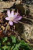
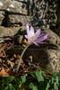
The above images may not be of the site on this page, but were taken nearby. They are loaded from Flickr so please click on them for image credits.
Click here to see more info for this site
Nearby sites
Click here to view sites on an interactive map of the areaKey: Red: member's photo, Blue: 3rd party photo, Yellow: other image, Green: no photo - please go there and take one, Grey: site destroyed
Download sites to:
KML (Google Earth)
GPX (GPS waypoints)
CSV (Garmin/Navman)
CSV (Excel)
To unlock full downloads you need to sign up as a Contributory Member. Otherwise downloads are limited to 50 sites.
Turn off the page maps and other distractions
Nearby sites listing. In the following links * = Image available
2.4km ESE 103° Tingstad Flisor* Standing Stones
4.6km ENE 74° Grösslunda Rör* Chambered Cairn
5.6km N 351° Mysinge Hög* Barrow Cemetery
6.2km N 354° Gynge Hög* Barrow Cemetery
7.5km E 80° Alby Mesolithic Village* Ancient Village or Settlement
8.0km ESE 122° Hulterstad* Standing Stones
10.1km S 187° Gettlinge* Stone Circle
10.1km S 186° Gettlinge Standing Stones* Standing Stones
12.3km NE 51° Frösslunda Gravfält* Standing Stones
13.0km N 4° Karlevi Stenkvarn* Stone Circle
14.0km NE 54° Sandby borg Stone Fort or Dun
14.1km NNE 33° Dröstorps* Chambered Cairn
14.4km N 357° Karlevistenen* Standing Stone (Menhir)
15.0km SSE 161° Seby (Öland)* Standing Stones
15.2km S 190° Degerhamn Standing Stone* Standing Stone (Menhir)
15.6km N 9° Skogsby dolmen* Burial Chamber or Dolmen
15.8km N 9° Torslunda Stone* Standing Stone (Menhir)
15.8km N 9° Skogsby four-poster standing stones* Standing Stones
18.5km NNE 17° Degerrörsbacken* Cairn
19.5km N 4° Färjestaden Domarring* Stone Circle
20.4km S 174° Eketorps borg* Stone Fort or Dun
21.3km NE 36° Dörby Stones* Standing Stones
22.8km NNE 24° Gråborg* Stone Fort or Dun
23.0km NNE 18° Jordtorpsåsen* Standing Stones
24.7km S 185° Parboäng* Standing Stones
View more nearby sites and additional images


 We would like to know more about this location. Please feel free to add a brief description and any relevant information in your own language.
 Wir möchten mehr über diese Stätte erfahren. Bitte zögern Sie nicht, eine kurze Beschreibung und relevante Informationen in Deutsch hinzuzufügen.
 Nous aimerions en savoir encore un peu sur les lieux. S'il vous plaît n'hesitez pas à ajouter une courte description et tous les renseignements pertinents dans votre propre langue.
 Quisieramos informarnos un poco más de las lugares. No dude en añadir una breve descripción y otros datos relevantes en su propio idioma.