


<< Our Photo Pages >> Venus of Willendorf - Ancient Village or Settlement in Austria
Submitted by AlexHunger on Wednesday, 24 September 2014 Page Views: 7315
DigsSite Name: Venus of WillendorfCountry: Austria
NOTE: This site is 11.621 km away from the location you searched for.
Type: Ancient Village or Settlement
Nearest Town: Vienna Nearest Village: Willendorf
Latitude: 48.323680N Longitude: 15.403310E
Condition:
| 5 | Perfect |
| 4 | Almost Perfect |
| 3 | Reasonable but with some damage |
| 2 | Ruined but still recognisable as an ancient site |
| 1 | Pretty much destroyed, possibly visible as crop marks |
| 0 | No data. |
| -1 | Completely destroyed |
| 5 | Superb |
| 4 | Good |
| 3 | Ordinary |
| 2 | Not Good |
| 1 | Awful |
| 0 | No data. |
| 5 | Can be driven to, probably with disabled access |
| 4 | Short walk on a footpath |
| 3 | Requiring a bit more of a walk |
| 2 | A long walk |
| 1 | In the middle of nowhere, a nightmare to find |
| 0 | No data. |
| 5 | co-ordinates taken by GPS or official recorded co-ordinates |
| 4 | co-ordinates scaled from a detailed map |
| 3 | co-ordinates scaled from a bad map |
| 2 | co-ordinates of the nearest village |
| 1 | co-ordinates of the nearest town |
| 0 | no data |
Internal Links:
External Links:
I have visited· I would like to visit
FreundHain Martin_L DrewParsons TheCaptain have visited here
")
The Willendorf sites lie on lower terraces above the Danube with stone tools dating to Aurignacian Culture. Site location given is the approximate location of the excavation of the Venus of Willendorf, an 11.1 cm tall female statuette believed to have been created between 24,000 BCE and 22,000 BCE.
Excavations at Willendorf I through Willendorf VIII reveal early Upper Palaeolithic or Aurignacian settlements in four lower excavation levels, while the five levels above originate in the Mid-Upper Palaeolithic period during the Gravettian culture. (from the Venusium Museum at Willendorf.)
The venus statuette was discovered in 1908 by archaeologist Josef Szombathy at a paleolithic site near Willendorf, Austria. It is carved from an oolitic limestone that is not local to the area, and tinted with red ochre. it is believed to represent the Mother Goddess.
The original Venus is housed at the Naturhistorisches Museum in Vienna, where it only occasionally is displayed.
See the large collection of information at Don Hitchcock's website, "Don's Maps"
Note: "The remarkably early date of the finds shows that modern humans and Neanderthals overlapped for much longer than we thought and that modern humans coped well with a variety of climates."
You may be viewing yesterday's version of this page. To see the most up to date information please register for a free account.
")
")
")
")
Do not use the above information on other web sites or publications without permission of the contributor.
Nearby Images from Flickr
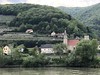
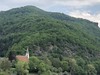
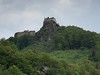
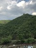
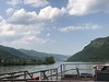
The above images may not be of the site on this page, but were taken nearby. They are loaded from Flickr so please click on them for image credits.
Click here to see more info for this site
Nearby sites
Click here to view sites on an interactive map of the areaKey: Red: member's photo, Blue: 3rd party photo, Yellow: other image, Green: no photo - please go there and take one, Grey: site destroyed
Download sites to:
KML (Google Earth)
GPX (GPS waypoints)
CSV (Garmin/Navman)
CSV (Excel)
To unlock full downloads you need to sign up as a Contributory Member. Otherwise downloads are limited to 50 sites.
Turn off the page maps and other distractions
Nearby sites listing. In the following links * = Image available
3.4km NNW 337° Gars-Thunau Hillfort* Hillfort
21.8km E 81° Urzeitmuseum* Museum
23.4km E 82° Gräberfeld Traisental* Barrow Cemetery
37.7km NW 318° Gross Gerungs Steinpyramide* Pyramid / Mastaba
40.1km NNE 31° Mold and Rosenburg Ancient Settlements Ancient Village or Settlement
41.9km NW 317° Weltkugel* Natural Stone / Erratic / Other Natural Feature
43.8km NW 311° Summstein Thail* Modern Stone Circle etc
43.8km NW 311° Thail Opferstein* Natural Stone / Erratic / Other Natural Feature
44.1km NW 306° Wackelstein bei Harruck* Natural Stone / Erratic / Other Natural Feature
46.1km NW 325° Summstein Thaya* Modern Stone Circle etc
46.3km NW 314° Kierlingstein* Natural Stone / Erratic / Other Natural Feature
55.4km NE 37° Kalenderstein von Leodagger* Rock Art
55.8km SE 126° Fuxbauer Kalendarium Holed Stone
55.9km N 352° Grosse Basilica* Modern Stone Circle etc
55.9km SE 126° Hafnerberg Lochstein 2 Holed Stone
55.9km SE 126° Hafnerberg Felsnadel Standing Stone (Menhir)
56.0km SE 126° Hafnerberg Visurhügel 1 Round Barrow(s)
56.0km SE 126° Hafnerberg Visurhügel 2 Round Barrow(s)
56.0km SE 124° Hafnerberg Steinkreise Stone Circle
56.0km SE 126° Hafnerberg Lochstein 1 Holed Stone
56.1km NNE 20° Summstein Geras* Modern Stone Circle etc
56.3km NW 318° Steinernes Weib* Sculptured Stone
56.8km E 83° Hügelgrab Löwenberg* Round Barrow(s)
58.0km NNW 341° Wolfsegg* Sculptured Stone
58.1km NNW 330° Cristophstein* Natural Stone / Erratic / Other Natural Feature
View more nearby sites and additional images


 We would like to know more about this location. Please feel free to add a brief description and any relevant information in your own language.
 Wir möchten mehr über diese Stätte erfahren. Bitte zögern Sie nicht, eine kurze Beschreibung und relevante Informationen in Deutsch hinzuzufügen.
 Nous aimerions en savoir encore un peu sur les lieux. S'il vous plaît n'hesitez pas à ajouter une courte description et tous les renseignements pertinents dans votre propre langue.
 Quisieramos informarnos un poco más de las lugares. No dude en añadir una breve descripción y otros datos relevantes en su propio idioma.