

<< Our Photo Pages >> Libenice Menhir - Modern Stone Circle etc in Czech Republic
Submitted by AlexHunger on Wednesday, 17 May 2006 Page Views: 6508
Modern SitesSite Name: Libenice MenhirCountry: Czech Republic
NOTE: This site is 3.623 km away from the location you searched for.
Type: Modern Stone Circle etc
Nearest Town: Praha Nearest Village: Libenice
Latitude: 49.985460N Longitude: 15.258043E
Condition:
| 5 | Perfect |
| 4 | Almost Perfect |
| 3 | Reasonable but with some damage |
| 2 | Ruined but still recognisable as an ancient site |
| 1 | Pretty much destroyed, possibly visible as crop marks |
| 0 | No data. |
| -1 | Completely destroyed |
| 5 | Superb |
| 4 | Good |
| 3 | Ordinary |
| 2 | Not Good |
| 1 | Awful |
| 0 | No data. |
| 5 | Can be driven to, probably with disabled access |
| 4 | Short walk on a footpath |
| 3 | Requiring a bit more of a walk |
| 2 | A long walk |
| 1 | In the middle of nowhere, a nightmare to find |
| 0 | No data. |
| 5 | co-ordinates taken by GPS or official recorded co-ordinates |
| 4 | co-ordinates scaled from a detailed map |
| 3 | co-ordinates scaled from a bad map |
| 2 | co-ordinates of the nearest village |
| 1 | co-ordinates of the nearest town |
| 0 | no data |
Internal Links:
External Links:
")
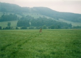
Tall pointy menhir from former dug in henge. (ed.: the Libenice menhir has been moved to a museum at Prague, the standing stone to be seen at Libenice nowadays is a modern commemorative stone)
You may be viewing yesterday's version of this page. To see the most up to date information please register for a free account.
Do not use the above information on other web sites or publications without permission of the contributor.
Nearby Images from Flickr
The above images may not be of the site on this page, but were taken nearby. They are loaded from Flickr so please click on them for image credits.
Click here to see more info for this site
Nearby sites
Click here to view sites on an interactive map of the areaKey: Red: member's photo, Blue: 3rd party photo, Yellow: other image, Green: no photo - please go there and take one, Grey: site destroyed
Download sites to:
KML (Google Earth)
GPX (GPS waypoints)
CSV (Garmin/Navman)
CSV (Excel)
To unlock full downloads you need to sign up as a Contributory Member. Otherwise downloads are limited to 50 sites.
Turn off the page maps and other distractions
Nearby sites listing. In the following links * = Image available
531m NNE 24° Libenice Shrine* Ancient Temple
2.3km SE 130° Bába (The Hag)* Ancient Cross
2.4km SE 134° Kaňk Menhir* Modern Stone Circle etc
2.9km SSE 164° Kutna Hora's stone circle* Modern Stone Circle etc
2.9km SSE 164° Kutná Hora Megaliths* Modern Stone Circle etc
4.9km SSW 202° Wellspring of St. Vojtech* Standing Stone (Menhir)
4.9km SSW 202° Spring of St. Vojtech* Holy Well or Sacred Spring
5.6km SSW 193° Bylany Neolithic Settlement* Ancient Village or Settlement
5.7km NW 318° Rondel Enclosures near Kolin Causewayed Enclosure
6.0km S 188° Bylany stone row* Stone Row / Alignment
6.9km SW 226° Hill of Vysoka Modern Stone Circle etc
19.2km W 275° Stará Kouřim* Hillfort
19.5km W 276° Lechův Kámen* Rock Outcrop
22.9km WNW 293° Mohyla Chotouň* Artificial Mound
26.3km WSW 240° Stone Man* Standing Stone (Menhir)
27.1km NW 326° Prehistoric Barrow Nymburk* Chambered Cairn
27.8km WSW 246° Devil's Groove* Misc. Earthwork
29.4km WSW 244° Well of St.Procopius* Holy Well or Sacred Spring
31.2km NW 310° Hradištko Menhir* Standing Stone (Menhir)
35.7km NW 304° Přerovská Hůra* Hillfort
37.0km E 89° Mikulovice Ancient Village or Settlement
39.5km WNW 286° Úvaly Stonehenge* Modern Stone Circle etc
40.2km W 276° Prehistoric hillfort Březí* Hillfort
47.1km NE 50° Archaeological park Všestary* Museum
48.6km SW 236° Menhir Líšno* Standing Stone (Menhir)
View more nearby sites and additional images


 We would like to know more about this location. Please feel free to add a brief description and any relevant information in your own language.
 Wir möchten mehr über diese Stätte erfahren. Bitte zögern Sie nicht, eine kurze Beschreibung und relevante Informationen in Deutsch hinzuzufügen.
 Nous aimerions en savoir encore un peu sur les lieux. S'il vous plaît n'hesitez pas à ajouter une courte description et tous les renseignements pertinents dans votre propre langue.
 Quisieramos informarnos un poco más de las lugares. No dude en añadir una breve descripción y otros datos relevantes en su propio idioma.