 with our Megalithic Portal iPhone app")

<< Our Photo Pages >> Apollo 11 Cave - Cave or Rock Shelter in Namibia
Submitted by KaiHofmann on Thursday, 27 January 2011 Page Views: 7340
Natural PlacesSite Name: Apollo 11 CaveCountry: Namibia Type: Cave or Rock Shelter
Nearest Town: Ais-Ais Nearest Village: Sendelingsdrif
Latitude: 27.715386S Longitude: 17.094594E
Condition:
| 5 | Perfect |
| 4 | Almost Perfect |
| 3 | Reasonable but with some damage |
| 2 | Ruined but still recognisable as an ancient site |
| 1 | Pretty much destroyed, possibly visible as crop marks |
| 0 | No data. |
| -1 | Completely destroyed |
| 5 | Superb |
| 4 | Good |
| 3 | Ordinary |
| 2 | Not Good |
| 1 | Awful |
| 0 | No data. |
| 5 | Can be driven to, probably with disabled access |
| 4 | Short walk on a footpath |
| 3 | Requiring a bit more of a walk |
| 2 | A long walk |
| 1 | In the middle of nowhere, a nightmare to find |
| 0 | No data. |
| 5 | co-ordinates taken by GPS or official recorded co-ordinates |
| 4 | co-ordinates scaled from a detailed map |
| 3 | co-ordinates scaled from a bad map |
| 2 | co-ordinates of the nearest village |
| 1 | co-ordinates of the nearest town |
| 0 | no data |
Internal Links:
External Links:
I have visited· I would like to visit
WindC would like to visit
")
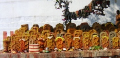
Scientists found in this cave some of the oldest artefacts of humans in Africa and even the world. They excavated disks with paintings from 26.000 -28.000 BCE!!
For more information: This is a link
You may be viewing yesterday's version of this page. To see the most up to date information please register for a free account.
")
")
")
")
")
")
")
")
Do not use the above information on other web sites or publications without permission of the contributor.
Click here to see more info for this site
Nearby sites
Click here to view sites on an interactive map of the areaKey: Red: member's photo, Blue: 3rd party photo, Yellow: other image, Green: no photo - please go there and take one, Grey: site destroyed
Download sites to:
KML (Google Earth)
GPX (GPS waypoints)
CSV (Garmin/Navman)
CSV (Excel)
To unlock full downloads you need to sign up as a Contributory Member. Otherwise downloads are limited to 50 sites.
Turn off the page maps and other distractions
Nearby sites listing. In the following links * = Image available
128.5km S 182° Spitzkloof* Cave or Rock Shelter
264.4km ENE 66° The Lost City of Kalahari* Ancient Village or Settlement
505.0km NNW 339° Mirabib* Natural Stone / Erratic / Other Natural Feature
515.7km NNW 348° Rooisand Rock Painting* Rock Art
535.6km SSE 166° Diepkloof* Rock Outcrop
586.2km E 91° Kathu Pan* Ancient Mine, Quarry or other Industry
635.6km E 93° Wonderwerk Cave* Cave or Rock Shelter
665.5km N 355° Oropoko* Rock Art
669.1km N 350° Paula's Cave Rock Art
674.0km NNW 347° Phillipp's Cave Rock Art
682.2km NNW 343° Bushman Paradise* Rock Art
702.3km S 170° Iziko South African Museum Museum
713.2km ESE 103° Driekopseiland Rock Art Rock Art
732.1km ESE 107° Thomas' Farm Belmont Rock Art Rock Art
743.0km E 99° Nooitgedacht Rock art Rock Art
747.9km E 100° Wildebeestkuil* Rock Art
761.5km E 100° McGregor Museum Museum
774.5km NNW 341° The White Lady Group* Rock Art
796.6km E 93° Stowlands Rock art Rock Art
827.5km NNW 348° Omburo Ost* Rock Art
832.6km NNW 348° Vingerklip* Natural Stone / Erratic / Other Natural Feature
838.1km NNW 340° Twyfelfontein* Stone Circle
838.3km NNW 340° Twyfelfontein* Rock Art
841.8km SSE 153° Blombos Cave* Cave or Rock Shelter
864.6km SSE 148° Pinnacle Point* Cave or Rock Shelter
View more nearby sites and additional images


 We would like to know more about this location. Please feel free to add a brief description and any relevant information in your own language.
 Wir möchten mehr über diese Stätte erfahren. Bitte zögern Sie nicht, eine kurze Beschreibung und relevante Informationen in Deutsch hinzuzufügen.
 Nous aimerions en savoir encore un peu sur les lieux. S'il vous plaît n'hesitez pas à ajouter une courte description et tous les renseignements pertinents dans votre propre langue.
 Quisieramos informarnos un poco más de las lugares. No dude en añadir una breve descripción y otros datos relevantes en su propio idioma.