


<< Text Pages >> 57-4-0209 - Stone Row / Alignment in Australia
Submitted by Andy B on Wednesday, 15 May 2013 Page Views: 3838
Neolithic and Bronze AgeSite Name: 57-4-0209Country: Australia
NOTE: This site is 64.702 km away from the location you searched for.
Type: Stone Row / Alignment
Latitude: 35.8S Longitude: 148.900000E
Condition:
| 5 | Perfect |
| 4 | Almost Perfect |
| 3 | Reasonable but with some damage |
| 2 | Ruined but still recognisable as an ancient site |
| 1 | Pretty much destroyed, possibly visible as crop marks |
| 0 | No data. |
| -1 | Completely destroyed |
| 5 | Superb |
| 4 | Good |
| 3 | Ordinary |
| 2 | Not Good |
| 1 | Awful |
| 0 | No data. |
| 5 | Can be driven to, probably with disabled access |
| 4 | Short walk on a footpath |
| 3 | Requiring a bit more of a walk |
| 2 | A long walk |
| 1 | In the middle of nowhere, a nightmare to find |
| 0 | No data. |
| 5 | co-ordinates taken by GPS or official recorded co-ordinates |
| 4 | co-ordinates scaled from a detailed map |
| 3 | co-ordinates scaled from a bad map |
| 2 | co-ordinates of the nearest village |
| 1 | co-ordinates of the nearest town |
| 0 | no data |
Be the first person to rate this site - see the 'Contribute!' box in the right hand menu.
Internal Links:
External Links:
Stone Row / Alignment in Australia
Site from paper Orientations of linear stone arrangements in New South Wales.
Note: location is approximate.
You may be viewing yesterday's version of this page. To see the most up to date information please register for a free account.
Do not use the above information on other web sites or publications without permission of the contributor.
Nearby Images from Flickr
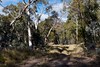
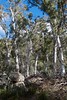
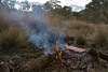


The above images may not be of the site on this page, but were taken nearby. They are loaded from Flickr so please click on them for image credits.
Click here to see more info for this site
Nearby sites
Click here to view sites on an interactive map of the areaKey: Red: member's photo, Blue: 3rd party photo, Yellow: other image, Green: no photo - please go there and take one, Grey: site destroyed
Download sites to:
KML (Google Earth)
GPX (GPS waypoints)
CSV (Garmin/Navman)
CSV (Excel)
To unlock full downloads you need to sign up as a Contributory Member. Otherwise downloads are limited to 50 sites.
Turn off the page maps and other distractions
Nearby sites listing. In the following links * = Image available
67.4km SSW 201° Jindabyne rock walls Stone Row / Alignment
106.3km SSW 200° 62-4-0127 Stone Row / Alignment
157.9km NE 40° 51-6-0250 Stone Row / Alignment
200.4km N 3° 51-1-0053 Stone Row / Alignment
218.4km NE 49° 52-2-2245 Stone Row / Alignment
271.3km NNE 32° Lawson Engraving Site* Rock Art
271.6km NNE 20° 44-6-0019 Stone Row / Alignment
276.1km NNE 33° Faulconbridge Emus Rock Art
281.8km NE 48° Jibbon Head engravings Rock Art
296.5km NE 39° 45-4-0217 Stone Row / Alignment
298.2km NE 45° University of Sydney Nicholson Museum* Museum
300.7km NE 45° Australian Museum* Museum
301.4km NE 45° NSW Art Gallery* Museum
301.9km NE 44° Berry Island* Rock Art
301.9km NE 44° Cammeraygal Midden* Ancient Village or Settlement
302.0km NE 45° Balls Head* Rock Art
302.7km NE 46° Tamarama Rock Art* Rock Art
303.7km NE 46° Ben Buckler Rock* Rock Art
304.4km NE 46° Bondi Golf Course rock art site* Rock Art
308.7km NE 45° Grotto Point Petroglyphs Rock Art
310.7km NE 44° Bantry Bay Engravings Rock Art
312.0km NE 44° Gumbooya site* Rock Art
313.6km NE 42° Bobbin Head petroglyphs Rock Art
314.1km NE 43° 45-6-0224 Stone Row / Alignment
314.3km NE 42° Gibberagong Rock Art
View more nearby sites and additional images


 We would like to know more about this location. Please feel free to add a brief description and any relevant information in your own language.
 Wir möchten mehr über diese Stätte erfahren. Bitte zögern Sie nicht, eine kurze Beschreibung und relevante Informationen in Deutsch hinzuzufügen.
 Nous aimerions en savoir encore un peu sur les lieux. S'il vous plaît n'hesitez pas à ajouter une courte description et tous les renseignements pertinents dans votre propre langue.
 Quisieramos informarnos un poco más de las lugares. No dude en añadir una breve descripción y otros datos relevantes en su propio idioma.