


<< Our Photo Pages >> Wonnemoto Chashi - Hillfort in Japan in Hokkaidō
Submitted by Aska on Saturday, 10 September 2011 Page Views: 4004
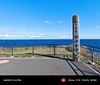
Medieval (High and Late)Site Name: Wonnemoto Chashi Alternative Name: ヲンネモトチャシ, オンネモトチャシCountry: Japan
NOTE: This site is 17.912 km away from the location you searched for.
Region: Hokkaidō Type: Hillfort
Nearest Town: Nemuro (Hokkaidō pref.) Nearest Village: Onnemoto 温根元
Latitude: 43.388620N Longitude: 145.782520E
Condition:
| 5 | Perfect |
| 4 | Almost Perfect |
| 3 | Reasonable but with some damage |
| 2 | Ruined but still recognisable as an ancient site |
| 1 | Pretty much destroyed, possibly visible as crop marks |
| 0 | No data. |
| -1 | Completely destroyed |
| 5 | Superb |
| 4 | Good |
| 3 | Ordinary |
| 2 | Not Good |
| 1 | Awful |
| 0 | No data. |
| 5 | Can be driven to, probably with disabled access |
| 4 | Short walk on a footpath |
| 3 | Requiring a bit more of a walk |
| 2 | A long walk |
| 1 | In the middle of nowhere, a nightmare to find |
| 0 | No data. |
| 5 | co-ordinates taken by GPS or official recorded co-ordinates |
| 4 | co-ordinates scaled from a detailed map |
| 3 | co-ordinates scaled from a bad map |
| 2 | co-ordinates of the nearest village |
| 1 | co-ordinates of the nearest town |
| 0 | no data |
Internal Links:
External Links:
")
You may be viewing yesterday's version of this page. To see the most up to date information please register for a free account.
Do not use the above information on other web sites or publications without permission of the contributor.
Nearby Images from Flickr
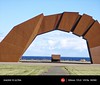
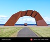
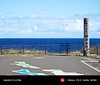
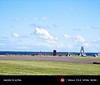

The above images may not be of the site on this page, but were taken nearby. They are loaded from Flickr so please click on them for image credits.
Click here to see more info for this site
Nearby sites
Click here to view sites on an interactive map of the areaKey: Red: member's photo, Blue: 3rd party photo, Yellow: other image, Green: no photo - please go there and take one, Grey: site destroyed
Download sites to:
KML (Google Earth)
GPX (GPS waypoints)
CSV (Garmin/Navman)
CSV (Excel)
To unlock full downloads you need to sign up as a Contributory Member. Otherwise downloads are limited to 50 sites.
Turn off the page maps and other distractions
Nearby sites listing. In the following links * = Image available
63.6km WNW 301° Ichani Karikariusu* Ancient Village or Settlement
63.6km WNW 301° Ichani Karikariusu Chashi* Hillfort
84.7km WSW 243° Shika-otoshi-no Chashi* Hillfort
85.4km NNW 329° Tobinitai* Ancient Village or Settlement
101.5km NW 304° Shuen* Henge
106.7km WNW 304° OkushibetsuGawa* Stone Circle
120.4km WSW 248° Charanke Chashi* Hillfort
121.1km WSW 249° Mosirya Chashi* Hillfort
140.3km WNW 300° KatsuragaOka Toride* Hillfort
140.8km WNW 301° Moyoro Kaizuka* Ancient Village or Settlement
142.0km WNW 299° Abashiri prison* Modern Stone Circle etc
159.2km WNW 301° Tokor Chashi* Hillfort
163.2km WNW 301° SakaeUra Iseki* Ancient Village or Settlement
165.5km W 274° Yuk'epira Chashi* Hillfort
166.8km WNW 300° Tokoro Iseki* Ancient Village or Settlement
169.5km WSW 249° Otafunbe Chashi* Hillfort
283.6km W 273° Nokanan henge* Henge
291.2km W 279° Kamui-Kotan stone circle* Stone Circle
298.3km WSW 249° Mena Chashi* Hillfort
301.6km WSW 248° Sibecar Chashi* Hillfort
302.0km WSW 248° Hoinasir Chashi* Hillfort
303.9km W 277° Otoe* Stone Circle
311.0km W 274° Hokkaidō Children's Land* Modern Stone Circle etc
334.6km W 262° Kiusu* Henge
346.6km W 267° Ebetsu Chashi* Hillfort
View more nearby sites and additional images


 We would like to know more about this location. Please feel free to add a brief description and any relevant information in your own language.
 Wir möchten mehr über diese Stätte erfahren. Bitte zögern Sie nicht, eine kurze Beschreibung und relevante Informationen in Deutsch hinzuzufügen.
 Nous aimerions en savoir encore un peu sur les lieux. S'il vous plaît n'hesitez pas à ajouter une courte description et tous les renseignements pertinents dans votre propre langue.
 Quisieramos informarnos un poco más de las lugares. No dude en añadir una breve descripción y otros datos relevantes en su propio idioma.