

<< Our Photo Pages >> Tsunami stones (in Settai) - Natural Stone / Erratic / Other Natural Feature in Japan in Honshū
Submitted by Aska on Sunday, 10 September 2017 Page Views: 1206
Natural PlacesSite Name: Tsunami stones (in Settai) Alternative Name: 摂待Country: Japan
NOTE: This site is 202.41 km away from the location you searched for.
Region: Honshū Type: Natural Stone / Erratic / Other Natural Feature
Nearest Town: Miyako (Iwate pref.) Nearest Village: Tarō 田老
Latitude: 39.811910N Longitude: 141.975170E
Condition:
| 5 | Perfect |
| 4 | Almost Perfect |
| 3 | Reasonable but with some damage |
| 2 | Ruined but still recognisable as an ancient site |
| 1 | Pretty much destroyed, possibly visible as crop marks |
| 0 | No data. |
| -1 | Completely destroyed |
| 5 | Superb |
| 4 | Good |
| 3 | Ordinary |
| 2 | Not Good |
| 1 | Awful |
| 0 | No data. |
| 5 | Can be driven to, probably with disabled access |
| 4 | Short walk on a footpath |
| 3 | Requiring a bit more of a walk |
| 2 | A long walk |
| 1 | In the middle of nowhere, a nightmare to find |
| 0 | No data. |
| 5 | co-ordinates taken by GPS or official recorded co-ordinates |
| 4 | co-ordinates scaled from a detailed map |
| 3 | co-ordinates scaled from a bad map |
| 2 | co-ordinates of the nearest village |
| 1 | co-ordinates of the nearest town |
| 0 | no data |
Internal Links:
External Links:
 (PID:170362)")
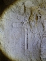
Tarō (田老) village in Miyako city, Iwate prefecture, is one of the areas severely damaged by 2011 tsunami. The river mouth plain of Settai (摂待) hamlet is a place where many tsunami stones have been rolled. A huge one, which is supposed to be moved by the tsunami in 1611, lies on the edge of the wood. By the 2011 tsunami, larger stones had been moved close to that one but blasted to make use of the land for farming.
You may be viewing yesterday's version of this page. To see the most up to date information please register for a free account.
Do not use the above information on other web sites or publications without permission of the contributor.
Nearby Images from Flickr
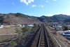
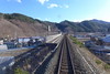
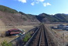
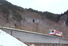
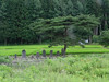
The above images may not be of the site on this page, but were taken nearby. They are loaded from Flickr so please click on them for image credits.
Click here to see more info for this site
Nearby sites
Click here to view sites on an interactive map of the areaKey: Red: member's photo, Blue: 3rd party photo, Yellow: other image, Green: no photo - please go there and take one, Grey: site destroyed
Download sites to:
KML (Google Earth)
GPX (GPS waypoints)
CSV (Garmin/Navman)
CSV (Excel)
To unlock full downloads you need to sign up as a Contributory Member. Otherwise downloads are limited to 50 sites.
Turn off the page maps and other distractions
Nearby sites listing. In the following links * = Image available
13.2km NNW 347° Tsunami stone (in Haipe)* Natural Stone / Erratic / Other Natural Feature
14.3km NNW 347° Tsunami stones (in Raga)* Natural Stone / Erratic / Other Natural Feature
15.3km S 184° Sakiyama Kaizuka kitchen midden* Ancient Village or Settlement
31.5km S 169° Aneyoshi tsunami warning stone tablet* Modern Stone Circle etc
54.1km S 187° The new tsunami memorial tablets* Modern Stone Circle etc
69.4km SW 221° Tsuzukiishi* Natural Stone / Erratic / Other Natural Feature
70.8km NW 307° Goshono* Ancient Village or Settlement
71.1km W 261° Mitsuishi Jinja shrine* Natural Stone / Erratic / Other Natural Feature
72.4km WSW 252° Tokutan-jō* Ancient Village or Settlement
75.1km W 268° Yubunezawa* Stone Circle
75.2km S 189° Tsunami stone (in Yoshihama)* Natural Stone / Erratic / Other Natural Feature
75.7km W 259° Shiwa-jō* Ancient Village or Settlement
85.9km W 279° Kamaishi* Stone Circle
88.6km SSW 192° Tsunami stone (in Attari)* Natural Stone / Erratic / Other Natural Feature
95.8km SW 233° Ezuriko Kofungun* Chambered Cairn
96.2km SW 229° Kabayama* Stone Circle
112.0km WNW 298° Ōyu* Stone Circle
112.5km WNW 295° Takaya-date* Ancient Village or Settlement
113.4km WSW 246° Uchinosawa* Stone Circle
118.1km SW 219° Mōtsū-ji temple* Modern Stone Circle etc
120.2km WNW 300° Kosaka* Stone Circle
123.2km W 259° Kakunodate samurai residences* Modern Stone Circle etc
128.0km WSW 253° Hotta-no Saku* Ancient Village or Settlement
134.1km SSW 200° Minamisanriku replica Moai statues* Modern Stone Circle etc
135.2km W 277° Sakeishi (in Nekko)* Carving
View more nearby sites and additional images


 We would like to know more about this location. Please feel free to add a brief description and any relevant information in your own language.
 Wir möchten mehr über diese Stätte erfahren. Bitte zögern Sie nicht, eine kurze Beschreibung und relevante Informationen in Deutsch hinzuzufügen.
 Nous aimerions en savoir encore un peu sur les lieux. S'il vous plaît n'hesitez pas à ajouter une courte description et tous les renseignements pertinents dans votre propre langue.
 Quisieramos informarnos un poco más de las lugares. No dude en añadir una breve descripción y otros datos relevantes en su propio idioma.