


<< Our Photo Pages >> Sakiyama Kaizuka kitchen midden - Ancient Village or Settlement in Japan in Honshū
Submitted by Aska on Friday, 18 September 2015 Page Views: 1130
Neolithic and Bronze AgeSite Name: Sakiyama Kaizuka kitchen midden Alternative Name: 崎山貝塚Country: Japan
NOTE: This site is 6.464 km away from the location you searched for.
Region: Honshū Type: Ancient Village or Settlement
Nearest Town: Miyako (Iwate pref.) Nearest Village: Sakiyama 崎山
Latitude: 39.674660N Longitude: 141.961440E
Condition:
| 5 | Perfect |
| 4 | Almost Perfect |
| 3 | Reasonable but with some damage |
| 2 | Ruined but still recognisable as an ancient site |
| 1 | Pretty much destroyed, possibly visible as crop marks |
| 0 | No data. |
| -1 | Completely destroyed |
| 5 | Superb |
| 4 | Good |
| 3 | Ordinary |
| 2 | Not Good |
| 1 | Awful |
| 0 | No data. |
| 5 | Can be driven to, probably with disabled access |
| 4 | Short walk on a footpath |
| 3 | Requiring a bit more of a walk |
| 2 | A long walk |
| 1 | In the middle of nowhere, a nightmare to find |
| 0 | No data. |
| 5 | co-ordinates taken by GPS or official recorded co-ordinates |
| 4 | co-ordinates scaled from a detailed map |
| 3 | co-ordinates scaled from a bad map |
| 2 | co-ordinates of the nearest village |
| 1 | co-ordinates of the nearest town |
| 0 | no data |
Internal Links:
External Links:
I have visited· I would like to visit
eirrac5 would like to visit
")
It is supposed to be resided during 4000 - 1500 BC. The burial and ritual space lay in the centre, while the houses surrounded the space.
Many artefacts were excavated : shells, fish bones, fish hooks, stone tools, stone or clay figures and raised stone phallus. Now a standing stone remains in the centre space. An attatched museum will be open in 2016.
You may be viewing yesterday's version of this page. To see the most up to date information please register for a free account.
Do not use the above information on other web sites or publications without permission of the contributor.
Nearby Images from Flickr
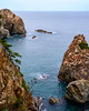
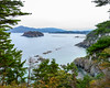
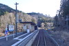
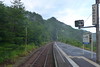

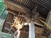
The above images may not be of the site on this page, but were taken nearby. They are loaded from Flickr so please click on them for image credits.
Click here to see more info for this site
Nearby sites
Click here to view sites on an interactive map of the areaKey: Red: member's photo, Blue: 3rd party photo, Yellow: other image, Green: no photo - please go there and take one, Grey: site destroyed
Download sites to:
KML (Google Earth)
GPX (GPS waypoints)
CSV (Garmin/Navman)
CSV (Excel)
To unlock full downloads you need to sign up as a Contributory Member. Otherwise downloads are limited to 50 sites.
Turn off the page maps and other distractions
Nearby sites listing. In the following links * = Image available
15.3km N 4° Tsunami stones (in Settai)* Natural Stone / Erratic / Other Natural Feature
17.2km SSE 155° Aneyoshi tsunami warning stone tablet* Modern Stone Circle etc
28.2km N 356° Tsunami stone (in Haipe)* Natural Stone / Erratic / Other Natural Feature
29.3km N 356° Tsunami stones (in Raga)* Natural Stone / Erratic / Other Natural Feature
38.8km S 188° The new tsunami memorial tablets* Modern Stone Circle etc
57.8km SW 230° Tsuzukiishi* Natural Stone / Erratic / Other Natural Feature
60.0km S 190° Tsunami stone (in Yoshihama)* Natural Stone / Erratic / Other Natural Feature
68.0km W 264° Tokutan-jō* Ancient Village or Settlement
69.2km W 273° Mitsuishi Jinja shrine* Natural Stone / Erratic / Other Natural Feature
73.2km W 271° Shiwa-jō* Ancient Village or Settlement
73.5km SSW 193° Tsunami stone (in Attari)* Natural Stone / Erratic / Other Natural Feature
74.8km W 279° Yubunezawa* Stone Circle
80.2km NW 317° Goshono* Ancient Village or Settlement
86.0km SW 236° Kabayama* Stone Circle
86.4km WSW 241° Ezuriko Kofungun* Chambered Cairn
88.3km WNW 288° Kamaishi* Stone Circle
105.9km SW 224° Mōtsū-ji temple* Modern Stone Circle etc
107.0km WSW 253° Uchinosawa* Stone Circle
118.7km WNW 302° Takaya-date* Ancient Village or Settlement
118.9km NW 304° Ōyu* Stone Circle
119.4km SSW 202° Minamisanriku replica Moai statues* Modern Stone Circle etc
120.1km W 266° Kakunodate samurai residences* Modern Stone Circle etc
123.3km W 260° Hotta-no Saku* Ancient Village or Settlement
127.5km NW 306° Kosaka* Stone Circle
136.6km WNW 283° Sakeishi (in Nekko)* Carving
View more nearby sites and additional images


 We would like to know more about this location. Please feel free to add a brief description and any relevant information in your own language.
 Wir möchten mehr über diese Stätte erfahren. Bitte zögern Sie nicht, eine kurze Beschreibung und relevante Informationen in Deutsch hinzuzufügen.
 Nous aimerions en savoir encore un peu sur les lieux. S'il vous plaît n'hesitez pas à ajouter une courte description et tous les renseignements pertinents dans votre propre langue.
 Quisieramos informarnos un poco más de las lugares. No dude en añadir una breve descripción y otros datos relevantes en su propio idioma.