

<< Our Photo Pages >> Hokkaidō Children's Land - Modern Stone Circle etc in Japan in Hokkaidō
Submitted by Aska on Sunday, 03 October 2010 Page Views: 5321
Modern SitesSite Name: Hokkaidō Children's Land Alternative Name: 北海道子どもの国 Hokkaido Kodomo-no-KuniCountry: Japan
NOTE: This site is 3.473 km away from the location you searched for.
Region: Hokkaidō Type: Modern Stone Circle etc
Nearest Town: Sunagawa (Hokkaidō pref.) Nearest Village: Sorachibuto 空知太
Latitude: 43.518990N Longitude: 141.934190E
Condition:
| 5 | Perfect |
| 4 | Almost Perfect |
| 3 | Reasonable but with some damage |
| 2 | Ruined but still recognisable as an ancient site |
| 1 | Pretty much destroyed, possibly visible as crop marks |
| 0 | No data. |
| -1 | Completely destroyed |
| 5 | Superb |
| 4 | Good |
| 3 | Ordinary |
| 2 | Not Good |
| 1 | Awful |
| 0 | No data. |
| 5 | Can be driven to, probably with disabled access |
| 4 | Short walk on a footpath |
| 3 | Requiring a bit more of a walk |
| 2 | A long walk |
| 1 | In the middle of nowhere, a nightmare to find |
| 0 | No data. |
| 5 | co-ordinates taken by GPS or official recorded co-ordinates |
| 4 | co-ordinates scaled from a detailed map |
| 3 | co-ordinates scaled from a bad map |
| 2 | co-ordinates of the nearest village |
| 1 | co-ordinates of the nearest town |
| 0 | no data |
Internal Links:
External Links:
")
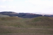
In an amusement park 'Hokkaidō Kodomo-no Kuni (北海道子どもの国=Hokkaido Children's Land)' connected to parking area of a motor way, there is an area called Fushigi-no-Mori (ふしぎの森=mysterious forest). The area contains the replicas of the 7 secrets of the world : pyramid, catacomb, labylinth, leaning tower of Pisa, great wall of China, lighthouse of Alexandoria and ... Stonehenge. But Hokkaidō children seem to prefer other wooden playground equipments on the grass or trampoline & swings in the pyramid-shaped mainhouse.
You may be viewing yesterday's version of this page. To see the most up to date information please register for a free account.
Do not use the above information on other web sites or publications without permission of the contributor.
Nearby Images from Flickr
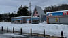
The above images may not be of the site on this page, but were taken nearby. They are loaded from Flickr so please click on them for image credits.
Click here to see more info for this site
Nearby sites
Click here to view sites on an interactive map of the areaKey: Red: member's photo, Blue: 3rd party photo, Yellow: other image, Green: no photo - please go there and take one, Grey: site destroyed
Download sites to:
KML (Google Earth)
GPX (GPS waypoints)
CSV (Garmin/Navman)
CSV (Excel)
To unlock full downloads you need to sign up as a Contributory Member. Otherwise downloads are limited to 50 sites.
Turn off the page maps and other distractions
Nearby sites listing. In the following links * = Image available
19.0km NNE 25° Otoe* Stone Circle
28.1km ESE 103° Nokanan henge* Henge
31.5km NE 43° Kamui-Kotan stone circle* Stone Circle
55.8km SW 217° Ebetsu Chashi* Hillfort
56.1km SW 217° Ebetsu Kofungun* Round Barrow(s)
72.6km SSW 194° Kiusu* Henge
81.0km SW 215° Makomanai Takino-Reien cemetery* Modern Stone Circle etc
81.3km WSW 247° ex-Aoyama Bettei residence* Modern Stone Circle etc
82.6km WSW 246° Temiya cave* Carving
92.7km WSW 248° Oshoro* Stone Circle
93.0km WSW 248° ChijinYama* Stone Circle
95.3km WSW 248° NishizakiYama* Stone Circle
95.3km WSW 248° Fugoppe cave* Carving
128.1km SW 234° Hokuei* Stone Circle
133.9km SSE 163° Mena Chashi* Hillfort
136.9km SSE 165° Sibecar Chashi* Hillfort
137.1km SSE 165° Hoinasir Chashi* Hillfort
145.5km E 92° Yuk'epira Chashi* Hillfort
172.9km ESE 116° Otafunbe Chashi* Hillfort
176.9km ENE 67° Tokoro Iseki* Ancient Village or Settlement
180.9km ENE 67° SakaeUra Iseki* Ancient Village or Settlement
184.5km ENE 68° Tokor Chashi* Hillfort
191.8km ENE 73° Abashiri prison* Modern Stone Circle etc
193.7km SW 217° Washi-no-ki* Stone Circle
195.6km ENE 73° KatsuragaOka Toride* Hillfort
View more nearby sites and additional images


 We would like to know more about this location. Please feel free to add a brief description and any relevant information in your own language.
 Wir möchten mehr über diese Stätte erfahren. Bitte zögern Sie nicht, eine kurze Beschreibung und relevante Informationen in Deutsch hinzuzufügen.
 Nous aimerions en savoir encore un peu sur les lieux. S'il vous plaît n'hesitez pas à ajouter une courte description et tous les renseignements pertinents dans votre propre langue.
 Quisieramos informarnos un poco más de las lugares. No dude en añadir una breve descripción y otros datos relevantes en su propio idioma.