


<< Our Photo Pages >> Jōgan tsunami warning tablet - Modern Stone Circle etc in Japan in Honshū
Submitted by Aska on Saturday, 12 July 2014 Page Views: 3336
Multi-periodSite Name: Jōgan tsunami warning tablet Alternative Name: 貞観津波碑 Jogan tsunami-hiCountry: Japan Region: Honshū Type: Modern Stone Circle etc
Nearest Town: Higashi-Matsushima (Miyagi pref.) Nearest Village: Miyato-jima island 宮戸í
Latitude: 38.335350N Longitude: 141.153900E
Condition:
| 5 | Perfect |
| 4 | Almost Perfect |
| 3 | Reasonable but with some damage |
| 2 | Ruined but still recognisable as an ancient site |
| 1 | Pretty much destroyed, possibly visible as crop marks |
| 0 | No data. |
| -1 | Completely destroyed |
| 5 | Superb |
| 4 | Good |
| 3 | Ordinary |
| 2 | Not Good |
| 1 | Awful |
| 0 | No data. |
| 5 | Can be driven to, probably with disabled access |
| 4 | Short walk on a footpath |
| 3 | Requiring a bit more of a walk |
| 2 | A long walk |
| 1 | In the middle of nowhere, a nightmare to find |
| 0 | No data. |
| 5 | co-ordinates taken by GPS or official recorded co-ordinates |
| 4 | co-ordinates scaled from a detailed map |
| 3 | co-ordinates scaled from a bad map |
| 2 | co-ordinates of the nearest village |
| 1 | co-ordinates of the nearest town |
| 0 | no data |
Internal Links:
External Links:
")
Although the inscription was worn out, this stone is believed as the tsunami warning tablet built after the great earthquake and subsequent tsunami occured in 869AD during Jōgan period (859-877) when Mt.Fuji also erupted.
The name of place of this site "Futatsu-bashi (二ツ橋=2 bridges)" is suspected to mean the crossing point of the rising waves from opposite directions. So the islanders of Miyato-jima island, who believed in the folklore on this tablet, could evacuate to higher place than this stone and were secured from 2011 tsunami. Then they built another tablet in acknowledge of their ancestors' advice beside the old one.
You may be viewing yesterday's version of this page. To see the most up to date information please register for a free account.
Do not use the above information on other web sites or publications without permission of the contributor.
Nearby Images from Flickr

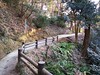
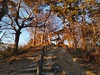
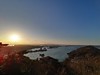
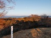

The above images may not be of the site on this page, but were taken nearby. They are loaded from Flickr so please click on them for image credits.
Click here to see more info for this site
Nearby sites
Click here to view sites on an interactive map of the areaKey: Red: member's photo, Blue: 3rd party photo, Yellow: other image, Green: no photo - please go there and take one, Grey: site destroyed
Download sites to:
KML (Google Earth)
GPX (GPS waypoints)
CSV (Garmin/Navman)
CSV (Excel)
To unlock full downloads you need to sign up as a Contributory Member. Otherwise downloads are limited to 50 sites.
Turn off the page maps and other distractions
Nearby sites listing. In the following links * = Image available
8.6km NNE 18° Yamoto Yokoana* Rock Cut Tomb
14.8km WSW 257° Tagajō* Ancient Village or Settlement
16.6km NNW 327° Takaiwa Yokoana* Rock Cut Tomb
20.4km NNW 338° Kamei Gakoi Yokoana rock cut tombs* Rock Cut Tomb
23.4km N 1° Oido Yokoana* Rock Cut Tomb
26.1km WSW 247° Atagoyama Yokoana* Rock Cut Tomb
26.7km NNE 34° Izumizawa Kofun* Chambered Cairn
28.3km ENE 64° Onagawa Stone Memorial of Life tsunami warning tablets* Modern Stone Circle etc
28.6km NW 316° Yamahata Yokoana* Rock Cut Tomb
34.2km ENE 69° Izushima stone settings* Stone Circle
41.6km SW 220° Takenohana Yokoana* Rock Cut Tomb
42.0km NNW 327° Kawakita Yokoana* Rock Cut Tomb
45.9km NE 34° Minamisanriku replica Moai statues* Modern Stone Circle etc
59.6km SW 224° IshiButai open air theater* Modern Stone Circle etc
72.3km W 262° Kōzen-ji temple (in Yamagata)* Modern Stone Circle etc
72.6km W 263° Ex-Saisei-kan hospital main building* Modern Stone Circle etc
72.6km N 357° Mōtsū-ji temple* Modern Stone Circle etc
77.0km W 273° Sagae* Stone Circle
89.6km WSW 249° Matsuzawa kofungun* Chambered Cairn
93.9km NE 34° Tsunami stone (in Attari)* Natural Stone / Erratic / Other Natural Feature
99.1km S 187° History and Folklore Museum Futaba-Machi* Museum
100.8km N 359° Kabayama* Stone Circle
102.2km NW 321° Sakeishi (in Innai)* Carving
106.5km N 357° Ezuriko Kofungun* Chambered Cairn
107.6km NNE 33° Tsunami stone (in Yoshihama)* Natural Stone / Erratic / Other Natural Feature
View more nearby sites and additional images


 We would like to know more about this location. Please feel free to add a brief description and any relevant information in your own language.
 Wir möchten mehr über diese Stätte erfahren. Bitte zögern Sie nicht, eine kurze Beschreibung und relevante Informationen in Deutsch hinzuzufügen.
 Nous aimerions en savoir encore un peu sur les lieux. S'il vous plaît n'hesitez pas à ajouter une courte description et tous les renseignements pertinents dans votre propre langue.
 Quisieramos informarnos un poco más de las lugares. No dude en añadir una breve descripción y otros datos relevantes en su propio idioma.