 with our Megalithic Portal iPhone app")


<< Our Photo Pages >> Yamahata Yokoana - Rock Cut Tomb in Japan in Honshū
Submitted by Aska on Sunday, 21 August 2016 Page Views: 1270
Rock ArtSite Name: Yamahata Yokoana Alternative Name: 山畑横穴Country: Japan
NOTE: This site is 12.529 km away from the location you searched for.
Region: Honshū Type: Rock Cut Tomb
Nearest Town: Ōsaki (Miyagi pref.) Nearest Village: Sanbongi-Arigafukuro 三本
Latitude: 38.520660N Longitude: 140.925750E
Condition:
| 5 | Perfect |
| 4 | Almost Perfect |
| 3 | Reasonable but with some damage |
| 2 | Ruined but still recognisable as an ancient site |
| 1 | Pretty much destroyed, possibly visible as crop marks |
| 0 | No data. |
| -1 | Completely destroyed |
| 5 | Superb |
| 4 | Good |
| 3 | Ordinary |
| 2 | Not Good |
| 1 | Awful |
| 0 | No data. |
| 5 | Can be driven to, probably with disabled access |
| 4 | Short walk on a footpath |
| 3 | Requiring a bit more of a walk |
| 2 | A long walk |
| 1 | In the middle of nowhere, a nightmare to find |
| 0 | No data. |
| 5 | co-ordinates taken by GPS or official recorded co-ordinates |
| 4 | co-ordinates scaled from a detailed map |
| 3 | co-ordinates scaled from a bad map |
| 2 | co-ordinates of the nearest village |
| 1 | co-ordinates of the nearest town |
| 0 | no data |
Internal Links:
External Links:
")
26 burial caves on a small hill. Caves nos.6,10&15 have red mural paintings. Now all the caves have been blockaded to avoid the occupation by the animals.
An attached vault contains the replica of the painted chamber of cave no.15 and the artifacts dug out from this and the neighboring sites, a nearby Konnaiyama Yokoana (混内山横穴) also had mural paintings but now demolished without traces.
You may be viewing yesterday's version of this page. To see the most up to date information please register for a free account.
")
Do not use the above information on other web sites or publications without permission of the contributor.
Nearby Images from Flickr

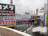
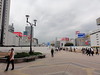
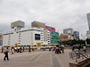
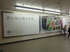
The above images may not be of the site on this page, but were taken nearby. They are loaded from Flickr so please click on them for image credits.
Click here to see more info for this site
Nearby sites
Click here to view sites on an interactive map of the areaKey: Red: member's photo, Blue: 3rd party photo, Yellow: other image, Green: no photo - please go there and take one, Grey: site destroyed
Download sites to:
KML (Google Earth)
GPX (GPS waypoints)
CSV (Garmin/Navman)
CSV (Excel)
To unlock full downloads you need to sign up as a Contributory Member. Otherwise downloads are limited to 50 sites.
Turn off the page maps and other distractions
Nearby sites listing. In the following links * = Image available
12.3km E 98° Kamei Gakoi Yokoana rock cut tombs* Rock Cut Tomb
12.7km ESE 121° Takaiwa Yokoana* Rock Cut Tomb
14.8km NNW 348° Kawakita Yokoana* Rock Cut Tomb
20.4km E 82° Oido Yokoana* Rock Cut Tomb
24.5km SSE 167° Tagajō* Ancient Village or Settlement
25.7km ESE 119° Yamoto Yokoana* Rock Cut Tomb
28.6km SE 136° Jōgan tsunami warning tablet* Modern Stone Circle etc
31.1km S 188° Atagoyama Yokoana* Rock Cut Tomb
34.7km E 87° Izumizawa Kofun* Chambered Cairn
45.9km E 100° Onagawa Stone Memorial of Life tsunami warning tablets* Modern Stone Circle etc
48.6km ENE 69° Minamisanriku replica Moai statues* Modern Stone Circle etc
52.3km E 99° Izushima stone settings* Stone Circle
52.9km S 187° Takenohana Yokoana* Rock Cut Tomb
54.3km NNE 17° Mōtsū-ji temple* Modern Stone Circle etc
59.3km WSW 254° Sagae* Stone Circle
59.9km WSW 240° Ex-Saisei-kan hospital main building* Modern Stone Circle etc
60.3km WSW 239° Kōzen-ji temple (in Yamagata)* Modern Stone Circle etc
66.9km SSW 199° IshiButai open air theater* Modern Stone Circle etc
73.7km NW 323° Sakeishi (in Innai)* Carving
82.1km NNE 12° Kabayama* Stone Circle
82.7km SW 231° Matsuzawa kofungun* Chambered Cairn
86.8km N 9° Ezuriko Kofungun* Chambered Cairn
92.4km NE 52° Tsunami stone (in Attari)* Natural Stone / Erratic / Other Natural Feature
98.0km N 352° Uchinosawa* Stone Circle
101.0km WNW 300° Kiwa-no Saku* Ancient Village or Settlement
View more nearby sites and additional images


 We would like to know more about this location. Please feel free to add a brief description and any relevant information in your own language.
 Wir möchten mehr über diese Stätte erfahren. Bitte zögern Sie nicht, eine kurze Beschreibung und relevante Informationen in Deutsch hinzuzufügen.
 Nous aimerions en savoir encore un peu sur les lieux. S'il vous plaît n'hesitez pas à ajouter une courte description et tous les renseignements pertinents dans votre propre langue.
 Quisieramos informarnos un poco más de las lugares. No dude en añadir una breve descripción y otros datos relevantes en su propio idioma.