


<< Our Photo Pages >> Yoshida Kofun - Passage Grave in Japan in Honshū
Submitted by Aska on Sunday, 08 February 2015 Page Views: 1460
Rock ArtSite Name: Yoshida Kofun Alternative Name: 吉田古墳Country: Japan
NOTE: This site is 0.724 km away from the location you searched for.
Region: Honshū Type: Passage Grave
Nearest Town: Mito (Ibaraki pref.) Nearest Village: MotoYoshida-chō 元吉
Latitude: 36.358660N Longitude: 140.475250E
Condition:
| 5 | Perfect |
| 4 | Almost Perfect |
| 3 | Reasonable but with some damage |
| 2 | Ruined but still recognisable as an ancient site |
| 1 | Pretty much destroyed, possibly visible as crop marks |
| 0 | No data. |
| -1 | Completely destroyed |
| 5 | Superb |
| 4 | Good |
| 3 | Ordinary |
| 2 | Not Good |
| 1 | Awful |
| 0 | No data. |
| 5 | Can be driven to, probably with disabled access |
| 4 | Short walk on a footpath |
| 3 | Requiring a bit more of a walk |
| 2 | A long walk |
| 1 | In the middle of nowhere, a nightmare to find |
| 0 | No data. |
| 5 | co-ordinates taken by GPS or official recorded co-ordinates |
| 4 | co-ordinates scaled from a detailed map |
| 3 | co-ordinates scaled from a bad map |
| 2 | co-ordinates of the nearest village |
| 1 | co-ordinates of the nearest town |
| 0 | no data |
Internal Links:
External Links:
")
A tumulus in a residential area of Mito city, the capital city of Ibaraki Prefecture. Regarded as a round mound for a long time, but recently some scholars suspects that it was a octagonal pyramid originally. This tumulus is well-known for its mural engravings of armour.
You may be viewing yesterday's version of this page. To see the most up to date information please register for a free account.
")
Do not use the above information on other web sites or publications without permission of the contributor.
Nearby Images from Flickr


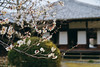

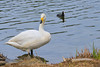

The above images may not be of the site on this page, but were taken nearby. They are loaded from Flickr so please click on them for image credits.
Click here to see more info for this site
Nearby sites
Click here to view sites on an interactive map of the areaKey: Red: member's photo, Blue: 3rd party photo, Yellow: other image, Green: no photo - please go there and take one, Grey: site destroyed
Download sites to:
KML (Google Earth)
GPX (GPS waypoints)
CSV (Garmin/Navman)
CSV (Excel)
To unlock full downloads you need to sign up as a Contributory Member. Otherwise downloads are limited to 50 sites.
Turn off the page maps and other distractions
Nearby sites listing. In the following links * = Image available
8.6km E 79° Torazuka Kofun* Long Barrow
9.1km ENE 58° Mawatari Haniwa Seisaku Iseki* Ancient Mine, Quarry or other Industry
10.9km WNW 289° Kurefushi-no-Sato Kofun Kōen park* Passage Grave
11.0km SSW 214° Obata Kitayama Haniwa Serisaku Iseki* Ancient Mine, Quarry or other Industry
13.7km NW 319° Masui Kofun* Passage Grave
14.0km N 0° Shirakōchi Kofungun* Passage Grave
20.1km W 272° Shumpū Banri-sō* Modern Stone Circle etc
20.8km NNE 17° Hata Bakke Yokoana* Rock Cut Tomb
21.6km N 359° Nekobuchi Yokoana* Rock Cut Tomb
22.4km N 355° Mi Kofun* Passage Grave
29.6km SSW 201° Ajiki Taishi Kofon* Passage Grave
32.6km W 271° Hanazono Kofungun* Passage Grave
39.5km NNE 31° Jūōmae Yokoana* Rock Cut Tomb
45.7km SSE 162° Kaname-ishi* Misc. Earthwork
51.6km W 260° Funadama Kofun* Passage Grave
59.4km WNW 297° Nagaoka Hyakuana* Rock Cut Tomb
62.7km SSW 197° Ryūkakuji Kofungun* Passage Grave
64.2km WNW 300° KamiYokokura* Standing Stones
74.0km S 183° Shibayama Kohun Haniwa Museum* Museum
84.3km NNE 31° Nakata Yokoana* Rock Cut Tomb
88.1km N 349° Nojikubo Kofun* Passage Grave
89.4km N 351° Izumizaki Yokoana* Rock Cut Tomb
90.3km WNW 300° Taiyū-in shrine* Modern Stone Circle etc
91.8km WSW 255° Hachiman-yama Kofun* Passage Grave
92.9km WSW 254° Sakitama Kofungun* Passage Grave
View more nearby sites and additional images


 We would like to know more about this location. Please feel free to add a brief description and any relevant information in your own language.
 Wir möchten mehr über diese Stätte erfahren. Bitte zögern Sie nicht, eine kurze Beschreibung und relevante Informationen in Deutsch hinzuzufügen.
 Nous aimerions en savoir encore un peu sur les lieux. S'il vous plaît n'hesitez pas à ajouter une courte description et tous les renseignements pertinents dans votre propre langue.
 Quisieramos informarnos un poco más de las lugares. No dude en añadir una breve descripción y otros datos relevantes en su propio idioma.