


<< Our Photo Pages >> Sakeishi (in Nekko) - Carving in Japan in Honshū
Submitted by Aska on Tuesday, 01 September 2009 Page Views: 3161
Multi-periodSite Name: Sakeishi (in Nekko) Alternative Name: 鮭石, 魚形文刻石Country: Japan
NOTE: This site is 12.094 km away from the location you searched for.
Region: Honshū Type: Carving
Nearest Town: Kita-Akita (Akita pref.) Nearest Village: Ani-Nekko 阿仁根
Latitude: 39.941840N Longitude: 140.400410E
Condition:
| 5 | Perfect |
| 4 | Almost Perfect |
| 3 | Reasonable but with some damage |
| 2 | Ruined but still recognisable as an ancient site |
| 1 | Pretty much destroyed, possibly visible as crop marks |
| 0 | No data. |
| -1 | Completely destroyed |
| 5 | Superb |
| 4 | Good |
| 3 | Ordinary |
| 2 | Not Good |
| 1 | Awful |
| 0 | No data. |
| 5 | Can be driven to, probably with disabled access |
| 4 | Short walk on a footpath |
| 3 | Requiring a bit more of a walk |
| 2 | A long walk |
| 1 | In the middle of nowhere, a nightmare to find |
| 0 | No data. |
| 5 | co-ordinates taken by GPS or official recorded co-ordinates |
| 4 | co-ordinates scaled from a detailed map |
| 3 | co-ordinates scaled from a bad map |
| 2 | co-ordinates of the nearest village |
| 1 | co-ordinates of the nearest town |
| 0 | no data |
Internal Links:
External Links:
 (PID:49816)")
In the ground of a closed elementary school in a mountain village, this menhir with fish-shaped engravings stands solitary. The engravings are thin and vage.
You may be viewing yesterday's version of this page. To see the most up to date information please register for a free account.
 (PID:49815)")
Do not use the above information on other web sites or publications without permission of the contributor.
Nearby Images from Flickr
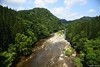
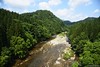

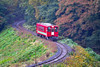
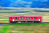
The above images may not be of the site on this page, but were taken nearby. They are loaded from Flickr so please click on them for image credits.
Click here to see more info for this site
Nearby sites
Click here to view sites on an interactive map of the areaKey: Red: member's photo, Blue: 3rd party photo, Yellow: other image, Green: no photo - please go there and take one, Grey: site destroyed
Download sites to:
KML (Google Earth)
GPX (GPS waypoints)
CSV (Garmin/Navman)
CSV (Excel)
To unlock full downloads you need to sign up as a Contributory Member. Otherwise downloads are limited to 50 sites.
Turn off the page maps and other distractions
Nearby sites listing. In the following links * = Image available
29.2km N 351° Isedōtai* Stone Circle
35.2km SW 230° Akita-jō* Ancient Village or Settlement
37.5km S 190° Tennichigū* Cairn
40.8km SSE 160° Kakunodate samurai residences* Modern Stone Circle etc
45.0km NE 44° Takaya-date* Ancient Village or Settlement
49.4km E 92° Kamaishi* Stone Circle
50.2km NE 43° Ōyu* Stone Circle
53.2km NNE 33° Kosaka* Stone Circle
54.5km SSE 166° Hotta-no Saku* Ancient Village or Settlement
55.8km W 261° Tsunami stone (at Shiosezaki cape)* Natural Stone / Erratic / Other Natural Feature
62.1km ESE 106° Yubunezawa* Stone Circle
66.8km ESE 115° Shiwa-jō* Ancient Village or Settlement
68.7km SSE 153° Uchinosawa* Stone Circle
69.4km ESE 112° Mitsuishi Jinja shrine* Natural Stone / Erratic / Other Natural Feature
74.1km N 4° Hirosaki-jō castle San-no-Maru* Modern Stone Circle etc
74.8km N 5° Iwata family residence garden* Modern Stone Circle etc
75.7km ESE 119° Tokutan-jō* Ancient Village or Settlement
76.3km N 11° Seidō family Shoin building* Modern Stone Circle etc
76.4km N 11° Seibi-en garden* Modern Stone Circle etc
78.7km N 1° Zuiraku-en garden* Modern Stone Circle etc
79.8km NNE 12° Myōkyō-ji temple* Modern Stone Circle etc
82.0km SSW 196° Sakeishi (in Yashima)* Carving
82.6km ENE 70° Goshono* Ancient Village or Settlement
84.3km N 358° Ōmori Katsuyama* Stone Circle
92.7km NNE 17° Komakino* Stone Circle
View more nearby sites and additional images


 We would like to know more about this location. Please feel free to add a brief description and any relevant information in your own language.
 Wir möchten mehr über diese Stätte erfahren. Bitte zögern Sie nicht, eine kurze Beschreibung und relevante Informationen in Deutsch hinzuzufügen.
 Nous aimerions en savoir encore un peu sur les lieux. S'il vous plaît n'hesitez pas à ajouter une courte description et tous les renseignements pertinents dans votre propre langue.
 Quisieramos informarnos un poco más de las lugares. No dude en añadir una breve descripción y otros datos relevantes en su propio idioma.