

<< Our Photo Pages >> Shumpū Banri-sō - Modern Stone Circle etc in Japan in Honshū
Submitted by Aska on Sunday, 05 January 2020 Page Views: 396
Modern SitesSite Name: Shumpū Banri-sō Alternative Name: 春風萬里荘 Shumpu Banri-soCountry: Japan
NOTE: This site is 2.641 km away from the location you searched for.
Region: Honshū Type: Modern Stone Circle etc
Nearest Town: Kasama (Ibaraki prefecture) Nearest Village: ShimoIchige 下市毛
Latitude: 36.364690N Longitude: 140.251130E
Condition:
| 5 | Perfect |
| 4 | Almost Perfect |
| 3 | Reasonable but with some damage |
| 2 | Ruined but still recognisable as an ancient site |
| 1 | Pretty much destroyed, possibly visible as crop marks |
| 0 | No data. |
| -1 | Completely destroyed |
| 5 | Superb |
| 4 | Good |
| 3 | Ordinary |
| 2 | Not Good |
| 1 | Awful |
| 0 | No data. |
| 5 | Can be driven to, probably with disabled access |
| 4 | Short walk on a footpath |
| 3 | Requiring a bit more of a walk |
| 2 | A long walk |
| 1 | In the middle of nowhere, a nightmare to find |
| 0 | No data. |
| 5 | co-ordinates taken by GPS or official recorded co-ordinates |
| 4 | co-ordinates scaled from a detailed map |
| 3 | co-ordinates scaled from a bad map |
| 2 | co-ordinates of the nearest village |
| 1 | co-ordinates of the nearest town |
| 0 | no data |
Internal Links:
External Links:
")
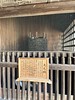
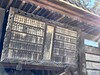
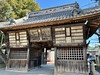
Annex of Kasama Nichidō Bijutsukan museum of Art (笠間日動美術館), originally built as an atelier in Kamakura for the artist-epicure Rosanjin KITAŌJI (1883-1959), moved to this artist commune in 1965. It has a fine dry landscape garden.
Open 9:30-16:30 (10:00-15:30 during Dec.-Feb.), closed on Monday and days around the New Years Day, admission 1000 Japanese Yen (2024 price).
Official site in English.
You may be viewing yesterday's version of this page. To see the most up to date information please register for a free account.
Do not use the above information on other web sites or publications without permission of the contributor.
Nearby Images from Flickr
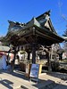
The above images may not be of the site on this page, but were taken nearby. They are loaded from Flickr so please click on them for image credits.
Click here to see more info for this site
Nearby sites
Click here to view sites on an interactive map of the areaKey: Red: member's photo, Blue: 3rd party photo, Yellow: other image, Green: no photo - please go there and take one, Grey: site destroyed
Download sites to:
KML (Google Earth)
GPX (GPS waypoints)
CSV (Garmin/Navman)
CSV (Excel)
To unlock full downloads you need to sign up as a Contributory Member. Otherwise downloads are limited to 50 sites.
Turn off the page maps and other distractions
Nearby sites listing. In the following links * = Image available
10.2km ENE 73° Kurefushi-no-Sato Kofun Kōen park* Passage Grave
12.5km W 269° Hanazono Kofungun* Passage Grave
14.6km NE 49° Masui Kofun* Passage Grave
17.1km SE 125° Obata Kitayama Haniwa Serisaku Iseki* Ancient Mine, Quarry or other Industry
20.1km E 92° Yoshida Kofun* Passage Grave
24.1km ENE 57° Shirakōchi Kofungun* Passage Grave
28.1km E 81° Mawatari Haniwa Seisaku Iseki* Ancient Mine, Quarry or other Industry
28.2km NE 40° Mi Kofun* Passage Grave
28.6km E 88° Torazuka Kofun* Long Barrow
28.8km NE 43° Nekobuchi Yokoana* Rock Cut Tomb
29.8km SSE 162° Ajiki Taishi Kofon* Passage Grave
32.3km WSW 252° Funadama Kofun* Passage Grave
32.4km NE 53° Hata Bakke Yokoana* Rock Cut Tomb
41.9km NW 308° Nagaoka Hyakuana* Rock Cut Tomb
47.6km NW 312° KamiYokokura* Standing Stones
52.2km NE 50° Jūōmae Yokoana* Rock Cut Tomb
56.0km SE 142° Kaname-ishi* Misc. Earthwork
60.8km S 178° Ryūkakuji Kofungun* Passage Grave
72.8km WSW 250° Hachiman-yama Kofun* Passage Grave
73.1km NW 307° Taiyū-in shrine* Modern Stone Circle etc
74.1km WSW 250° Sakitama Kofungun* Passage Grave
74.6km W 263° Tsukamawari Kofun* Long Barrow
75.6km W 271° Itakura Jinja shrine* Standing Stone (Menhir)
76.3km SSE 168° Shibayama Kohun Haniwa Museum* Museum
82.8km WSW 244° Yoshimi Hyakuana* Rock Cut Tomb
View more nearby sites and additional images


 We would like to know more about this location. Please feel free to add a brief description and any relevant information in your own language.
 Wir möchten mehr über diese Stätte erfahren. Bitte zögern Sie nicht, eine kurze Beschreibung und relevante Informationen in Deutsch hinzuzufügen.
 Nous aimerions en savoir encore un peu sur les lieux. S'il vous plaît n'hesitez pas à ajouter une courte description et tous les renseignements pertinents dans votre propre langue.
 Quisieramos informarnos un poco más de las lugares. No dude en añadir una breve descripción y otros datos relevantes en su propio idioma.