


<< Our Photo Pages >> Kiwa-no Saku - Ancient Village or Settlement in Japan in Honshū
Submitted by Aska on Wednesday, 04 November 2020 Page Views: 1408
Early Medieval (Dark Age)Site Name: Kiwa-no Saku Alternative Name: Kiwanosaku 城輪柵 Kiwa-no KiCountry: Japan Region: Honshū Type: Ancient Village or Settlement
Nearest Town: Sakata (Yamagata prefecture) Nearest Village: Kiwa 城輪
Latitude: 38.963750N Longitude: 139.909360E
Condition:
| 5 | Perfect |
| 4 | Almost Perfect |
| 3 | Reasonable but with some damage |
| 2 | Ruined but still recognisable as an ancient site |
| 1 | Pretty much destroyed, possibly visible as crop marks |
| 0 | No data. |
| -1 | Completely destroyed |
| 5 | Superb |
| 4 | Good |
| 3 | Ordinary |
| 2 | Not Good |
| 1 | Awful |
| 0 | No data. |
| 5 | Can be driven to, probably with disabled access |
| 4 | Short walk on a footpath |
| 3 | Requiring a bit more of a walk |
| 2 | A long walk |
| 1 | In the middle of nowhere, a nightmare to find |
| 0 | No data. |
| 5 | co-ordinates taken by GPS or official recorded co-ordinates |
| 4 | co-ordinates scaled from a detailed map |
| 3 | co-ordinates scaled from a bad map |
| 2 | co-ordinates of the nearest village |
| 1 | co-ordinates of the nearest town |
| 0 | no data |
Internal Links:
External Links:
")
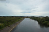
It is thought this fortress was built to replace the function of a branch of the central government of Akita-jō which was often disturbed by attacks by native tribes.
You may be viewing yesterday's version of this page. To see the most up to date information please register for a free account.
")
")
Do not use the above information on other web sites or publications without permission of the contributor.
Nearby Images from Flickr
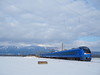

The above images may not be of the site on this page, but were taken nearby. They are loaded from Flickr so please click on them for image credits.
Click here to see more info for this site
Nearby sites
Click here to view sites on an interactive map of the areaKey: Red: member's photo, Blue: 3rd party photo, Yellow: other image, Green: no photo - please go there and take one, Grey: site destroyed
Download sites to:
KML (Google Earth)
GPX (GPS waypoints)
CSV (Garmin/Navman)
CSV (Excel)
To unlock full downloads you need to sign up as a Contributory Member. Otherwise downloads are limited to 50 sites.
Turn off the page maps and other distractions
Nearby sites listing. In the following links * = Image available
8.2km SW 228° Homma Bijutsukan museum of art* Modern Stone Circle etc
35.8km NNE 34° Sakeishi (in Yashima)* Carving
44.7km ENE 77° Sakeishi (in Innai)* Carving
73.0km SSE 154° Sagae* Stone Circle
78.4km NE 44° Hotta-no Saku* Ancient Village or Settlement
80.2km NNE 26° Tennichigū* Cairn
84.2km SSW 197° Achiyadaira* Stone Circle
87.0km SSE 155° Ex-Saisei-kan hospital main building* Modern Stone Circle etc
87.6km N 10° Akita-jō* Ancient Village or Settlement
88.1km ENE 57° Uchinosawa* Stone Circle
88.7km SSE 155° Kōzen-ji temple (in Yamagata)* Modern Stone Circle etc
90.1km NE 38° Kakunodate samurai residences* Modern Stone Circle etc
91.8km ESE 112° Kawakita Yokoana* Rock Cut Tomb
100.3km N 352° Tsunami stone (at Shiosezaki cape)* Natural Stone / Erratic / Other Natural Feature
101.0km ESE 119° Yamahata Yokoana* Rock Cut Tomb
103.7km E 88° Mōtsū-ji temple* Modern Stone Circle etc
105.1km SSE 166° Matsuzawa kofungun* Chambered Cairn
107.8km ENE 70° Ezuriko Kofungun* Chambered Cairn
109.9km ENE 73° Kabayama* Stone Circle
112.5km ESE 117° Kamei Gakoi Yokoana rock cut tombs* Rock Cut Tomb
113.7km ESE 119° Takaiwa Yokoana* Rock Cut Tomb
116.2km SE 133° Atagoyama Yokoana* Rock Cut Tomb
116.6km NNE 21° Sakeishi (in Nekko)* Carving
117.9km ESE 113° Oido Yokoana* Rock Cut Tomb
118.9km SE 128° Tagajō* Ancient Village or Settlement
View more nearby sites and additional images


 We would like to know more about this location. Please feel free to add a brief description and any relevant information in your own language.
 Wir möchten mehr über diese Stätte erfahren. Bitte zögern Sie nicht, eine kurze Beschreibung und relevante Informationen in Deutsch hinzuzufügen.
 Nous aimerions en savoir encore un peu sur les lieux. S'il vous plaît n'hesitez pas à ajouter une courte description et tous les renseignements pertinents dans votre propre langue.
 Quisieramos informarnos un poco más de las lugares. No dude en añadir una breve descripción y otros datos relevantes en su propio idioma.