


<< Text Pages >> Heimatmuseum Platkow - Museum in Germany in Brandenburg, Berlin
Submitted by KaiHofmann on Thursday, 01 February 2018 Page Views: 554
MuseumsSite Name: Heimatmuseum PlatkowCountry: Germany
NOTE: This site is 16.506 km away from the location you searched for.
Land: Brandenburg, Berlin Type: Museum
Nearest Town: Frankfurt Oder Nearest Village: Platkow
Latitude: 52.584503N Longitude: 14.323003E
Condition:
| 5 | Perfect |
| 4 | Almost Perfect |
| 3 | Reasonable but with some damage |
| 2 | Ruined but still recognisable as an ancient site |
| 1 | Pretty much destroyed, possibly visible as crop marks |
| 0 | No data. |
| -1 | Completely destroyed |
| 5 | Superb |
| 4 | Good |
| 3 | Ordinary |
| 2 | Not Good |
| 1 | Awful |
| 0 | No data. |
| 5 | Can be driven to, probably with disabled access |
| 4 | Short walk on a footpath |
| 3 | Requiring a bit more of a walk |
| 2 | A long walk |
| 1 | In the middle of nowhere, a nightmare to find |
| 0 | No data. |
| 5 | co-ordinates taken by GPS or official recorded co-ordinates |
| 4 | co-ordinates scaled from a detailed map |
| 3 | co-ordinates scaled from a bad map |
| 2 | co-ordinates of the nearest village |
| 1 | co-ordinates of the nearest town |
| 0 | no data |
Internal Links:
External Links:
Museum in Brandenburg, Berlin
Museum of local history with an archaeological department from neolihic to medieval.
You may be viewing yesterday's version of this page. To see the most up to date information please register for a free account.
Do not use the above information on other web sites or publications without permission of the contributor.
Nearby Images from Flickr

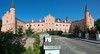

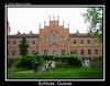
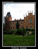
The above images may not be of the site on this page, but were taken nearby. They are loaded from Flickr so please click on them for image credits.
Click here to see more info for this site
Nearby sites
Click here to view sites on an interactive map of the areaKey: Red: member's photo, Blue: 3rd party photo, Yellow: other image, Green: no photo - please go there and take one, Grey: site destroyed
Download sites to:
KML (Google Earth)
GPX (GPS waypoints)
CSV (Garmin/Navman)
CSV (Excel)
To unlock full downloads you need to sign up as a Contributory Member. Otherwise downloads are limited to 50 sites.
Turn off the page maps and other distractions
Nearby sites listing. In the following links * = Image available
1.5km NW 306° Kreisgrabenanlage Platkow Henge
4.3km WNW 303° Kreisgrabenanlage Quappendorf Henge
9.7km SSE 149° Naepfchenstein Friedersdorf* Rock Art
13.1km NW 317° Wriezen Burgwall Ancient Village or Settlement
13.6km W 260° Muenchehofe dune find spot* Natural Stone / Erratic / Other Natural Feature
15.2km SW 233° Muencheberg Kreuz Early Christian Sculptured Stone
15.8km W 270° Teufelsstein Buckow Natural Stone / Erratic / Other Natural Feature
16.2km SSW 205° Teufelsstein Heinersdorf * Rock Art
17.3km WSW 253° Waldsieversdorf Burgwall Hillfort
20.2km ESE 121° Reitweiner Wallberge Hillfort
20.3km W 270° Schaelchenstein Bollersdorf* Rock Art
20.5km SSW 212° Tempelberg Steinkistengrab* Chambered Tomb
20.7km SSW 198° Arensdorf Wallanlage Ancient Village or Settlement
21.3km SE 132° Klessin Neolithische Siedlung Ancient Village or Settlement
22.8km SE 140° Lebus Burgberg Hillfort
23.5km W 261° Garzin Burgwall* Ancient Village or Settlement
26.0km NW 319° Altranft Chambered Tomb
26.6km SSE 163° Naefpchenstein Eduardspring Rock Art
27.6km WNW 283° Semnonenstein* Natural Stone / Erratic / Other Natural Feature
30.5km N 10° Diabelskie Kamienie - Moryń Natural Stone / Erratic / Other Natural Feature
31.0km SSE 159° Kanzelstein* Natural Stone / Erratic / Other Natural Feature
31.1km N 352° Steinkeller Burial Chamber or Dolmen
31.3km SSE 159° Schalenstein (Nuhnen)* Rock Art
34.1km SSE 151° Tzschetzschnower Burgwall Hillfort
34.7km W 261° Steinkreuz Eggersdorf* Ancient Cross
View more nearby sites and additional images


 We would like to know more about this location. Please feel free to add a brief description and any relevant information in your own language.
 Wir möchten mehr über diese Stätte erfahren. Bitte zögern Sie nicht, eine kurze Beschreibung und relevante Informationen in Deutsch hinzuzufügen.
 Nous aimerions en savoir encore un peu sur les lieux. S'il vous plaît n'hesitez pas à ajouter une courte description et tous les renseignements pertinents dans votre propre langue.
 Quisieramos informarnos un poco más de las lugares. No dude en añadir una breve descripción y otros datos relevantes en su propio idioma.