


<< Text Pages >> Alte Schloss Behlow - Hillfort in Germany in Brandenburg, Berlin
Submitted by KaiHofmann on Thursday, 16 December 2010 Page Views: 2124
Iron Age and Later PrehistorySite Name: Alte Schloss BehlowCountry: Germany
NOTE: This site is 6.42 km away from the location you searched for.
Land: Brandenburg, Berlin Type: Hillfort
Nearest Town: Lieberose Nearest Village: Behlow
Latitude: 51.995193N Longitude: 14.273225E
Condition:
| 5 | Perfect |
| 4 | Almost Perfect |
| 3 | Reasonable but with some damage |
| 2 | Ruined but still recognisable as an ancient site |
| 1 | Pretty much destroyed, possibly visible as crop marks |
| 0 | No data. |
| -1 | Completely destroyed |
| 5 | Superb |
| 4 | Good |
| 3 | Ordinary |
| 2 | Not Good |
| 1 | Awful |
| 0 | No data. |
| 5 | Can be driven to, probably with disabled access |
| 4 | Short walk on a footpath |
| 3 | Requiring a bit more of a walk |
| 2 | A long walk |
| 1 | In the middle of nowhere, a nightmare to find |
| 0 | No data. |
| 5 | co-ordinates taken by GPS or official recorded co-ordinates |
| 4 | co-ordinates scaled from a detailed map |
| 3 | co-ordinates scaled from a bad map |
| 2 | co-ordinates of the nearest village |
| 1 | co-ordinates of the nearest town |
| 0 | no data |
Internal Links:
External Links:
Hillfort in Brandenburg, Berlin
Natural hill with traces of a neolithic-, bronze-age- and slavonic settlements (80m diameter).
You may be viewing yesterday's version of this page. To see the most up to date information please register for a free account.
Do not use the above information on other web sites or publications without permission of the contributor.
Nearby Images from Flickr
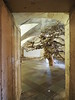
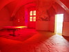
The above images may not be of the site on this page, but were taken nearby. They are loaded from Flickr so please click on them for image credits.
Click here to see more info for this site
Nearby sites
Click here to view sites on an interactive map of the areaKey: Red: member's photo, Blue: 3rd party photo, Yellow: other image, Green: no photo - please go there and take one, Grey: site destroyed
Download sites to:
KML (Google Earth)
GPX (GPS waypoints)
CSV (Garmin/Navman)
CSV (Excel)
To unlock full downloads you need to sign up as a Contributory Member. Otherwise downloads are limited to 50 sites.
Turn off the page maps and other distractions
Nearby sites listing. In the following links * = Image available
10.1km NW 314° Teufelsstein Zaue* Rock Art
14.6km SSW 196° Schötzens Stein Natural Stone / Erratic / Other Natural Feature
18.4km SSW 206° Schlossberg Burg Hillfort
19.4km NE 53° Kieselwitz Grabhuegelfeld* Barrow Cemetery
20.0km NNW 328° Mehrfachkreisanlage Wulfersdorf* Henge
20.3km N 1° Oegeln Steinkreuz Early Christian Sculptured Stone
20.5km ENE 57° Kieselwitz Teufelsstein* Natural Stone / Erratic / Other Natural Feature
22.0km WNW 299° Pretschen Kreuze Early Christian Sculptured Stone
22.4km NNW 340° Buckow Slawenburg Ancient Village or Settlement
22.7km ENE 59° Kobbelner Stein* Natural Stone / Erratic / Other Natural Feature
24.5km NNW 347° Klein-Rietz Steinkiste Cist
25.2km S 182° Zahsow Schwedenschanze Ancient Village or Settlement
26.4km NNE 20° Mixdorf Grabhuegelfeld Barrow Cemetery
26.9km SW 218° Slawenburg Raddusch* Museum
28.2km WSW 240° Kreuzstein Krimnitz* Early Christian Sculptured Stone
29.6km NNE 19° Heimatmuseum Müllrose* Museum
29.7km WSW 237° Gross Beuchow Ringwall* Ancient Village or Settlement
30.1km ENE 75° Wellmitz Steinkreuze Ancient Cross
31.5km E 100° Krzyże Pokutne Gubin Ancient Cross
35.3km SW 219° Calauer Kreuz Ancient Cross
36.0km SW 223° Kreuzstein Buckow Early Christian Sculptured Stone
36.3km SW 229° Slawenburg Gross Jehser Ancient Village or Settlement
37.6km SW 216° Goldbornquelle Werchow Holy Well or Sacred Spring
38.5km NNE 32° Lossow Burgwall* Hillfort
39.1km NNE 22° Schalenstein (Nuhnen)* Rock Art
View more nearby sites and additional images


 We would like to know more about this location. Please feel free to add a brief description and any relevant information in your own language.
 Wir möchten mehr über diese Stätte erfahren. Bitte zögern Sie nicht, eine kurze Beschreibung und relevante Informationen in Deutsch hinzuzufügen.
 Nous aimerions en savoir encore un peu sur les lieux. S'il vous plaît n'hesitez pas à ajouter une courte description et tous les renseignements pertinents dans votre propre langue.
 Quisieramos informarnos un poco más de las lugares. No dude en añadir una breve descripción y otros datos relevantes en su propio idioma.