

<< Text Pages >> Schalenstein Luppa - Rock Art in Germany in Saxony
Submitted by KaiHofmann on Friday, 04 May 2012 Page Views: 2202
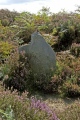
Rock ArtSite Name: Schalenstein Luppa Alternative Name: Opferstein LuppaCountry: Germany Land: Saxony Type: Rock Art
Nearest Town: Bautzen Nearest Village: Luppa
Latitude: 51.268774N Longitude: 14.396301E
Condition:
| 5 | Perfect |
| 4 | Almost Perfect |
| 3 | Reasonable but with some damage |
| 2 | Ruined but still recognisable as an ancient site |
| 1 | Pretty much destroyed, possibly visible as crop marks |
| 0 | No data. |
| -1 | Completely destroyed |
| 5 | Superb |
| 4 | Good |
| 3 | Ordinary |
| 2 | Not Good |
| 1 | Awful |
| 0 | No data. |
| 5 | Can be driven to, probably with disabled access |
| 4 | Short walk on a footpath |
| 3 | Requiring a bit more of a walk |
| 2 | A long walk |
| 1 | In the middle of nowhere, a nightmare to find |
| 0 | No data. |
| 5 | co-ordinates taken by GPS or official recorded co-ordinates |
| 4 | co-ordinates scaled from a detailed map |
| 3 | co-ordinates scaled from a bad map |
| 2 | co-ordinates of the nearest village |
| 1 | co-ordinates of the nearest town |
| 0 | no data |
Be the first person to rate this site - see the 'Contribute!' box in the right hand menu.
Internal Links:
External Links:
Cup-marked stone on the west Windmuehlenberg (windmill hill) near Luppa.
You may be viewing yesterday's version of this page. To see the most up to date information please register for a free account.
Do not use the above information on other web sites or publications without permission of the contributor.
Nearby Images from Flickr
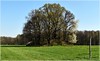
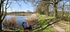
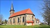
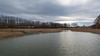
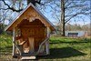
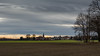
The above images may not be of the site on this page, but were taken nearby. They are loaded from Flickr so please click on them for image credits.
Click here to see more info for this site
Nearby sites
Click here to view sites on an interactive map of the areaKey: Red: member's photo, Blue: 3rd party photo, Yellow: other image, Green: no photo - please go there and take one, Grey: site destroyed
Download sites to:
KML (Google Earth)
GPX (GPS waypoints)
CSV (Garmin/Navman)
CSV (Excel)
To unlock full downloads you need to sign up as a Contributory Member. Otherwise downloads are limited to 50 sites.
Turn off the page maps and other distractions
Nearby sites listing. In the following links * = Image available
7.4km SE 137° Gottlobsberg Schalensteine Rock Art
7.8km SW 227° Dreikretscham Steinkreuz Ancient Cross
9.5km SW 227° Sollschwitz Schalenstein Rock Art
9.6km SSW 201° Bloaschuetz Schalenstein Rock Art
9.7km SSW 201° Bloaschuetz Grabhuegel Round Barrow(s)
10.3km ESE 122° Pliesskowitz Teufelsstein Natural Stone / Erratic / Other Natural Feature
11.4km SSE 148° Zieschuetz Schalenstein Rock Art
13.1km SE 141° Kubschuetz Schalenstein Rock Art
13.6km S 181° Doberschauer Schanze Hillfort
18.2km SSW 214° Dreistuehle Rock Art
18.7km SSE 152° Teufelstisch Czorneboh Natural Stone / Erratic / Other Natural Feature
22.2km S 170° Kaelbersteine Natural Stone / Erratic / Other Natural Feature
25.9km S 181° Sohland Opferbecken Natural Stone / Erratic / Other Natural Feature
26.3km SE 128° Bielplatz Wallburg Misc. Earthwork
27.0km SSE 159° Guettlerbueschl Chambered Tomb
27.1km S 181° Sohland Huehnengrab Chambered Tomb
28.8km SE 132° Geldkeller Felsen* Rock Outcrop
28.8km SE 132° Schafberg Siedlung Ancient Village or Settlement
29.6km NNE 33° Summstein Weißwasser Modern Stone Circle etc
30.3km ESE 113° Biesig Opferstein Natural Stone / Erratic / Other Natural Feature
39.4km SSW 194° Kuhstallhoehle Cave or Rock Shelter
42.1km S 186° Altarstein Sächsische Schweiz Natural Stone / Erratic / Other Natural Feature
43.5km SSW 210° Lilienstein Rock Art
44.7km ESE 107° Unknown wooden sculpture* Sculptured Stone
47.2km ESE 110° Grodzisko Tylice Hillfort
View more nearby sites and additional images


 We would like to know more about this location. Please feel free to add a brief description and any relevant information in your own language.
 Wir möchten mehr über diese Stätte erfahren. Bitte zögern Sie nicht, eine kurze Beschreibung und relevante Informationen in Deutsch hinzuzufügen.
 Nous aimerions en savoir encore un peu sur les lieux. S'il vous plaît n'hesitez pas à ajouter une courte description et tous les renseignements pertinents dans votre propre langue.
 Quisieramos informarnos un poco más de las lugares. No dude en añadir una breve descripción y otros datos relevantes en su propio idioma.