


<< Our Photo Pages >> Menhir of Parezí - Standing Stone (Menhir) in Czech Republic in Bohemia
Submitted by ladrin on Sunday, 14 November 2021 Page Views: 304
Neolithic and Bronze AgeSite Name: Menhir of Parezí Alternative Name: Menhir u ParezíCountry: Czech Republic
NOTE: This site is 6.744 km away from the location you searched for.
Region: Bohemia Type: Standing Stone (Menhir)
Nearest Town: Protivín Nearest Village: Krč
Latitude: 49.209116N Longitude: 14.266559E
Condition:
| 5 | Perfect |
| 4 | Almost Perfect |
| 3 | Reasonable but with some damage |
| 2 | Ruined but still recognisable as an ancient site |
| 1 | Pretty much destroyed, possibly visible as crop marks |
| 0 | No data. |
| -1 | Completely destroyed |
| 5 | Superb |
| 4 | Good |
| 3 | Ordinary |
| 2 | Not Good |
| 1 | Awful |
| 0 | No data. |
| 5 | Can be driven to, probably with disabled access |
| 4 | Short walk on a footpath |
| 3 | Requiring a bit more of a walk |
| 2 | A long walk |
| 1 | In the middle of nowhere, a nightmare to find |
| 0 | No data. |
| 5 | co-ordinates taken by GPS or official recorded co-ordinates |
| 4 | co-ordinates scaled from a detailed map |
| 3 | co-ordinates scaled from a bad map |
| 2 | co-ordinates of the nearest village |
| 1 | co-ordinates of the nearest town |
| 0 | no data |
Internal Links:
External Links:
")
In my humble opinion, despite if its interesting shape the stone is rather modern origin.
You may be viewing yesterday's version of this page. To see the most up to date information please register for a free account.
")
")
")
Do not use the above information on other web sites or publications without permission of the contributor.
Nearby Images from Flickr
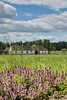
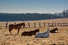
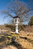
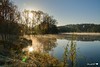
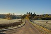
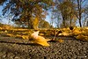
The above images may not be of the site on this page, but were taken nearby. They are loaded from Flickr so please click on them for image credits.
Click here to see more info for this site
Nearby sites
Click here to view sites on an interactive map of the areaKey: Red: member's photo, Blue: 3rd party photo, Yellow: other image, Green: no photo - please go there and take one, Grey: site destroyed
Download sites to:
KML (Google Earth)
GPX (GPS waypoints)
CSV (Garmin/Navman)
CSV (Excel)
To unlock full downloads you need to sign up as a Contributory Member. Otherwise downloads are limited to 50 sites.
Turn off the page maps and other distractions
Nearby sites listing. In the following links * = Image available
7.8km NNE 17° Barrow Cemetery U Honzíčka* Barrow Cemetery
10.0km NNW 343° Table of Bandits* Sculptured Stone
12.5km N 6° Chrestovice* Standing Stone (Menhir)
13.7km NNE 26° Nemějice modern stone circle* Modern Stone Circle etc
13.7km NNE 27° Tábor sanctum and barrow cemetery* Barrow Cemetery
13.8km NW 322° Prehistoric Tumuli Písek* Chambered Cairn
14.3km NNE 31° Stone Cross Nemějice* Ancient Cross
14.5km SSE 163° Zbudov Menhirs* Standing Stones
14.8km NNE 28° Barrow Cemetery Nemějice Hůrka* Barrow Cemetery
15.3km NE 46° Barrow cemetery Hemery* Barrow Cemetery
15.7km NNE 11° Olešná Propitiatory cross* Ancient Cross
16.5km W 272° Cehnice Stone Circle* Stone Circle
17.5km SSW 210° Velky Bor Menhir* Standing Stone (Menhir)
19.0km NNE 29° Bernartice stone cross 2* Ancient Cross
19.0km NNE 25° Bernartice stone cross 1* Ancient Cross
26.1km NNW 348° Hlízová Tower Zvíkov* Carving
26.7km WNW 296° Radomyšl Stone Cross I.* Ancient Cross
26.9km S 178° Holasovice Stone Circle* Modern Stone Circle etc
27.0km N 357° Obrovy Hroby (Giants graves)* Misc. Earthwork
27.5km NNE 30° Sepekov barrow cemetery* Barrow Cemetery
28.1km NNE 15° Milevsko stone cross I.* Ancient Cross
29.0km NNE 17° Menhir Milevsko* Standing Stone (Menhir)
29.2km NE 42° Barrow Cemetery Řepeč* Barrow Cemetery
30.2km SSE 150° Erratic Stone (Premysl Otakar II)* Sculptured Stone
30.4km N 360° Koška Menhir* Standing Stone (Menhir)
View more nearby sites and additional images


 We would like to know more about this location. Please feel free to add a brief description and any relevant information in your own language.
 Wir möchten mehr über diese Stätte erfahren. Bitte zögern Sie nicht, eine kurze Beschreibung und relevante Informationen in Deutsch hinzuzufügen.
 Nous aimerions en savoir encore un peu sur les lieux. S'il vous plaît n'hesitez pas à ajouter une courte description et tous les renseignements pertinents dans votre propre langue.
 Quisieramos informarnos un poco más de las lugares. No dude en añadir una breve descripción y otros datos relevantes en su propio idioma.