

<< Our Photo Pages >> Toftaholms Gravfält - Barrow Cemetery in Sweden in Småland
Submitted by FAE on Monday, 07 June 2010 Page Views: 4138
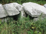
Neolithic and Bronze AgeSite Name: Toftaholms GravfältCountry: Sweden
NOTE: This site is 13.915 km away from the location you searched for.
Landskap: Småland Type: Barrow Cemetery
Nearest Town: Värnamo Nearest Village: Dörarp
Latitude: 57.019652N Longitude: 14.010639E
Condition:
| 5 | Perfect |
| 4 | Almost Perfect |
| 3 | Reasonable but with some damage |
| 2 | Ruined but still recognisable as an ancient site |
| 1 | Pretty much destroyed, possibly visible as crop marks |
| 0 | No data. |
| -1 | Completely destroyed |
| 5 | Superb |
| 4 | Good |
| 3 | Ordinary |
| 2 | Not Good |
| 1 | Awful |
| 0 | No data. |
| 5 | Can be driven to, probably with disabled access |
| 4 | Short walk on a footpath |
| 3 | Requiring a bit more of a walk |
| 2 | A long walk |
| 1 | In the middle of nowhere, a nightmare to find |
| 0 | No data. |
| 5 | co-ordinates taken by GPS or official recorded co-ordinates |
| 4 | co-ordinates scaled from a detailed map |
| 3 | co-ordinates scaled from a bad map |
| 2 | co-ordinates of the nearest village |
| 1 | co-ordinates of the nearest town |
| 0 | no data |
Internal Links:
External Links:
I have visited· I would like to visit
Oskmey visited on 26th Apr 2019 - their rating: Cond: 4 Amb: 5 Access: 5
")
The site is located directly next to the road between Dörarp and Tånnö, 3.5 km north of Dörarp and 900 m south of Toftaholm Herrgård. There is a parking place nearby.
You may be viewing yesterday's version of this page. To see the most up to date information please register for a free account.
Do not use the above information on other web sites or publications without permission of the contributor.
Nearby Images from Flickr

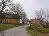
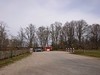
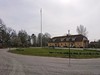
The above images may not be of the site on this page, but were taken nearby. They are loaded from Flickr so please click on them for image credits.
Click here to see more info for this site
Nearby sites
Click here to view sites on an interactive map of the areaKey: Red: member's photo, Blue: 3rd party photo, Yellow: other image, Green: no photo - please go there and take one, Grey: site destroyed
Download sites to:
KML (Google Earth)
GPX (GPS waypoints)
CSV (Garmin/Navman)
CSV (Excel)
To unlock full downloads you need to sign up as a Contributory Member. Otherwise downloads are limited to 50 sites.
Turn off the page maps and other distractions
Nearby sites listing. In the following links * = Image available
891m NNE 22° Toftaholm Runesten* Carving
24.4km SSW 194° Kånna Högar* Barrow Cemetery
39.0km WNW 296° Smålandsstenar* Stone Circle
41.3km NW 304° Horshaga hällkista* Burial Chamber or Dolmen
71.4km WSW 239° Tolarpsgraven* Passage Grave
76.0km WSW 244° Ivars Kulle* Round Barrow(s)
77.3km WSW 258° Öinge treuddar* Misc. Earthwork
77.7km WSW 257° Bostället* Cist
78.6km W 259° Hagbards Galge* Standing Stones
78.6km WSW 259° Asige bautastenar* Standing Stones
78.7km WSW 259° Asige Bronsåldersgravar* Round Barrow(s)
79.2km SW 229° Örelid* Standing Stones
79.5km W 261° Hagbards kulle* Round Barrow(s)
79.5km W 261° Särestad* Standing Stones
79.5km W 261° Särestad gravfält* Standing Stones
79.8km WSW 256° Getinge bautastenar* Standing Stones
81.0km NNE 11° Rogbergastenen* Carving
81.9km W 262° Munkakyrkan* Stone Circle
84.3km WSW 257° Klockstenarna Skeppssättning* Standing Stones
84.8km WNW 285° Källsjö Passage Grave* Burial Chamber or Dolmen
88.3km W 273° Källekullen* Standing Stones
91.1km SW 223° Lugnarohögen* Round Cairn
92.9km W 264° Stomma kulle* Cairn
95.8km SW 227° Båstad Gravfält* Barrow Cemetery
95.9km W 277° Högaberg* Barrow Cemetery
View more nearby sites and additional images


 We would like to know more about this location. Please feel free to add a brief description and any relevant information in your own language.
 Wir möchten mehr über diese Stätte erfahren. Bitte zögern Sie nicht, eine kurze Beschreibung und relevante Informationen in Deutsch hinzuzufügen.
 Nous aimerions en savoir encore un peu sur les lieux. S'il vous plaît n'hesitez pas à ajouter une courte description et tous les renseignements pertinents dans votre propre langue.
 Quisieramos informarnos un poco más de las lugares. No dude en añadir una breve descripción y otros datos relevantes en su propio idioma.