


<< Our Photo Pages >> Svatý Jan pod Skalou - Holy Well or Sacred Spring in Czech Republic in Bohemia
Submitted by rw1 on Sunday, 01 October 2006 Page Views: 4073
Springs and Holy WellsSite Name: Svatý Jan pod SkalouCountry: Czech Republic
NOTE: This site is 5.453 km away from the location you searched for.
Region: Bohemia Type: Holy Well or Sacred Spring
Nearest Town: Beroun Nearest Village: Svatý Jan pod Skalou
Latitude: 49.968910N Longitude: 14.133160E
Condition:
| 5 | Perfect |
| 4 | Almost Perfect |
| 3 | Reasonable but with some damage |
| 2 | Ruined but still recognisable as an ancient site |
| 1 | Pretty much destroyed, possibly visible as crop marks |
| 0 | No data. |
| -1 | Completely destroyed |
| 5 | Superb |
| 4 | Good |
| 3 | Ordinary |
| 2 | Not Good |
| 1 | Awful |
| 0 | No data. |
| 5 | Can be driven to, probably with disabled access |
| 4 | Short walk on a footpath |
| 3 | Requiring a bit more of a walk |
| 2 | A long walk |
| 1 | In the middle of nowhere, a nightmare to find |
| 0 | No data. |
| 5 | co-ordinates taken by GPS or official recorded co-ordinates |
| 4 | co-ordinates scaled from a detailed map |
| 3 | co-ordinates scaled from a bad map |
| 2 | co-ordinates of the nearest village |
| 1 | co-ordinates of the nearest town |
| 0 | no data |
Be the first person to rate this site - see the 'Contribute!' box in the right hand menu.
Internal Links:
External Links:
")
Nacional Park Bohemian Karst
Travertin Cave beneath Monastery, besize spring Well Holy Ivan
More details: http://www.svatyjan.cz/index_cz.htm
You may be viewing yesterday's version of this page. To see the most up to date information please register for a free account.
")
")
Do not use the above information on other web sites or publications without permission of the contributor.
Nearby Images from Flickr
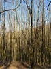
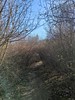
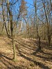
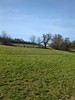
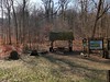
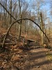
The above images may not be of the site on this page, but were taken nearby. They are loaded from Flickr so please click on them for image credits.
Click here to see more info for this site
Nearby sites
Click here to view sites on an interactive map of the areaKey: Red: member's photo, Blue: 3rd party photo, Yellow: other image, Green: no photo - please go there and take one, Grey: site destroyed
Download sites to:
KML (Google Earth)
GPX (GPS waypoints)
CSV (Garmin/Navman)
CSV (Excel)
To unlock full downloads you need to sign up as a Contributory Member. Otherwise downloads are limited to 50 sites.
Turn off the page maps and other distractions
Nearby sites listing. In the following links * = Image available
83m E 86° St. Ivan Stone* Sculptured Stone
339m NE 56° St. John Rock* Cave or Rock Shelter
2.8km SW 222° Turské Maštale Caves* Cave or Rock Shelter
2.9km SW 221° Hillfort Tetín* Hillfort
3.1km SW 225° Tetín cross and old slavic burial stones* Ancient Cross
3.1km SW 224° St. Ludmila Stone* Standing Stone (Menhir)
4.3km SSW 195° Koda.* Cave or Rock Shelter
8.4km SW 227° Aksamit Gate* Rock Outcrop
8.4km SW 227° Aksamitova Brana* Cave or Rock Shelter
8.5km SW 226° Kotýz Prehistoric hillfort* Hillfort
8.5km SW 225° Děravá Cave* Cave or Rock Shelter
9.8km WNW 287° Oppidum Stradonice* Hillfort
9.9km WNW 286° Stradonice Menhir* Standing Stone (Menhir)
11.1km NNW 334° High Hill hillfort* Hillfort
11.8km NNW 330° Žlábek holy well (Hollow)* Holy Well or Sacred Spring
12.3km ENE 61° Zbuzany Stone* Standing Stone (Menhir)
13.9km NW 314° Belec* Standing Stone (Menhir)
14.0km NW 320° Bratronice Menhir* Standing Stone (Menhir)
14.8km SSW 209° Šemík's grave* Standing Stone (Menhir)
14.8km SSW 209° Great stones of Neumětely* Standing Stones
15.2km SSW 196° Celtic Sanctum Skřipel* Hillfort
15.8km NNW 327° Lhota Stone* Standing Stone (Menhir)
16.3km NNW 338° Družec Menhir* Standing Stone (Menhir)
16.4km NNW 346° Velká Dobrá Stone* Standing Stone (Menhir)
16.6km NW 321° Spanilá hůrka (Graceful height)* Round Barrow(s)
View more nearby sites and additional images


 We would like to know more about this location. Please feel free to add a brief description and any relevant information in your own language.
 Wir möchten mehr über diese Stätte erfahren. Bitte zögern Sie nicht, eine kurze Beschreibung und relevante Informationen in Deutsch hinzuzufügen.
 Nous aimerions en savoir encore un peu sur les lieux. S'il vous plaît n'hesitez pas à ajouter une courte description et tous les renseignements pertinents dans votre propre langue.
 Quisieramos informarnos un poco más de las lugares. No dude en añadir una breve descripción y otros datos relevantes en su propio idioma.