


<< Our Photo Pages >> Stradonice Menhir - Standing Stone (Menhir) in Czech Republic in Bohemia
Submitted by ladrin on Thursday, 27 January 2022 Page Views: 254
Date UncertainSite Name: Stradonice Menhir Alternative Name: Stradonický MenhirCountry: Czech Republic
NOTE: This site is 0.671 km away from the location you searched for.
Region: Bohemia Type: Standing Stone (Menhir)
Nearest Town: Beroun Nearest Village: Nižbor
Latitude: 49.993969N Longitude: 13.999831E
Condition:
| 5 | Perfect |
| 4 | Almost Perfect |
| 3 | Reasonable but with some damage |
| 2 | Ruined but still recognisable as an ancient site |
| 1 | Pretty much destroyed, possibly visible as crop marks |
| 0 | No data. |
| -1 | Completely destroyed |
| 5 | Superb |
| 4 | Good |
| 3 | Ordinary |
| 2 | Not Good |
| 1 | Awful |
| 0 | No data. |
| 5 | Can be driven to, probably with disabled access |
| 4 | Short walk on a footpath |
| 3 | Requiring a bit more of a walk |
| 2 | A long walk |
| 1 | In the middle of nowhere, a nightmare to find |
| 0 | No data. |
| 5 | co-ordinates taken by GPS or official recorded co-ordinates |
| 4 | co-ordinates scaled from a detailed map |
| 3 | co-ordinates scaled from a bad map |
| 2 | co-ordinates of the nearest village |
| 1 | co-ordinates of the nearest town |
| 0 | no data |
Internal Links:
External Links:
")
I couldn't find any additional information about the stone itself so I rather tend to speculate about the modern origin of the stone. Anyway the stone is about 80 cm high and can be found almost in the middle of the former ancient Celtic city within the area of acropolis. The place is the part of the signposted tourist trail and seems to be very popular.
You may be viewing yesterday's version of this page. To see the most up to date information please register for a free account.
")
")
")
Do not use the above information on other web sites or publications without permission of the contributor.
Nearby Images from Flickr
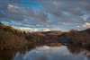
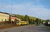
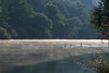
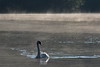
The above images may not be of the site on this page, but were taken nearby. They are loaded from Flickr so please click on them for image credits.
Click here to see more info for this site
Nearby sites
Click here to view sites on an interactive map of the areaKey: Red: member's photo, Blue: 3rd party photo, Yellow: other image, Green: no photo - please go there and take one, Grey: site destroyed
Download sites to:
KML (Google Earth)
GPX (GPS waypoints)
CSV (Garmin/Navman)
CSV (Excel)
To unlock full downloads you need to sign up as a Contributory Member. Otherwise downloads are limited to 50 sites.
Turn off the page maps and other distractions
Nearby sites listing. In the following links * = Image available
132m E 89° Oppidum Stradonice* Hillfort
6.9km N 356° Belec* Standing Stone (Menhir)
7.2km NW 310° Rosalia Well* Holy Well or Sacred Spring
8.0km N 4° Bratronice Menhir* Standing Stone (Menhir)
8.2km NNE 25° Žlábek holy well (Hollow)* Holy Well or Sacred Spring
8.6km NNE 33° High Hill hillfort* Hillfort
8.9km SE 124° Tetín cross and old slavic burial stones* Ancient Cross
8.9km SE 124° St. Ludmila Stone* Standing Stone (Menhir)
9.1km ESE 123° Turské Maštale Caves* Cave or Rock Shelter
9.1km ESE 123° Hillfort Tetín* Hillfort
9.1km NW 316° Zbečno standing stone* Standing Stone (Menhir)
9.2km SSE 158° Aksamit Gate* Rock Outcrop
9.2km SSE 158° Aksamitova Brana* Cave or Rock Shelter
9.3km SSE 158° Kotýz Prehistoric hillfort* Hillfort
9.4km SSE 158° Děravá Cave* Cave or Rock Shelter
9.9km ESE 106° Svatý Jan pod Skalou* Holy Well or Sacred Spring
10.0km ESE 106° St. Ivan Stone* Sculptured Stone
10.1km ESE 105° St. John Rock* Cave or Rock Shelter
10.2km N 355° Spanilá hůrka (Graceful height)* Round Barrow(s)
10.5km N 5° Lhota Stone* Standing Stone (Menhir)
10.9km SE 130° Koda.* Cave or Rock Shelter
12.8km NNE 15° Družec Menhir* Standing Stone (Menhir)
14.3km NNE 23° Velká Dobrá Stone* Standing Stone (Menhir)
14.6km NNE 20° Barrow Cemetery Hora (The Hill)* Barrow Cemetery
14.8km N 6° Saint Roch Stone* Rock Outcrop
View more nearby sites and additional images


 We would like to know more about this location. Please feel free to add a brief description and any relevant information in your own language.
 Wir möchten mehr über diese Stätte erfahren. Bitte zögern Sie nicht, eine kurze Beschreibung und relevante Informationen in Deutsch hinzuzufügen.
 Nous aimerions en savoir encore un peu sur les lieux. S'il vous plaît n'hesitez pas à ajouter une courte description et tous les renseignements pertinents dans votre propre langue.
 Quisieramos informarnos un poco más de las lugares. No dude en añadir una breve descripción y otros datos relevantes en su propio idioma.