


<< Our Photo Pages >> Kiyosumi Teien garden - Modern Stone Circle etc in Japan in Honshū
Submitted by Aska on Sunday, 05 January 2020 Page Views: 969
Modern SitesSite Name: Kiyosumi Teien garden Alternative Name: 清澄庭園Country: Japan
NOTE: This site is 0.783 km away from the location you searched for.
Region: Honshū Type: Modern Stone Circle etc
Nearest Town: Tōkyō Nearest Village: Sumida-ku 墨田区
Latitude: 35.679660N Longitude: 139.797970E
Condition:
| 5 | Perfect |
| 4 | Almost Perfect |
| 3 | Reasonable but with some damage |
| 2 | Ruined but still recognisable as an ancient site |
| 1 | Pretty much destroyed, possibly visible as crop marks |
| 0 | No data. |
| -1 | Completely destroyed |
| 5 | Superb |
| 4 | Good |
| 3 | Ordinary |
| 2 | Not Good |
| 1 | Awful |
| 0 | No data. |
| 5 | Can be driven to, probably with disabled access |
| 4 | Short walk on a footpath |
| 3 | Requiring a bit more of a walk |
| 2 | A long walk |
| 1 | In the middle of nowhere, a nightmare to find |
| 0 | No data. |
| 5 | co-ordinates taken by GPS or official recorded co-ordinates |
| 4 | co-ordinates scaled from a detailed map |
| 3 | co-ordinates scaled from a bad map |
| 2 | co-ordinates of the nearest village |
| 1 | co-ordinates of the nearest town |
| 0 | no data |
Internal Links:
External Links:
")
A vast garden with a great pond in the heart of Tokyo metropolis. In the garden there stand several fine stone settings.
Open 9:00-16:30, closed on the days around the New Years Day, admission 150 Japanese Yen (2024 price).
You may be viewing yesterday's version of this page. To see the most up to date information please register for a free account.
Do not use the above information on other web sites or publications without permission of the contributor.
Nearby Images from Flickr

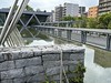

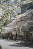


The above images may not be of the site on this page, but were taken nearby. They are loaded from Flickr so please click on them for image credits.
Click here to see more info for this site
Nearby sites
Click here to view sites on an interactive map of the areaKey: Red: member's photo, Blue: 3rd party photo, Yellow: other image, Green: no photo - please go there and take one, Grey: site destroyed
Download sites to:
KML (Google Earth)
GPX (GPS waypoints)
CSV (Garmin/Navman)
CSV (Excel)
To unlock full downloads you need to sign up as a Contributory Member. Otherwise downloads are limited to 50 sites.
Turn off the page maps and other distractions
Nearby sites listing. In the following links * = Image available
3.1km W 266° Hemisphere* Modern Stone Circle etc
5.2km NW 322° Yayoi* Ancient Mine, Quarry or other Industry
11.4km SSW 212° Ōmori Kaizuka* Ancient Village or Settlement
14.0km WSW 256° Gōtoku-ji temple* Modern Stone Circle etc
15.6km SW 229° Sengen Jinja Kofun* NOT SET
16.3km WSW 239° Noge Ōtsuka Kofun* Long Barrow
20.7km WSW 239° Maginu Kofun* Passage Grave
23.4km W 269° Tenmondai-Kōnai Kofun* Passage Grave
27.0km WSW 240° Ichigao Yokoana* Rock Cut Tomb
27.8km WSW 245° Hayano Yokoana* Rock Cut Tomb
30.8km W 269° Musashi-Fuchū Kumano-Jinja Kofun* Passage Grave
33.1km W 262° Inarizuka Kofun* Passage Grave
39.0km NW 309° Sannōzuka Kofun* Passage Grave
40.2km WSW 258° Tabata* Stone Circle
41.4km SSW 213° Shichikokuyama Yokoana* Rock Cut Tomb
42.7km S 169° Shōjigayatsu Yokoana* Rock Cut Tomb
43.8km SW 216° Senbagayatsu Yokoana* Rock Cut Tomb
43.8km S 170° Kinu Yokoana* Rock Cut Tomb
44.1km SSW 207° Zuisen-ji temple* Modern Stone Circle etc
44.2km S 172° Terayatsu Yokoana* Rock Cut Tomb
44.3km SSW 210° Meigetsu-in temple* Modern Stone Circle etc
44.4km SSW 210° Kenchō-ji temple* Modern Stone Circle etc
44.7km SSW 207° Jōmyō-ji temple* Modern Stone Circle etc
45.8km ENE 70° Ryūkakuji Kofungun* Passage Grave
46.6km W 278° Sedo-oka Kofungun* Chambered Cairn
View more nearby sites and additional images


 We would like to know more about this location. Please feel free to add a brief description and any relevant information in your own language.
 Wir möchten mehr über diese Stätte erfahren. Bitte zögern Sie nicht, eine kurze Beschreibung und relevante Informationen in Deutsch hinzuzufügen.
 Nous aimerions en savoir encore un peu sur les lieux. S'il vous plaît n'hesitez pas à ajouter une courte description et tous les renseignements pertinents dans votre propre langue.
 Quisieramos informarnos un poco más de las lugares. No dude en añadir una breve descripción y otros datos relevantes en su propio idioma.