


<< Our Photo Pages >> Uenoyama Kofun (in Yamanashi) - Chambered Cairn in Japan in Honshū
Submitted by Aska on Saturday, 07 April 2018 Page Views: 776
Neolithic and Bronze AgeSite Name: Uenoyama Kofun (in Yamanashi) Alternative Name: 上の山古墳Country: Japan
NOTE: This site is 6.519 km away from the location you searched for.
Region: Honshū Type: Chambered Cairn
Nearest Town: Uenohara (Yamanashi pref.) Nearest Village: Tsurugawa 鶴川
Latitude: 35.633300N Longitude: 139.101530E
Condition:
| 5 | Perfect |
| 4 | Almost Perfect |
| 3 | Reasonable but with some damage |
| 2 | Ruined but still recognisable as an ancient site |
| 1 | Pretty much destroyed, possibly visible as crop marks |
| 0 | No data. |
| -1 | Completely destroyed |
| 5 | Superb |
| 4 | Good |
| 3 | Ordinary |
| 2 | Not Good |
| 1 | Awful |
| 0 | No data. |
| 5 | Can be driven to, probably with disabled access |
| 4 | Short walk on a footpath |
| 3 | Requiring a bit more of a walk |
| 2 | A long walk |
| 1 | In the middle of nowhere, a nightmare to find |
| 0 | No data. |
| 5 | co-ordinates taken by GPS or official recorded co-ordinates |
| 4 | co-ordinates scaled from a detailed map |
| 3 | co-ordinates scaled from a bad map |
| 2 | co-ordinates of the nearest village |
| 1 | co-ordinates of the nearest town |
| 0 | no data |
Internal Links:
External Links:
 (PID:179896)")
In an agricultural field behind a shinto shrine in a staging post town of an ancient highway, Tsurugawa (鶴川), a cairn lies which is covered with the pebbles dug out from the field and a tiny white stone shrine is placed on whose top. This white shrine can be observed from the opposite side, on the highway from Uenohara (上野原) the previous stage town to next Tsurugawa, across a river.
You may be viewing yesterday's version of this page. To see the most up to date information please register for a free account.
Do not use the above information on other web sites or publications without permission of the contributor.
Nearby Images from Flickr
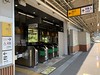
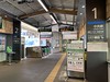
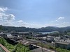
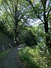
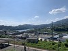
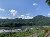
The above images may not be of the site on this page, but were taken nearby. They are loaded from Flickr so please click on them for image credits.
Click here to see more info for this site
Nearby sites
Click here to view sites on an interactive map of the areaKey: Red: member's photo, Blue: 3rd party photo, Yellow: other image, Green: no photo - please go there and take one, Grey: site destroyed
Download sites to:
KML (Google Earth)
GPX (GPS waypoints)
CSV (Garmin/Navman)
CSV (Excel)
To unlock full downloads you need to sign up as a Contributory Member. Otherwise downloads are limited to 50 sites.
Turn off the page maps and other distractions
Nearby sites listing. In the following links * = Image available
12.7km W 263° Oni-no Tsue* Standing Stone (Menhir)
20.0km NNE 22° Gyokudō Bijutsukan art museum* Modern Stone Circle etc
20.6km NE 55° Sedo-oka Kofungun* Chambered Cairn
23.1km W 261° Oni-no Tateishi* Standing Stone (Menhir)
24.0km E 99° Tabata* Stone Circle
26.4km W 277° Seiun-ji temple* Modern Stone Circle etc
30.1km E 89° Inarizuka Kofun* Passage Grave
30.6km SSE 147° Sannomiya-Shimoyato* Stone Circle
31.5km NE 37° Nōnin-ji temple* Modern Stone Circle etc
32.5km E 82° Musashi-Fuchū Kumano-Jinja Kofun* Passage Grave
33.0km S 171° Kanekodai* Stone Circle
35.2km NE 34° Shōden-in temple* Modern Stone Circle etc
37.1km WNW 288° Jōko-ji temple* Modern Stone Circle etc
37.5km SSE 159° Dainichigakubo Yokoana* Rock Cut Tomb
38.3km W 271° Kyōzuka Kofun (in Yamanashi)* Passage Grave
38.3km E 100° Hayano Yokoana* Rock Cut Tomb
38.4km SSE 156° Tarekoyato-nishi Yokoana* Rock Cut Tomb
38.6km SSE 153° Manda Miyanoiri Yokoana* Rock Cut Tomb
39.0km WNW 293° Somaguchi* Standing Stone (Menhir)
39.4km SSE 154° Shōgakubo Yokoana* Rock Cut Tomb
39.5km SSE 163° Haneo Yokoana* Rock Cut Tomb
39.6km SE 137° Koshinoyama Yokoana* Rock Cut Tomb
39.8km E 83° Tenmondai-Kōnai Kofun* Passage Grave
40.5km ESE 102° Ichigao Yokoana* Rock Cut Tomb
40.8km W 279° Eian-ji temple* Modern Stone Circle etc
View more nearby sites and additional images


 We would like to know more about this location. Please feel free to add a brief description and any relevant information in your own language.
 Wir möchten mehr über diese Stätte erfahren. Bitte zögern Sie nicht, eine kurze Beschreibung und relevante Informationen in Deutsch hinzuzufügen.
 Nous aimerions en savoir encore un peu sur les lieux. S'il vous plaît n'hesitez pas à ajouter une courte description et tous les renseignements pertinents dans votre propre langue.
 Quisieramos informarnos un poco más de las lugares. No dude en añadir una breve descripción y otros datos relevantes en su propio idioma.