 with our Megalithic Portal iPhone app")


<< Our Photo Pages >> Kanekodai - Stone Circle in Japan in Honshū
Submitted by Aska on Tuesday, 25 August 2009 Page Views: 3564
Neolithic and Bronze AgeSite Name: Kanekodai Alternative Name: 金子台Country: Japan
NOTE: This site is 2.223 km away from the location you searched for.
Region: Honshū Type: Stone Circle
Nearest Town: Ōi-machi (Kanagawa pref.) Nearest Village: Yamada 山田
Latitude: 35.339760N Longitude: 139.156130E
Condition:
| 5 | Perfect |
| 4 | Almost Perfect |
| 3 | Reasonable but with some damage |
| 2 | Ruined but still recognisable as an ancient site |
| 1 | Pretty much destroyed, possibly visible as crop marks |
| 0 | No data. |
| -1 | Completely destroyed |
| 5 | Superb |
| 4 | Good |
| 3 | Ordinary |
| 2 | Not Good |
| 1 | Awful |
| 0 | No data. |
| 5 | Can be driven to, probably with disabled access |
| 4 | Short walk on a footpath |
| 3 | Requiring a bit more of a walk |
| 2 | A long walk |
| 1 | In the middle of nowhere, a nightmare to find |
| 0 | No data. |
| 5 | co-ordinates taken by GPS or official recorded co-ordinates |
| 4 | co-ordinates scaled from a detailed map |
| 3 | co-ordinates scaled from a bad map |
| 2 | co-ordinates of the nearest village |
| 1 | co-ordinates of the nearest town |
| 0 | no data |
Internal Links:
External Links:
")
In the site of head office of Daiichi Seimei (第一生命) insurance company on a rustic hill 50 km away from Tokyo, this stone setting was found. Not in a circle shape, the locals call it 'Stōn sākuru' (stone circle).
You may be viewing yesterday's version of this page. To see the most up to date information please register for a free account.
")
Do not use the above information on other web sites or publications without permission of the contributor.
Nearby Images from Flickr
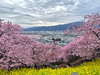


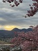


The above images may not be of the site on this page, but were taken nearby. They are loaded from Flickr so please click on them for image credits.
Click here to see more info for this site
Nearby sites
Click here to view sites on an interactive map of the areaKey: Red: member's photo, Blue: 3rd party photo, Yellow: other image, Green: no photo - please go there and take one, Grey: site destroyed
Download sites to:
KML (Google Earth)
GPX (GPS waypoints)
CSV (Garmin/Navman)
CSV (Excel)
To unlock full downloads you need to sign up as a Contributory Member. Otherwise downloads are limited to 50 sites.
Turn off the page maps and other distractions
Nearby sites listing. In the following links * = Image available
8.3km SE 129° Haneo Yokoana* Rock Cut Tomb
8.8km ESE 106° Dainichigakubo Yokoana* Rock Cut Tomb
10.7km ESE 104° Tarekoyato-nishi Yokoana* Rock Cut Tomb
12.4km ESE 104° Shōgakubo Yokoana* Rock Cut Tomb
12.9km E 98° Manda Miyanoiri Yokoana* Rock Cut Tomb
13.1km SSW 201° Sōun-ji temple* Modern Stone Circle etc
13.5km ENE 59° Sannomiya-Shimoyato* Stone Circle
22.5km E 80° Koshinoyama Yokoana* Rock Cut Tomb
32.5km SSW 213° Yōtoku-ji temple* Standing Stones
32.8km E 86° Senbagayatsu Yokoana* Rock Cut Tomb
33.0km N 351° Uenoyama Kofun (in Yamanashi)* Chambered Cairn
33.7km SSW 212° Kashiya-no Hyakketsu* Rock Cut Tomb
33.9km SW 232° Shimizu Yanagikita Kofun* Passage Grave
34.6km NNE 33° Tabata* Stone Circle
35.5km E 85° Shichikokuyama Yokoana* Rock Cut Tomb
35.6km NNW 331° Oni-no Tsue* Standing Stone (Menhir)
35.9km E 91° Meigetsu-in temple* Modern Stone Circle etc
36.2km E 91° Kenchō-ji temple* Modern Stone Circle etc
36.4km E 96° Kōmyō-ji temple (in Kamakura)* Modern Stone Circle etc
37.4km SW 224° Tama-Toishi* Polissoir
37.7km E 93° Jōmyō-ji temple* Modern Stone Circle etc
38.0km E 92° Zuisen-ji temple* Modern Stone Circle etc
38.6km SW 222° JA Nansun* Modern Stone Circle etc
40.3km NW 316° Oni-no Tateishi* Standing Stone (Menhir)
41.7km NE 37° Inarizuka Kofun* Passage Grave
View more nearby sites and additional images


 We would like to know more about this location. Please feel free to add a brief description and any relevant information in your own language.
 Wir möchten mehr über diese Stätte erfahren. Bitte zögern Sie nicht, eine kurze Beschreibung und relevante Informationen in Deutsch hinzuzufügen.
 Nous aimerions en savoir encore un peu sur les lieux. S'il vous plaît n'hesitez pas à ajouter une courte description et tous les renseignements pertinents dans votre propre langue.
 Quisieramos informarnos un poco más de las lugares. No dude en añadir una breve descripción y otros datos relevantes en su propio idioma.