


<< Our Photo Pages >> Seiken-ji temple - Modern Stone Circle etc in Japan in Honshū
Submitted by Aska on Sunday, 02 February 2020 Page Views: 378
Modern SitesSite Name: Seiken-ji temple Alternative Name: 清見寺Country: Japan
NOTE: This site is 4.455 km away from the location you searched for.
Region: Honshū Type: Modern Stone Circle etc
Nearest Town: Shizuoka (Shizuoka prefecture) Nearest Village: OkitsuSeikenjichō 興津
Latitude: 35.047960N Longitude: 138.513020E
Condition:
| 5 | Perfect |
| 4 | Almost Perfect |
| 3 | Reasonable but with some damage |
| 2 | Ruined but still recognisable as an ancient site |
| 1 | Pretty much destroyed, possibly visible as crop marks |
| 0 | No data. |
| -1 | Completely destroyed |
| 5 | Superb |
| 4 | Good |
| 3 | Ordinary |
| 2 | Not Good |
| 1 | Awful |
| 0 | No data. |
| 5 | Can be driven to, probably with disabled access |
| 4 | Short walk on a footpath |
| 3 | Requiring a bit more of a walk |
| 2 | A long walk |
| 1 | In the middle of nowhere, a nightmare to find |
| 0 | No data. |
| 5 | co-ordinates taken by GPS or official recorded co-ordinates |
| 4 | co-ordinates scaled from a detailed map |
| 3 | co-ordinates scaled from a bad map |
| 2 | co-ordinates of the nearest village |
| 1 | co-ordinates of the nearest town |
| 0 | no data |
Internal Links:
External Links:
")
A temple at the narrow foot of a hill has a fine pond garden with stones in its backyard. Once the sea shore was close to the temple and the temple has a huge watchtower but now the reclaimed industrial area in front of the temple disturbs the marine view.
Open 8:30-16:00, admission 300 Japanese Yen (2024 price).
Official site in Japanese
You may be viewing yesterday's version of this page. To see the most up to date information please register for a free account.
Do not use the above information on other web sites or publications without permission of the contributor.
Nearby Images from Flickr
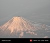
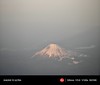


The above images may not be of the site on this page, but were taken nearby. They are loaded from Flickr so please click on them for image credits.
Click here to see more info for this site
Nearby sites
Click here to view sites on an interactive map of the areaKey: Red: member's photo, Blue: 3rd party photo, Yellow: other image, Green: no photo - please go there and take one, Grey: site destroyed
Download sites to:
KML (Google Earth)
GPX (GPS waypoints)
CSV (Garmin/Navman)
CSV (Excel)
To unlock full downloads you need to sign up as a Contributory Member. Otherwise downloads are limited to 50 sites.
Turn off the page maps and other distractions
Nearby sites listing. In the following links * = Image available
13.9km WSW 244° Rinsai-ji temple* Modern Stone Circle etc
14.0km SW 223° Toro Iseki* Ancient Village or Settlement
19.3km WSW 238° Saioku-ji temple* Modern Stone Circle etc
23.6km ENE 66° Kōshinzuka Kofun* Passage Grave
27.5km N 11° Sengo* Stone Circle
32.7km E 83° JA Nansun* Modern Stone Circle etc
32.9km E 80° Tama-Toishi* Polissoir
33.8km ENE 70° Shimizu Yanagikita Kofun* Passage Grave
40.9km E 84° Kashiya-no Hyakketsu* Rock Cut Tomb
41.2km E 83° Yōtoku-ji temple* Standing Stones
43.9km ESE 102° KamiShiroiwa* Stone Circle
47.8km SSE 148° Iwakura Kofungun* Chambered Cairn
48.1km SW 223° Koumare-ishi* Natural Stone / Erratic / Other Natural Feature
57.4km ENE 69° Sōun-ji temple* Modern Stone Circle etc
59.2km N 4° Ōzuka Kofun (in Yamanashi)* Long Barrow
65.6km WSW 255° Terayama Kofungun* Chambered Cairn
66.8km ENE 61° Kanekodai* Stone Circle
67.4km NNE 13° Kyōzuka Kofun (in Yamanashi)* Passage Grave
68.2km WSW 237° Iō-ji temple* Modern Stone Circle etc
68.7km NNE 26° Oni-no Tateishi* Standing Stone (Menhir)
69.3km N 7° Yokone Sakurai Kofungun* Chambered Cairn
69.3km N 6° Tōkō-ji temple* Modern Stone Circle etc
69.6km WSW 251° Nekata cave* Cave or Rock Shelter
70.4km ENE 67° Haneo Yokoana* Rock Cut Tomb
70.6km N 3° Yumurayama Kofungun* Chambered Cairn
View more nearby sites and additional images


 We would like to know more about this location. Please feel free to add a brief description and any relevant information in your own language.
 Wir möchten mehr über diese Stätte erfahren. Bitte zögern Sie nicht, eine kurze Beschreibung und relevante Informationen in Deutsch hinzuzufügen.
 Nous aimerions en savoir encore un peu sur les lieux. S'il vous plaît n'hesitez pas à ajouter une courte description et tous les renseignements pertinents dans votre propre langue.
 Quisieramos informarnos un poco más de las lugares. No dude en añadir una breve descripción y otros datos relevantes en su propio idioma.