


<< Our Photo Pages >> Kinsei - Stone Circle in Japan in Honshū
Submitted by Aska on Wednesday, 06 February 2008 Page Views: 3448
Neolithic and Bronze AgeSite Name: Kinsei Alternative Name: 金生Country: Japan
NOTE: This site is 9.151 km away from the location you searched for.
Region: Honshū Type: Stone Circle
Nearest Town: Hokuto (Yamanashi pref.) Nearest Village: Ōizumichō-Yato 大泉
Latitude: 35.848270N Longitude: 138.385023E
Condition:
| 5 | Perfect |
| 4 | Almost Perfect |
| 3 | Reasonable but with some damage |
| 2 | Ruined but still recognisable as an ancient site |
| 1 | Pretty much destroyed, possibly visible as crop marks |
| 0 | No data. |
| -1 | Completely destroyed |
| 5 | Superb |
| 4 | Good |
| 3 | Ordinary |
| 2 | Not Good |
| 1 | Awful |
| 0 | No data. |
| 5 | Can be driven to, probably with disabled access |
| 4 | Short walk on a footpath |
| 3 | Requiring a bit more of a walk |
| 2 | A long walk |
| 1 | In the middle of nowhere, a nightmare to find |
| 0 | No data. |
| 5 | co-ordinates taken by GPS or official recorded co-ordinates |
| 4 | co-ordinates scaled from a detailed map |
| 3 | co-ordinates scaled from a bad map |
| 2 | co-ordinates of the nearest village |
| 1 | co-ordinates of the nearest town |
| 0 | no data |
Internal Links:
External Links:
")
This site is stone-settings rather circles. Some small menhirs, stone phallus, bones and traces of housing were discovered.
You may be viewing yesterday's version of this page. To see the most up to date information please register for a free account.
Do not use the above information on other web sites or publications without permission of the contributor.
Nearby Images from Flickr


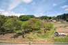
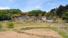
The above images may not be of the site on this page, but were taken nearby. They are loaded from Flickr so please click on them for image credits.
Click here to see more info for this site
Nearby sites
Click here to view sites on an interactive map of the areaKey: Red: member's photo, Blue: 3rd party photo, Yellow: other image, Green: no photo - please go there and take one, Grey: site destroyed
Download sites to:
KML (Google Earth)
GPX (GPS waypoints)
CSV (Garmin/Navman)
CSV (Excel)
To unlock full downloads you need to sign up as a Contributory Member. Otherwise downloads are limited to 50 sites.
Turn off the page maps and other distractions
Nearby sites listing. In the following links * = Image available
5.8km SSW 208° Mumei-no Daisekitō* Modern Stone Circle etc
10.3km WNW 289° Mukōhara* Stone Circle
14.3km NW 309° Tsubodaira* Burial Chamber or Dolmen
19.1km SSE 154° Myōzen-ji temple* Modern Stone Circle etc
22.6km SE 139° Otengusan Kofun* Chambered Cairn
22.9km NW 323° Togariishi* Ancient Village or Settlement
23.4km SE 141° Ōhira Kofungun* Chambered Cairn
24.0km SE 140° Yumurayama Kofungun* Chambered Cairn
25.6km W 269° Onshō-ji temple* Modern Stone Circle etc
27.1km SE 137° Tōkō-ji temple* Modern Stone Circle etc
28.7km SE 135° Yokone Sakurai Kofungun* Chambered Cairn
30.0km ESE 107° Somaguchi* Standing Stone (Menhir)
30.2km SE 126° Eian-ji temple* Modern Stone Circle etc
31.9km ESE 113° Jōko-ji temple* Modern Stone Circle etc
33.6km SSE 153° Ōzuka Kofun (in Yamanashi)* Long Barrow
35.2km SE 131° Kyōzuka Kofun (in Yamanashi)* Passage Grave
36.1km NNE 13° Kitazawa* Standing Stone (Menhir)
37.8km NW 314° Manji-no Sekibutsu* Sculptured Stone
40.6km W 281° Ina Baien plum orchard* Modern Stone Circle etc
43.7km ESE 118° Seiun-ji temple* Modern Stone Circle etc
46.6km NW 308° Shiojiri Honjin* Modern Stone Circle etc
50.1km ESE 123° Oni-no Tateishi* Standing Stone (Menhir)
54.8km NNE 17° Mozawa Minami-Ishidō* Stone Circle
55.0km NW 321° Harizuka Kofun* Chambered Cairn
58.0km ESE 116° Oni-no Tsue* Standing Stone (Menhir)
View more nearby sites and additional images


 We would like to know more about this location. Please feel free to add a brief description and any relevant information in your own language.
 Wir möchten mehr über diese Stätte erfahren. Bitte zögern Sie nicht, eine kurze Beschreibung und relevante Informationen in Deutsch hinzuzufügen.
 Nous aimerions en savoir encore un peu sur les lieux. S'il vous plaît n'hesitez pas à ajouter une courte description et tous les renseignements pertinents dans votre propre langue.
 Quisieramos informarnos un poco más de las lugares. No dude en añadir una breve descripción y otros datos relevantes en su propio idioma.