


<< Our Photo Pages >> Tsubodaira - Burial Chamber or Dolmen in Japan in Honshū
Submitted by Aska on Sunday, 24 February 2008 Page Views: 3841
Neolithic and Bronze AgeSite Name: Tsubodaira Alternative Name: 坪平遺跡, ドルメン類似遺跡 Dorumen Ruiji IsekiCountry: Japan Region: Honshū Type: Burial Chamber or Dolmen
Nearest Town: Fujimi-machi (Nagano pref.) Nearest Village: Tatsuzawa 立沢
Latitude: 35.930000N Longitude: 138.262327E
Condition:
| 5 | Perfect |
| 4 | Almost Perfect |
| 3 | Reasonable but with some damage |
| 2 | Ruined but still recognisable as an ancient site |
| 1 | Pretty much destroyed, possibly visible as crop marks |
| 0 | No data. |
| -1 | Completely destroyed |
| 5 | Superb |
| 4 | Good |
| 3 | Ordinary |
| 2 | Not Good |
| 1 | Awful |
| 0 | No data. |
| 5 | Can be driven to, probably with disabled access |
| 4 | Short walk on a footpath |
| 3 | Requiring a bit more of a walk |
| 2 | A long walk |
| 1 | In the middle of nowhere, a nightmare to find |
| 0 | No data. |
| 5 | co-ordinates taken by GPS or official recorded co-ordinates |
| 4 | co-ordinates scaled from a detailed map |
| 3 | co-ordinates scaled from a bad map |
| 2 | co-ordinates of the nearest village |
| 1 | co-ordinates of the nearest town |
| 0 | no data |
Internal Links:
External Links:
")
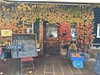
Burial cists with cap stones. Although not related to the Korean-origin dolmen in Kyūshū island far away, a dolmen-mania archaeologist Dr. Ryūzō Torii, made his own tombstone in a dolmen-shape, and named this site "Dorumen Ruiji Iseki (=dolmen-like ruin).
You may be viewing yesterday's version of this page. To see the most up to date information please register for a free account.
Do not use the above information on other web sites or publications without permission of the contributor.
Nearby Images from Flickr
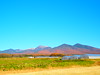
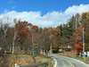
The above images may not be of the site on this page, but were taken nearby. They are loaded from Flickr so please click on them for image credits.
Click here to see more info for this site
Nearby sites
Click here to view sites on an interactive map of the areaKey: Red: member's photo, Blue: 3rd party photo, Yellow: other image, Green: no photo - please go there and take one, Grey: site destroyed
Download sites to:
KML (Google Earth)
GPX (GPS waypoints)
CSV (Garmin/Navman)
CSV (Excel)
To unlock full downloads you need to sign up as a Contributory Member. Otherwise downloads are limited to 50 sites.
Turn off the page maps and other distractions
Nearby sites listing. In the following links * = Image available
5.9km SSE 167° Mukōhara* Stone Circle
9.6km NNW 344° Togariishi* Ancient Village or Settlement
14.3km SE 129° Kinsei* Stone Circle
16.5km SSE 150° Mumei-no Daisekitō* Modern Stone Circle etc
17.3km WSW 237° Onshō-ji temple* Modern Stone Circle etc
23.5km NW 316° Manji-no Sekibutsu* Sculptured Stone
28.9km W 267° Ina Baien plum orchard* Modern Stone Circle etc
32.3km NW 307° Shiojiri Honjin* Modern Stone Circle etc
32.4km NE 36° Kitazawa* Standing Stone (Menhir)
32.7km SE 144° Myōzen-ji temple* Modern Stone Circle etc
36.8km SE 135° Otengusan Kofun* Chambered Cairn
37.5km SE 136° Ōhira Kofungun* Chambered Cairn
38.2km SE 136° Yumurayama Kofungun* Chambered Cairn
41.1km NW 325° Harizuka Kofun* Chambered Cairn
41.4km SE 135° Tōkō-ji temple* Modern Stone Circle etc
42.9km SE 133° Yokone Sakurai Kofungun* Chambered Cairn
43.5km ESE 114° Somaguchi* Standing Stone (Menhir)
44.5km SE 127° Eian-ji temple* Modern Stone Circle etc
45.8km ESE 118° Jōko-ji temple* Modern Stone Circle etc
47.0km SE 146° Ōzuka Kofun (in Yamanashi)* Long Barrow
49.5km SE 131° Kyōzuka Kofun (in Yamanashi)* Passage Grave
51.0km NNE 32° Mozawa Minami-Ishidō* Stone Circle
51.7km NW 321° Honmura-no-Jindaimoji-hi* Carving
52.9km N 351° Jingū-ji Kofun* Passage Grave
57.8km ESE 121° Seiun-ji temple* Modern Stone Circle etc
View more nearby sites and additional images


 We would like to know more about this location. Please feel free to add a brief description and any relevant information in your own language.
 Wir möchten mehr über diese Stätte erfahren. Bitte zögern Sie nicht, eine kurze Beschreibung und relevante Informationen in Deutsch hinzuzufügen.
 Nous aimerions en savoir encore un peu sur les lieux. S'il vous plaît n'hesitez pas à ajouter une courte description et tous les renseignements pertinents dans votre propre langue.
 Quisieramos informarnos un poco más de las lugares. No dude en añadir una breve descripción y otros datos relevantes en su propio idioma.