


<< Our Photo Pages >> Sengo - Stone Circle in Japan in Honshū
Submitted by Aska on Wednesday, 06 February 2008 Page Views: 4930
Neolithic and Bronze AgeSite Name: Sengo Alternative Name: 千居Country: Japan
NOTE: This site is 14.899 km away from the location you searched for.
Region: Honshū Type: Stone Circle
Nearest Town: Fujinomiya (Shizuoka pref.) Nearest Village: Kamijō 上条
Latitude: 35.291076N Longitude: 138.568278E
Condition:
| 5 | Perfect |
| 4 | Almost Perfect |
| 3 | Reasonable but with some damage |
| 2 | Ruined but still recognisable as an ancient site |
| 1 | Pretty much destroyed, possibly visible as crop marks |
| 0 | No data. |
| -1 | Completely destroyed |
| 5 | Superb |
| 4 | Good |
| 3 | Ordinary |
| 2 | Not Good |
| 1 | Awful |
| 0 | No data. |
| 5 | Can be driven to, probably with disabled access |
| 4 | Short walk on a footpath |
| 3 | Requiring a bit more of a walk |
| 2 | A long walk |
| 1 | In the middle of nowhere, a nightmare to find |
| 0 | No data. |
| 5 | co-ordinates taken by GPS or official recorded co-ordinates |
| 4 | co-ordinates scaled from a detailed map |
| 3 | co-ordinates scaled from a bad map |
| 2 | co-ordinates of the nearest village |
| 1 | co-ordinates of the nearest town |
| 0 | no data |
Internal Links:
External Links:
")
Great stone sttings consists of small stones. From this site, Mt.Fuji can be seen wonderfully, so this site is supposed to be a ritual place of the Fuji worship.
You may be viewing yesterday's version of this page. To see the most up to date information please register for a free account.
")
Do not use the above information on other web sites or publications without permission of the contributor.
Nearby Images from Flickr
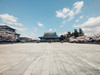
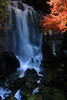
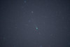
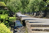
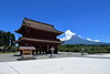
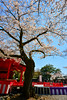
The above images may not be of the site on this page, but were taken nearby. They are loaded from Flickr so please click on them for image credits.
Click here to see more info for this site
Nearby sites
Click here to view sites on an interactive map of the areaKey: Red: member's photo, Blue: 3rd party photo, Yellow: other image, Green: no photo - please go there and take one, Grey: site destroyed
Download sites to:
KML (Google Earth)
GPX (GPS waypoints)
CSV (Garmin/Navman)
CSV (Excel)
To unlock full downloads you need to sign up as a Contributory Member. Otherwise downloads are limited to 50 sites.
Turn off the page maps and other distractions
Nearby sites listing. In the following links * = Image available
23.9km SE 136° Kōshinzuka Kofun* Passage Grave
27.5km S 191° Seiken-ji temple* Modern Stone Circle etc
30.7km ESE 120° Shimizu Yanagikita Kofun* Passage Grave
32.1km N 358° Ōzuka Kofun (in Yamanashi)* Long Barrow
34.6km SE 128° Tama-Toishi* Polissoir
35.8km SE 130° JA Nansun* Modern Stone Circle etc
37.5km SSW 208° Rinsai-ji temple* Modern Stone Circle etc
39.9km NNE 14° Kyōzuka Kofun (in Yamanashi)* Passage Grave
40.0km SSW 201° Toro Iseki* Ancient Village or Settlement
41.9km N 5° Yokone Sakurai Kofungun* Chambered Cairn
42.0km ESE 121° Yōtoku-ji temple* Standing Stones
42.0km N 2° Tōkō-ji temple* Modern Stone Circle etc
42.5km ESE 123° Kashiya-no Hyakketsu* Rock Cut Tomb
42.9km NE 36° Oni-no Tateishi* Standing Stone (Menhir)
43.0km SSW 210° Saioku-ji temple* Modern Stone Circle etc
43.5km N 358° Yumurayama Kofungun* Chambered Cairn
43.9km N 358° Ōhira Kofungun* Chambered Cairn
44.9km N 10° Eian-ji temple* Modern Stone Circle etc
44.9km N 358° Otengusan Kofun* Chambered Cairn
45.5km N 349° Myōzen-ji temple* Modern Stone Circle etc
46.6km NNE 28° Seiun-ji temple* Modern Stone Circle etc
49.1km E 98° Sōun-ji temple* Modern Stone Circle etc
51.0km NE 44° Oni-no Tsue* Standing Stone (Menhir)
51.3km NNE 15° Jōko-ji temple* Modern Stone Circle etc
52.5km SE 134° KamiShiroiwa* Stone Circle
View more nearby sites and additional images


 We would like to know more about this location. Please feel free to add a brief description and any relevant information in your own language.
 Wir möchten mehr über diese Stätte erfahren. Bitte zögern Sie nicht, eine kurze Beschreibung und relevante Informationen in Deutsch hinzuzufügen.
 Nous aimerions en savoir encore un peu sur les lieux. S'il vous plaît n'hesitez pas à ajouter une courte description et tous les renseignements pertinents dans votre propre langue.
 Quisieramos informarnos un poco más de las lugares. No dude en añadir una breve descripción y otros datos relevantes en su propio idioma.