


<< Our Photo Pages >> Hayashiguro Kofun - Passage Grave in Japan in Honshū
Submitted by Aska on Thursday, 25 August 2011 Page Views: 2912
Iron Age and Later PrehistorySite Name: Hayashiguro Kofun Alternative Name: 林畔古墳Country: Japan
NOTE: This site is 12.878 km away from the location you searched for.
Region: Honshū Type: Passage Grave
Nearest Town: Nakano (Nagano pref.) Nearest Village: Tamugi 田麦
Latitude: 36.764990N Longitude: 138.345920E
Condition:
| 5 | Perfect |
| 4 | Almost Perfect |
| 3 | Reasonable but with some damage |
| 2 | Ruined but still recognisable as an ancient site |
| 1 | Pretty much destroyed, possibly visible as crop marks |
| 0 | No data. |
| -1 | Completely destroyed |
| 5 | Superb |
| 4 | Good |
| 3 | Ordinary |
| 2 | Not Good |
| 1 | Awful |
| 0 | No data. |
| 5 | Can be driven to, probably with disabled access |
| 4 | Short walk on a footpath |
| 3 | Requiring a bit more of a walk |
| 2 | A long walk |
| 1 | In the middle of nowhere, a nightmare to find |
| 0 | No data. |
| 5 | co-ordinates taken by GPS or official recorded co-ordinates |
| 4 | co-ordinates scaled from a detailed map |
| 3 | co-ordinates scaled from a bad map |
| 2 | co-ordinates of the nearest village |
| 1 | co-ordinates of the nearest town |
| 0 | no data |
Internal Links:
External Links:
")
It is said that the chamber of no.1 was gable-roofed and vermilioned inside but is difficult to confirm now.
You may be viewing yesterday's version of this page. To see the most up to date information please register for a free account.
Do not use the above information on other web sites or publications without permission of the contributor.
Nearby Images from Flickr
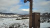
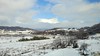
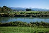

The above images may not be of the site on this page, but were taken nearby. They are loaded from Flickr so please click on them for image credits.
Click here to see more info for this site
Nearby sites
Click here to view sites on an interactive map of the areaKey: Red: member's photo, Blue: 3rd party photo, Yellow: other image, Green: no photo - please go there and take one, Grey: site destroyed
Download sites to:
KML (Google Earth)
GPX (GPS waypoints)
CSV (Garmin/Navman)
CSV (Excel)
To unlock full downloads you need to sign up as a Contributory Member. Otherwise downloads are limited to 50 sites.
Turn off the page maps and other distractions
Nearby sites listing. In the following links * = Image available
4.8km SSE 159° Kingaizan Kofun* Chambered Cairn
7.5km S 187° Ganshōin Kofungun* Chambered Cairn
8.5km S 191° Tonobayashi Kofungun* Chambered Cairn
9.2km S 189° Sotofudō Kofungun* Chambered Cairn
9.3km SSW 198° Rokusendō Nishioki Kofungun* Chambered Cairn
9.4km SSW 192° Tambazuka Kofun* Chambered Cairn
9.5km S 189° Kuchimyōzuka Kofungun* Chambered Cairn
10.6km S 185° Sakaizuka Kofun* Chambered Cairn
11.0km NNE 26° Nezuka Iseki* Chambered Cairn
11.3km S 188° Urushizuka Kofungun* Chambered Cairn
11.5km S 190° GyōninZuka Kofun* Chambered Cairn
11.5km NNE 28° Asahi Gōro Kofun* Chambered Cairn
11.6km NNE 31° Oni-no Kama Kofun* Chambered Cairn
11.7km SW 235° Yoshi Kofungun* Passage Grave
13.0km NNE 29° Waguri Kofun* Passage Grave
13.1km S 188° Ōboshi Kofungun* Chambered Cairn
13.1km S 187° Ōgi-no-Iri Kofungun* Chambered Cairn
14.9km SSW 198° Tenjin Kofungun* Chambered Cairn
14.9km SSW 197° Jūsanzuka Kofun* Chambered Cairn
15.0km SSW 198° Yonamochi Tenjin Kofun* Chambered Cairn
15.0km SSW 197° Nobe Tenjin Kofungun* Chambered Cairn
15.4km SSW 195° Daimyōjin Kofungun* Chambered Cairn
15.5km SSW 192° Amazuka Kofungun* Chambered Cairn
15.8km S 187° Hatchō Yoroizuka Kofun* Chambered Cairn
18.4km SSW 207° Kitano Museum of Art* Modern Stone Circle etc
View more nearby sites and additional images


 We would like to know more about this location. Please feel free to add a brief description and any relevant information in your own language.
 Wir möchten mehr über diese Stätte erfahren. Bitte zögern Sie nicht, eine kurze Beschreibung und relevante Informationen in Deutsch hinzuzufügen.
 Nous aimerions en savoir encore un peu sur les lieux. S'il vous plaît n'hesitez pas à ajouter une courte description et tous les renseignements pertinents dans votre propre langue.
 Quisieramos informarnos un poco más de las lugares. No dude en añadir una breve descripción y otros datos relevantes en su propio idioma.