 with our Megalithic Portal iPhone app")


<< Our Photo Pages >> Kaitō - Stone Circle in Japan in Honshū
Submitted by Aska on Thursday, 07 February 2008 Page Views: 4004
Neolithic and Bronze AgeSite Name: Kaitō Alternative Name: 垣内 Kaito, Mitsuiwa 三ツ岩Country: Japan
NOTE: This site is 2.681 km away from the location you searched for.
Region: Honshū Type: Stone Circle
Nearest Town: Takayama (Gifu pref.) Nearest Village: Uwano-machi 上野町
Latitude: 36.167554N Longitude: 137.270823E
Condition:
| 5 | Perfect |
| 4 | Almost Perfect |
| 3 | Reasonable but with some damage |
| 2 | Ruined but still recognisable as an ancient site |
| 1 | Pretty much destroyed, possibly visible as crop marks |
| 0 | No data. |
| -1 | Completely destroyed |
| 5 | Superb |
| 4 | Good |
| 3 | Ordinary |
| 2 | Not Good |
| 1 | Awful |
| 0 | No data. |
| 5 | Can be driven to, probably with disabled access |
| 4 | Short walk on a footpath |
| 3 | Requiring a bit more of a walk |
| 2 | A long walk |
| 1 | In the middle of nowhere, a nightmare to find |
| 0 | No data. |
| 5 | co-ordinates taken by GPS or official recorded co-ordinates |
| 4 | co-ordinates scaled from a detailed map |
| 3 | co-ordinates scaled from a bad map |
| 2 | co-ordinates of the nearest village |
| 1 | co-ordinates of the nearest town |
| 0 | no data |
Internal Links:
External Links:
")
3 stones of stone circle originally consisted of 7 stones remain. The alternate name "Mitsuiwa" means 3 boulders.
You may be viewing yesterday's version of this page. To see the most up to date information please register for a free account.
Do not use the above information on other web sites or publications without permission of the contributor.
Nearby Images from Flickr
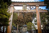
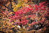
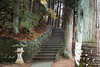
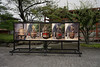

The above images may not be of the site on this page, but were taken nearby. They are loaded from Flickr so please click on them for image credits.
Click here to see more info for this site
Nearby sites
Click here to view sites on an interactive map of the areaKey: Red: member's photo, Blue: 3rd party photo, Yellow: other image, Green: no photo - please go there and take one, Grey: site destroyed
Download sites to:
KML (Google Earth)
GPX (GPS waypoints)
CSV (Garmin/Navman)
CSV (Excel)
To unlock full downloads you need to sign up as a Contributory Member. Otherwise downloads are limited to 50 sites.
Turn off the page maps and other distractions
Nearby sites listing. In the following links * = Image available
7.1km NNW 330° Hieda Jinja shrine* Standing Stones
15.1km NNE 12° Tateishi Iseki Kuromurehi* Standing Stone (Menhir)
18.0km N 11° Ema Family House Garden* Modern Stone Circle etc
50.4km SW 218° Tō Clan Residence Garden* Modern Stone Circle etc
58.2km ENE 76° Honmura-no-Jindaimoji-hi* Carving
62.1km NE 51° Wappara* Stone Circle
63.6km E 96° Shiojiri Honjin* Modern Stone Circle etc
64.6km NE 51° Shingō Kofungun* Chambered Cairn
64.6km SE 144° Kōzen-ji temple (in Nagano)* Modern Stone Circle etc
64.6km SE 144° Jōshō-ji temple* Modern Stone Circle etc
65.9km E 83° Harizuka Kofun* Chambered Cairn
66.5km ESE 115° Ina Baien plum orchard* Modern Stone Circle etc
67.2km WSW 258° ex-Genshō-in temple* Modern Stone Circle etc
67.9km NNW 328° Sakura-machi* Timber Circle
68.2km NW 309° Tentoku-in temple (in Kanazawa)* Modern Stone Circle etc
73.5km E 97° Manji-no Sekibutsu* Sculptured Stone
73.6km NW 305° Okyōzuka* Ancient Village or Settlement
73.6km NW 306° Chikamori* Timber Circle
75.2km NNW 342° Kokutai-ji temple* Modern Stone Circle etc
75.9km ENE 65° Kanorizuka Kofun* Chambered Cairn
76.1km S 175° Mitabi* Standing Stone (Menhir)
76.2km S 176° Kawai* Standing Stones
76.8km S 174° Himeguri* Standing Stones
77.1km ENE 66° Oisawa Kofungun* Chambered Cairn
77.5km SSW 198° Shōgen-ji Temple* Modern Stone Circle etc
View more nearby sites and additional images


 We would like to know more about this location. Please feel free to add a brief description and any relevant information in your own language.
 Wir möchten mehr über diese Stätte erfahren. Bitte zögern Sie nicht, eine kurze Beschreibung und relevante Informationen in Deutsch hinzuzufügen.
 Nous aimerions en savoir encore un peu sur les lieux. S'il vous plaît n'hesitez pas à ajouter une courte description et tous les renseignements pertinents dans votre propre langue.
 Quisieramos informarnos un poco más de las lugares. No dude en añadir una breve descripción y otros datos relevantes en su propio idioma.