


<< Our Photo Pages >> Kezō-ji temple - Modern Stone Circle etc in Japan in Honshū
Submitted by Aska on Sunday, 02 February 2020 Page Views: 478
Modern SitesSite Name: Kezō-ji temple Alternative Name: 華蔵寺 Kezo-jiCountry: Japan
NOTE: This site is 12.383 km away from the location you searched for.
Region: Honshū Type: Modern Stone Circle etc
Nearest Town: Nishio (Aichi prefecture) Nearest Village: KirachōOkayama 吉良
Latitude: 34.843030N Longitude: 137.081500E
Condition:
| 5 | Perfect |
| 4 | Almost Perfect |
| 3 | Reasonable but with some damage |
| 2 | Ruined but still recognisable as an ancient site |
| 1 | Pretty much destroyed, possibly visible as crop marks |
| 0 | No data. |
| -1 | Completely destroyed |
| 5 | Superb |
| 4 | Good |
| 3 | Ordinary |
| 2 | Not Good |
| 1 | Awful |
| 0 | No data. |
| 5 | Can be driven to, probably with disabled access |
| 4 | Short walk on a footpath |
| 3 | Requiring a bit more of a walk |
| 2 | A long walk |
| 1 | In the middle of nowhere, a nightmare to find |
| 0 | No data. |
| 5 | co-ordinates taken by GPS or official recorded co-ordinates |
| 4 | co-ordinates scaled from a detailed map |
| 3 | co-ordinates scaled from a bad map |
| 2 | co-ordinates of the nearest village |
| 1 | co-ordinates of the nearest town |
| 0 | no data |
Internal Links:
External Links:
")
A temple which contains the tomb of the model of the villain in popular Japanese vengeance story “Chūshingura” also has a compact dry landscape garden. Actually the villain model Kōzuke-no-suke KIRA (1641-) seemed to be a sensible land lord for the Kira villagers.
You may be viewing yesterday's version of this page. To see the most up to date information please register for a free account.
")
Do not use the above information on other web sites or publications without permission of the contributor.
Nearby Images from Flickr
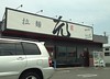
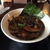
The above images may not be of the site on this page, but were taken nearby. They are loaded from Flickr so please click on them for image credits.
Click here to see more info for this site
Nearby sites
Click here to view sites on an interactive map of the areaKey: Red: member's photo, Blue: 3rd party photo, Yellow: other image, Green: no photo - please go there and take one, Grey: site destroyed
Download sites to:
KML (Google Earth)
GPX (GPS waypoints)
CSV (Garmin/Navman)
CSV (Excel)
To unlock full downloads you need to sign up as a Contributory Member. Otherwise downloads are limited to 50 sites.
Turn off the page maps and other distractions
Nearby sites listing. In the following links * = Image available
9.7km N 8° Futago Kofun (in Aichi)* Long Barrow
31.3km E 86° Jōyama Kofungun* Chambered Cairn
32.9km NNW 327° Nagoya Port replica Moai* Modern Stone Circle etc
34.3km E 86° Hatagashirayama One Kofungun* Chambered Cairn
35.7km E 88° Kichijō Kofungun* Chambered Cairn
41.3km NNW 337° Nagoya Castle* Modern Stone Circle etc
42.5km NNW 329° Ryōun-ji temple* Modern Stone Circle etc
43.4km E 94° Makaya-ji temple* Modern Stone Circle etc
46.9km E 90° Shinradō* Hillfort
49.1km E 82° Mankō-ji temple* Modern Stone Circle etc
53.5km W 272° Hokori Kofun* Passage Grave
53.5km E 92° Ryōtan-ji temple (in Hamamatsu)* Modern Stone Circle etc
54.6km E 92° Jissō-ji temple* Modern Stone Circle etc
56.2km N 4° Kokeizan Kofungun* Chambered Cairn
59.1km NW 313° Gyōki-ji temple* Modern Stone Circle etc
59.2km W 262° Akeai Kofun* Long Barrow
61.1km SSW 211° Izumi* Stone Row / Alignment
61.4km E 95° Nihongaya Kofungun* Chambered Cairn
62.2km SSW 213° Yajiro* Stone Row / Alignment
63.8km N 7° Fudōdō Kofungun* Chambered Cairn
64.2km WSW 246° Tempaku* Stone Circle
64.6km SSW 213° Gyōjayama* Stone Row / Alignment
64.7km SW 215° Ryūsenzan* Stone Row / Alignment
64.7km E 90° Nekata cave* Cave or Rock Shelter
64.7km N 7° Mizano Kofungun* Chambered Cairn
View more nearby sites and additional images


 We would like to know more about this location. Please feel free to add a brief description and any relevant information in your own language.
 Wir möchten mehr über diese Stätte erfahren. Bitte zögern Sie nicht, eine kurze Beschreibung und relevante Informationen in Deutsch hinzuzufügen.
 Nous aimerions en savoir encore un peu sur les lieux. S'il vous plaît n'hesitez pas à ajouter une courte description et tous les renseignements pertinents dans votre propre langue.
 Quisieramos informarnos un poco más de las lugares. No dude en añadir una breve descripción y otros datos relevantes en su propio idioma.