

, Aubrey Burl")
<< Our Photo Pages >> Nishi-Hongan-ji temple - Modern Stone Circle etc in Japan in Honshū
Submitted by Aska on Sunday, 20 November 2011 Page Views: 4143
Modern SitesSite Name: Nishi-Hongan-ji temple Alternative Name: 西本願寺Country: Japan
NOTE: This site is 0.89 km away from the location you searched for.
Region: Honshū Type: Modern Stone Circle etc
Nearest Town: Kyōto (Kyōto pref.) Nearest Village: Shimogyō-ku 下京区
Latitude: 34.990890N Longitude: 135.751330E
Condition:
| 5 | Perfect |
| 4 | Almost Perfect |
| 3 | Reasonable but with some damage |
| 2 | Ruined but still recognisable as an ancient site |
| 1 | Pretty much destroyed, possibly visible as crop marks |
| 0 | No data. |
| -1 | Completely destroyed |
| 5 | Superb |
| 4 | Good |
| 3 | Ordinary |
| 2 | Not Good |
| 1 | Awful |
| 0 | No data. |
| 5 | Can be driven to, probably with disabled access |
| 4 | Short walk on a footpath |
| 3 | Requiring a bit more of a walk |
| 2 | A long walk |
| 1 | In the middle of nowhere, a nightmare to find |
| 0 | No data. |
| 5 | co-ordinates taken by GPS or official recorded co-ordinates |
| 4 | co-ordinates scaled from a detailed map |
| 3 | co-ordinates scaled from a bad map |
| 2 | co-ordinates of the nearest village |
| 1 | co-ordinates of the nearest town |
| 0 | no data |
Internal Links:
External Links:
")
You may be viewing yesterday's version of this page. To see the most up to date information please register for a free account.
Do not use the above information on other web sites or publications without permission of the contributor.
Nearby Images from Flickr
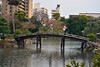
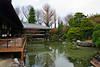
The above images may not be of the site on this page, but were taken nearby. They are loaded from Flickr so please click on them for image credits.
Click here to see more info for this site
Nearby sites
Click here to view sites on an interactive map of the areaKey: Red: member's photo, Blue: 3rd party photo, Yellow: other image, Green: no photo - please go there and take one, Grey: site destroyed
Download sites to:
KML (Google Earth)
GPX (GPS waypoints)
CSV (Garmin/Navman)
CSV (Excel)
To unlock full downloads you need to sign up as a Contributory Member. Otherwise downloads are limited to 50 sites.
Turn off the page maps and other distractions
Nearby sites listing. In the following links * = Image available
658m N 353° Shinnyo-in temple* Modern Stone Circle etc
989m SSW 199° Kanchi-in temple* Modern Stone Circle etc
1.4km NNW 328° Mibu-dera temple* Modern Stone Circle etc
2.2km E 93° Myōhō-in temple* Modern Stone Circle etc
2.2km ENE 63° Kyūshō-in temple* Modern Stone Circle etc
2.3km ENE 62° Kennin-ji temple* Modern Stone Circle etc
2.3km SE 127° Reiun-in temple (in Tōfuku-ji tempels complex)* Modern Stone Circle etc
2.4km ENE 65° Ryōsoku-in temple* Modern Stone Circle etc
2.4km ESE 120° Shōrin-ji temple* Modern Stone Circle etc
2.5km SE 131° Funda-in temple* Modern Stone Circle etc
2.5km SE 129° Tentoku-in temple* Modern Stone Circle etc
2.5km SE 126° Fumon-in temple* Modern Stone Circle etc
2.6km SE 127° Tōfuku-ji temple* Modern Stone Circle etc
2.6km SE 125° Ryōgin-an temple* Modern Stone Circle etc
2.8km SE 132° Kōmyō-in temple* Modern Stone Circle etc
2.9km ESE 117° Zennō-ji temple* Modern Stone Circle etc
2.9km ENE 69° Entoku-in temple.* Modern Stone Circle etc
3.0km ENE 68° Kōdai-ji temple* Modern Stone Circle etc
3.1km ESE 118° Sennyū-ji temple* Modern Stone Circle etc
3.5km ENE 69° Shōgun-zuka (in Kyōto)* Modern Stone Circle etc
3.6km NNW 333° Hōrin-ji temple* Modern Stone Circle etc
3.7km SE 142° Sekihō-ji temple* Sculptured Stone
4.0km NNE 16° Kyōto Gosho* Modern Stone Circle etc
4.0km NNW 343° Ryūhon-ji temple* Modern Stone Circle etc
4.1km NNE 22° Shōjōke-in temple* Modern Stone Circle etc
View more nearby sites and additional images


 We would like to know more about this location. Please feel free to add a brief description and any relevant information in your own language.
 Wir möchten mehr über diese Stätte erfahren. Bitte zögern Sie nicht, eine kurze Beschreibung und relevante Informationen in Deutsch hinzuzufügen.
 Nous aimerions en savoir encore un peu sur les lieux. S'il vous plaît n'hesitez pas à ajouter une courte description et tous les renseignements pertinents dans votre propre langue.
 Quisieramos informarnos un poco más de las lugares. No dude en añadir una breve descripción y otros datos relevantes en su propio idioma.